- Sanpoil River
Geobox River
name = Sanpoil River
native_name =
other_name =
other_name1 =
image_size =
image_caption =
country = United States
country1 =
state = Washington
state1 =
region =
region1 =
district =
district1 =
city = Republic
city1 =
length_imperial = 70
length_note = [http://www.bartleby.com/69/57/G04257.html Grande Ronde River] , The Columbia Gazetteer of North America]
watershed_imperial = 981
watershed_note = [http://www.nwcouncil.org/fw/subbasinplanning/admin/level2/intermtn/plan/sanpoil.pdf San Poil] , Intermountain Province Plan, Northwest Power and Conservation Council]
discharge_location =
discharge_imperial =
discharge_max_imperial =
discharge_min_imperial =
discharge1_location =
discharge1_imperial =
source_name =
source_location =
source_district =
source_region =
source_state =
source_country =
source_lat_d = 48
source_lat_m = 38
source_lat_s = 54
source_lat_NS = N
source_long_d = 118
source_long_m = 38
source_long_s = 12
source_long_EW = W
source_coordinates_note = Gnis|1531504|Sanpoil River, USGS, GNIS]
source_elevation_imperial = 2735
source_elevation_note =Google Earth elevation for GNIS coordinates.]
source_length_imperial =
mouth_name = Columbia River
mouth_location =
mouth_district =
mouth_region =
mouth_state =
mouth_country =
mouth_lat_d = 47
mouth_lat_m = 56
mouth_lat_s = 55
mouth_lat_NS = N
mouth_long_d = 118
mouth_long_m = 40
mouth_long_s = 50
mouth_long_EW = W
mouth_coordinates_note =
mouth_elevation_imperial = 1293
mouth_elevation_note =
tributary_left =
tributary_left1 =
tributary_right = West Fork Sanpoil River
tributary_right1 =
free_name =
free_value =
map_size =
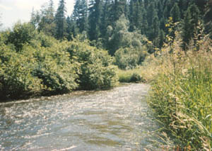
map_caption = ::"For other references, seeSanpoil (disambiguation) ."The Sanpoil River (also spelled San Poil) is atributary of theColumbia River , in theU.S. state ofWashington .Course
The Sanpoil River originates near the city of Republic, in the
Okanagan Highland , east of theOkanogan River . It flows south through theColville National Forest ,Okanogan National Forest , and theColville Indian Reservation . After entering the reservation the river receives its main tributary, the West Fork Sanpoil River. It then receives a number of smaller tributaries such as Twentyone Mile Creek, Twentythree Mile Creek, and Thirty Mile Creek.The Sanpoil River enters
Franklin D. Roosevelt Lake (FDR Lake), the impoundedColumbia River aboveGrand Coulee Dam . The dam impounded the last few miles of the Sanpoil River as well. This part of FDR Lake is called Sanpoil Arm.Habitats
* mountain riparian
* mixed forest
* wetland
* freshwater marshBirds
* Common Loon
* Barrow’s Goldeneye
* Golden and Bald Eagles
* Northern Pygmy-Owl
* Black-chinned, Calliope, and Rufous Hummingbirds
* Lewis’s and Pileated Woodpeckers
* Red-naped Sapsucker
* Hammond’s, Dusky, and Pacific-slope Flycatchers
* Cassin’s Vireo
* Pygmy Nuthatch
* Western Bluebird
* Northern Waterthrushee also
*
Tributaries of the Columbia River References
Further reading
* Atwater, Brian F. "Pleistocene Glacial-Lake Deposits of the Sanpoil River Valley, Northeastern Washington. U.S. Geological Survey bulletin, 1661". Washington: G.P.O., 1986.
* Atwater, Brian F. "Guidebook for 1983 Friends of the Pleistocene Field Trip to the Sanpoil River Valley, Northeastern Washington". U.S. Geological Survey open-file report, 83-456. Menlo Park, CA: U.S. Geological Survey, 1983.
* Geological Survey (U.S.), and L. L. Bryan. "Plan and Profile of Hall Creek, Mouth to Mile 4 and Dam Sites on Sanpoil River, Washington". [Washington, D.C.] : Dept. of the Interior, U.S. Geological Survey, 1930.
* Juul, Steve Thorvald Julius, et al. "Nonpoint Pollution at the Headwaters of the Sanpoil River in Ferry County, Washington". Pullman, Wash: State of Washington Water Research Center, 1993.
* Pacific Northwest River Basins Commission. "River Mile Index: Moses Coulee, Crab & Foster Creeks, Okanogan (Okanagan), Sanpoil, Colville & Kettle Rivers". [S.l.] : The Committee, 1968.
* Trotter, Patrick C. "Genetic and Phenotype Catalog of Native Resident Trout of the Interior Columbia River Basin: FY-99 Report : Populations of the Pend Oreille, Kettle, and Sanpoil River Basins of Colville National Forest". [Portland, OR: Bonneville Power Administration, 2001.External links
* [http://www.trails.com/tcatalog_trail.asp?trailid=XFA061-056 Birdwatching along the Sanpoil River trail]
Wikimedia Foundation. 2010.