- Clevedon, New Zealand
-
For the United Kingdom town, see Clevedon.
Clevedon Basic information Local authority Auckland City Electoral ward Franklin Date established 1866 Population 2,508 (2006) Facilities Surrounds North Maraetai Northeast Kawakawa Bay East (Hunua Ranges) Southeast (Hunua Ranges) South (Hunua Ranges) Southwest Papakura West Brookby Northwest Whitford 
 Clevedon
Clevedon is a rural town in Auckland, New Zealand, located in the Franklin ward, one of the thirteen administrative divisions of Auckland city. The town is governed by the Auckland Council.
The town and surrounding rural area has a population of 2,508 (2006 census),[1] and is the centre of an administrative ward of Manukau which takes in much of the largely rural area to the east of the urban heart of the city.
Clevedon is located on the Wairoa River five kilometres from its estuary and outflow into the Tamaki Strait, an arm of the Hauraki Gulf. It is 14 kilometres from the centre of the suburb of Manukau, which lies to the northwest. To the south of Clevedon rise the rugged hills of the Hunua Ranges. Several popular beaches are located on the coast close to Clevedon, including Duder's Beach and Kawakawa Bay. Between these two beaches lies the Duder Regional Park.
Clevedon was named for Clevedon, England, in 1866. It was previously known as Te Wairoa (Māori: 'the Long River').
There were formerly many schools located in Clevedon (the Wairoa district) but only one remains, Clevedon School.
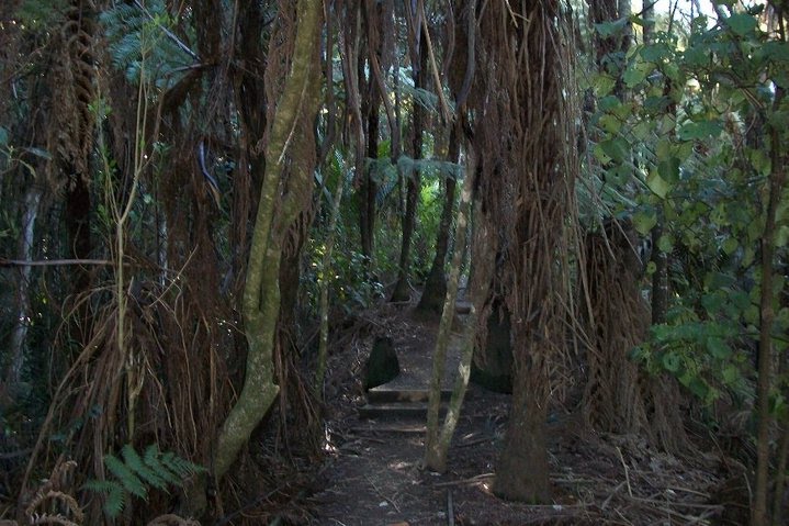
 This nature walk near Clevedon takes 45 minutes to get to the top of a small hill with a view towards both coasts.
See also
References
- Reed, A. W. (2002). The Reed Dictionary of New Zealand Place Names. Auckland: Reed Books. ISBN 0-7900-0761-4..
External links
Coordinates: 36°59′27″S 175°02′16″E / 36.990813°S 175.037774°E
Categories:- Suburbs of Auckland
- Populated places in New Zealand
- Auckland Region geography stubs

Wikimedia Foundation. 2010.