Dampierland

Dampierland
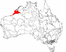
The IBRA regions, with Dampierland in red

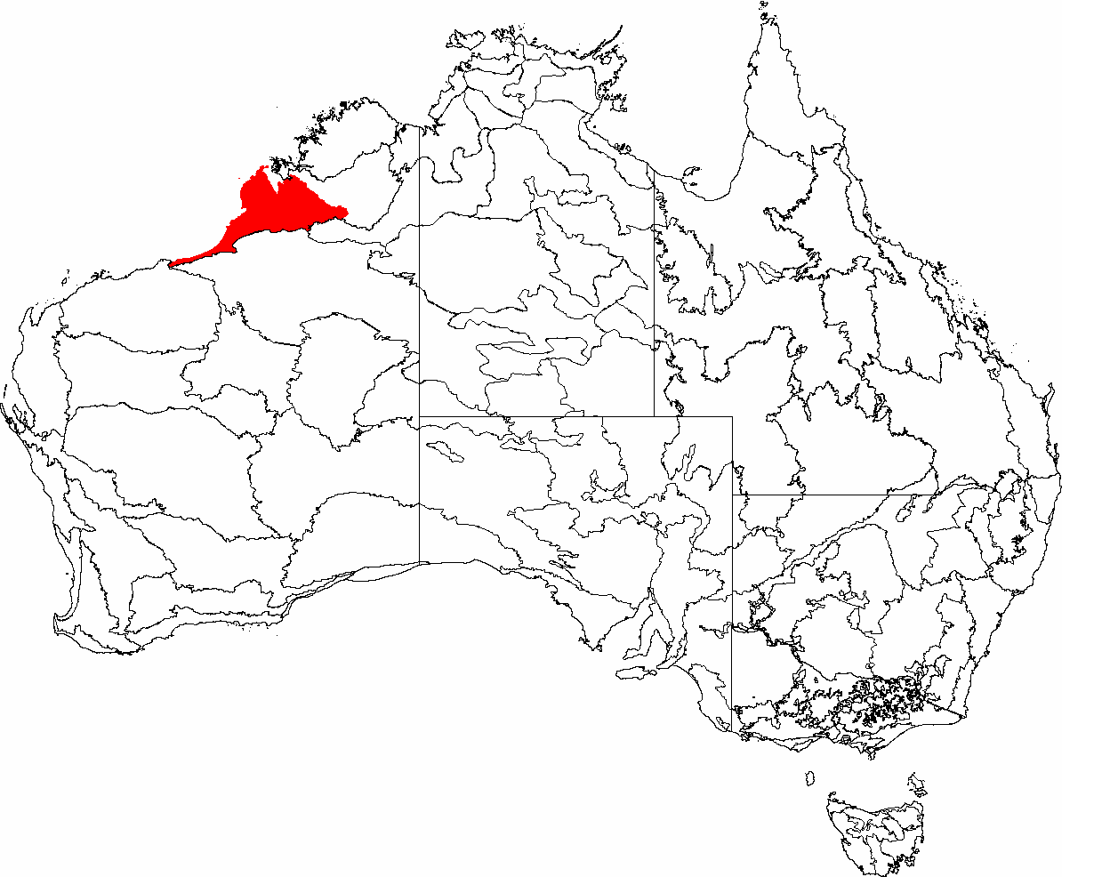
Dampierland is an Interim Biogeographic Regionalisation for Australia (IBRA) region in Western Australia.[1][2] This area also is a distinct physiographic section of the larger Nullagine Platform province, which in turn is part of the larger West Australian Shield division.

It is located in the West Kimberley (Western Australia) area and incorporates the country that is adjacent to Broome, Western Australia. Its characteristic vegetation is pindan woodland.

References

Further reading

  • Thackway, R and I D Cresswell (1995) An interim biogeographic regionalisation for Australia : a framework for setting priorities in the National Reserves System Cooperative Program Version 4.0 Canberra : Australian Nature Conservation Agency, Reserve Systems Unit, 1995. ISBN 0642213712


Wikimedia Foundation. 2010.

Игры ⚽ Поможем решить контрольную работу

Look at other dictionaries:

  • Dampierland — Dampierland, Halbinsel an der Nordwestküste des britisch austral. Staates Westaustralien, zwischen 16°30 und 18° südl. Br., im O. vom Kingsund begrenzt. Die nördlichste Spitze ist Kap Lévèque …   Meyers Großes Konversations-Lexikon

  • Dampierland — Les régions de l IBRA, avec le Dampierland en rouge. Le Dampierland Wheatbelt est une région de l’Interim Biogeographic Regionalisation for Australia (IBRA) située en Australie Occidentale[1] …   Wikipédia en Français

  • Drovers Cave National Park — IUCN Category II (National Park) …   Wikipedia

  • Interim Biogeographic Regionalisation for Australia — The Interim Biogeographic Regionalisation for Australia (IBRA) is a biogeographic regionalisation of Australia developed by the Australian Government s Department of the Environment and Heritage. It was developed for use as a planning tool, for… …   Wikipedia

  • Geography of Western Australia — Western Australia occupies nearly one third of the Australian continent.Due to the size and the isolation of the state, considerable emphasis has been made of these features; it is the second largest administrative territory in the world, after… …   Wikipedia

  • Banks-Rabenkakadu — Banks Rabenkakadus, Paar. Links das Männchen, das noch nicht den dunkelgrauen Schnabel ausgewachsener Männchen aufweist Systematik K …   Deutsch Wikipedia

  • Banks Rabenkakadu — Banks Rabenkakadus, Paar. Links das Männchen, das noch nicht den dunkelgrauen Schnabel ausgewachsener Männchen aufweist Systematik …   Deutsch Wikipedia

  • Berlintief — Das Berlintief ist ein Meerestief im östlichen Teil des Indischen Ozeans (Indik) und ist mit 6.840 m Meerestiefe die tiefste Stelle des Nordaustralischen Beckens. Das Berlintief befindet sich im Zentrum des zuvor genannten Tiefseebeckens… …   Deutsch Wikipedia

  • Berlintiefe — Das 6.840 m tiefe Berlintief ist ein Meerestief im östlichen Indik. Mit dieser Meerestiefe stellt es die tiefste Stelle des Nordaustralischen Beckens dar. Das Berlintief befindet sich im Zentrum des zuvor genannten Tiefseebeckens etwa 600 km… …   Deutsch Wikipedia

  • Calyptorhynchus banksii — Banks Rabenkakadu Banks Rabenkakadus, Paar. Links das Männchen, das noch nicht den dunkelgrauen Schnabel ausgewachsener Männchen aufweist Systematik …   Deutsch Wikipedia

Share the article and excerpts

Direct link
Do a right-click on the link above
and select “Copy Link”