- Mount Albert, New Zealand
-
For the parliamentary electorate, see Mount Albert (New Zealand electorate).
Mount Albert 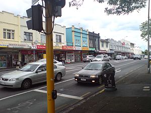
The town centre, dominated by New North Road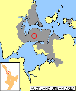
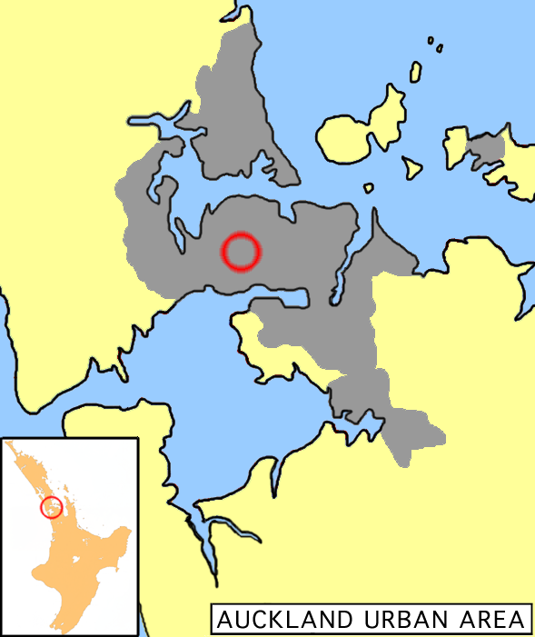
Location in AucklandBasic information Local authority Auckland Council Facilities Surrounds North Point Chevalier Northeast Western Springs East Morningside Southeast Sandringham South Owairaka Southwest Avondale West Waterview Northwest Waterview Mount Albert is a volcanic peak and suburban area in the city of Auckland, New Zealand. The suburb was Auckland's second, after Remuera, and was mostly settled by well-off families in the late 1800s and early 1900s.[1] Significant growth occurred between the two world wars.[2]
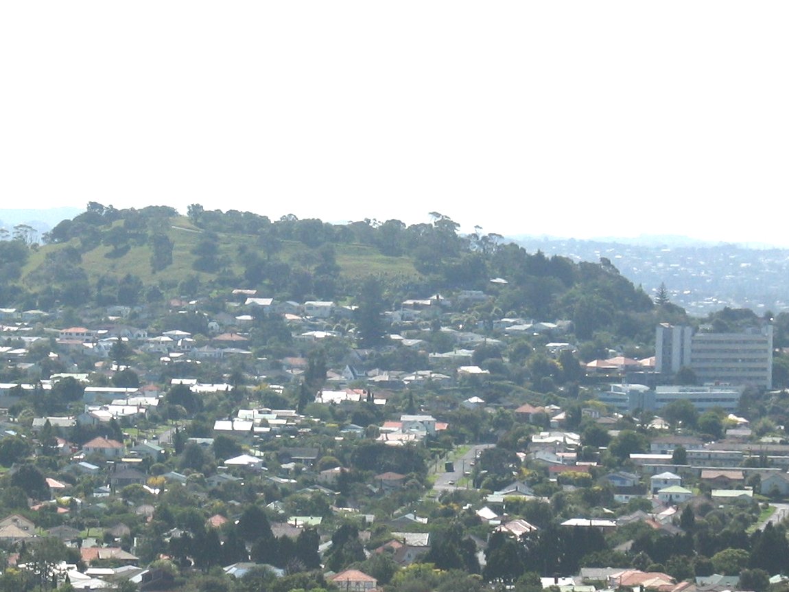
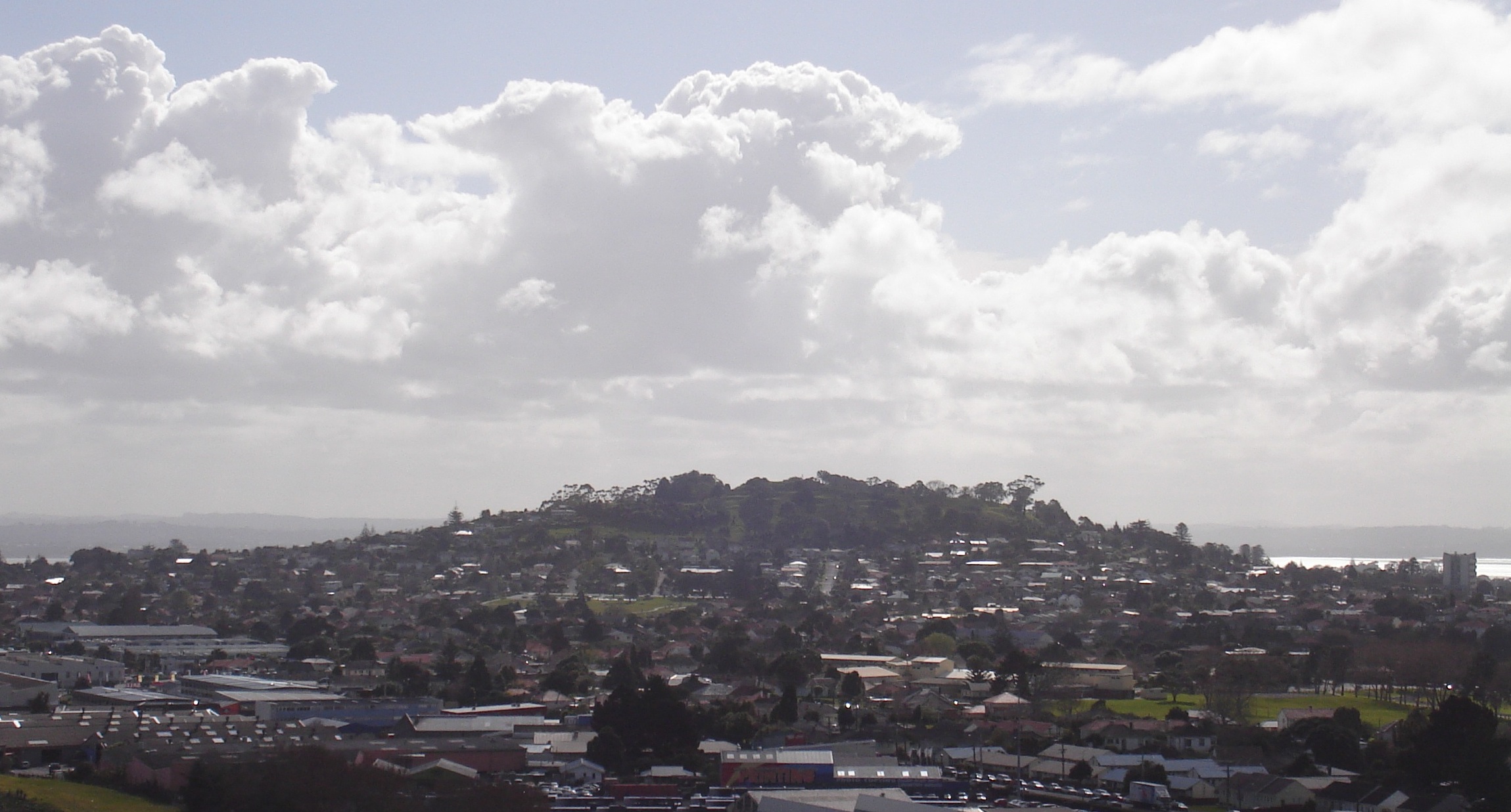
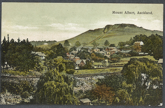
The peak, in parkland at the southern end of the suburb, is 135 metres in height, and is one of the many extinct cones which dot the city of Auckland, all of which are part of the Auckland Volcanic Field. The age of the volcano is currently unknown. It was the site of a pā, and was known as Owairaka. Extensive quarrying has reduced the height of the scoria cone by about 15 m and significantly altered its shape, but a few remnants of Maori earthworks such as terracing are still visible.
The suburb is located seven kilometres to the southwest of the city centre, and is surrounded by the neighbouring suburbs of Owairaka, Sandringham, Morningside, Point Chevalier and Waterview. Its postcode is 1025.
Unitec Institute of Technology is located towards the northern end of the suburb. The Mount Albert Research Centre (originally established by the DSIR) houses the Auckland centre of Plant & Food Research and other Crown Research Institutes.
Contents
Government
Mount Albert has been administered by Auckland Council since 2010, and Auckland City Council from 1989 to 2010. An early local government body was the Mount Albert Highway District Board, which was formed in 1866 and became Mount Albert Road Board in 1883. The road board became Mount Albert Borough Council in 1911, and then Mount Albert City Council in 1978. It amalgamated with Auckland City Council in a nation-wide local government reorganisation in 1989.[3]
Mount Albert has been part of the Mount Albert parliamentary electorate since 1946, except for the 1996–99 term, when it was the Owairaka electorate.
Notable buildings
Ferndale House is a wooden Gothic house at 830 New North Road, near the main shopping area. It was built by Jonathon Tonson Garlick as a four-room cottage in 1865 and extended in 1881. His widow sold it to Mount Albert Borough Council in the 1940s. The family firm Tonson Garlick manufactured furniture. The house is now a community venue.[4][5]
Alberton, on Mount Albert Road, was the residence of Allan Kerr Taylor.[6] This two-storied wooden house has wrap-round verandahs and turrets in the Anglo-Indian style, possibly due to the family having spent time in India before coming to New Zealand. Originally this property commanded a view towards Auckland across a thousand acre (4 km²) farm. Over the years the family sold off land for suburban development leaving only one acre around the house. Now the property of the New Zealand Historic Places Trust, Alberton is open to the public as a museum. Allan Kerr Taylor had three brothers who lived in Auckland near the Tamaki River: Charles John Taylor at Glen Orchard (now St Heliers), William Innes Taylor at Glen Innes, and Richard James Taylor at Glen Dowie. The names of their properties later became the names of the suburbs.
Education
Primary schools include Gladstone Primary School and Marist Primary School. Secondary schools include Mount Albert Grammar School (co-ed). Catholic girls may attend Marist College and Catholic boys generally commute by train to St Peter's College.
Association football
Mount Albert is the home of association football club Metro F.C., who compete in the Lotto Sport Italia NRFL Premier, and Mount Albert-Ponsonby, who compete in the Lotto Sport Italia NRFL Division 2.
-
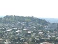
Mount Albert from Big King. Mt Albert Research Centre is visible on the right.
-
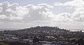
Mount Albert from Mount Roskill
-

Mount Albert in a postcard from around 1910
See also
References
- ^ "Mt Albert". The New Zealand Herald. 14 September 2005. http://www.nzherald.co.nz/st-lukes/news/article.cfm?l_id=420&objectid=10332502. Retrieved 19 November 2011.
- ^ "So you want to live in...? Mt Albert". The New Zealand Herald. 14 June 2011. http://www.nzherald.co.nz/property/news/article.cfm?c_id=8&objectid=10732213. Retrieved 19 November 2011.
- ^ "Mount Albert Highway District Rate Books 1867-1884". Auckland City Council. http://www.aucklandcity.govt.nz/dbtw-wpd/CityArchives/FamilyHistory/MAC104/searchmtalbertratebooks.htm. Retrieved 19 November 2011.
- ^ "Ferndale House". Auckland Council. http://www.aucklandcity.govt.nz/council/services/venues/ferndale.asp. Retrieved 19 November 2011.
- ^ Turner, Arnold R. (March 2011). "Local heritage: Ferndale". Mount Albert Historical Society. http://www.mtalberthistoricalsociety.org.nz/Local_Heritage.php. Retrieved 19 November 2011.
- ^ Stacpoole, John (1 September 2010). "Taylor, Allan Kerr". Dictionary of New Zealand Biography. http://www.teara.govt.nz/en/biographies/2t15/1. Retrieved 19 November 2011.
- City of Volcanoes: A geology of Auckland - Searle, Ernest J.; revised by Mayhill, R.D.; Longman Paul, 1981. First published 1964. ISBN 0-582-71784-1.
- Volcanoes of Auckland: The Essential guide - Hayward, B.W., Murdoch, G., Maitland, G.; Auckland University Press, 2011.
External links
Coordinates: 36°53′27″S 174°43′12″E / 36.890931°S 174.720125°E
Categories:- Suburbs of Auckland
- Auckland Volcanic Field
- Mountains of New Zealand
- Parks in Auckland
-

Wikimedia Foundation. 2010.