Naszály

Naszály
Naszály
Naszály is located in Hungary
Naszály
Location of Naszály
Coordinates: 47°41′55″N 18°15′39″E / 47.69873°N 18.26075°E / 47.69873; 18.26075Coordinates: 47°41′55″N 18°15′39″E / 47.69873°N 18.26075°E / 47.69873; 18.26075
Country  Hungary
County Komárom-Esztergom
Area
 – Total 30.23 km2 (11.7 sq mi)
Population (2004)
 – Total 2,294
 – Density 75.88/km2 (196.5/sq mi)
Time zone CET (UTC+1)
 – Summer (DST) CEST (UTC+2)
Postal code 2899
Area code(s) 34

Naszály is a village in Komárom-Esztergom county, Hungary.

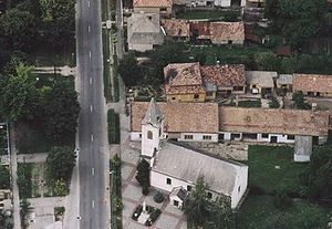
Aerialphotography of Naszály

External links


Wikimedia Foundation. 2010.

Игры ⚽ Поможем решить контрольную работу

Look at other dictionaries:

  • Naszály — Administration …   Wikipédia en Français

  • Naszaly — Original name in latin Naszly Name in other language Naszaly, Naszly State code HU Continent/City Europe/Budapest longitude 47.70329 latitude 18.25751 altitude 117 Population 2239 Date 2012 05 06 …   Cities with a population over 1000 database

  • Countrywide Blue Tour in Hungary — The route of the Countrywide Blue Tour in Hungary The Countrywide Blue Tour (in Hungarian: Országos Kéktúra, Kéktúra or simply OKT) is a part of the Hungarian section of the European Long Distance Walking Route E4. The route starts atop the… …   Wikipedia

  • Nötincs — Nőtincs Wappen Karte fehlt noch fehlt noch Basisdaten Staat: Ungarn Komitat: Nógrád Höhe: 210 m ü …   Deutsch Wikipedia

  • Nőtincs — Wappen Karte fehlt noch fehlt noch Basisdaten Staat: Ungarn Komitat: Nógrád …   Deutsch Wikipedia

  • Komárom-Esztergom County — Infobox Hungarian county name =Komárom Esztergom region =Central Transdanubia seat = Tatabánya area = 2265 population = 319,000 density = 142 cities = 76Komárom Esztergom is the name of an administrative county (comitatus or megye) in northern… …   Wikipedia

  • Oroszlány — Aerial view …   Wikipedia

  • Vác — Infobox Settlement image caption = Vác Cathedral subdivision type = Country subdivision name = HUN timezone=CET utc offset=+1 timezone DST=CEST utc offset DST=+2 pushpin pushpin label position = pushpin map caption =Location of Vác pushpin… …   Wikipedia

  • Nőtincs — Country  Hungary County Nógrád Area  – Total 20.47 km2 (7.9 sq mi) …   Wikipedia

  • Dorog —   Town   …   Wikipedia

Share the article and excerpts

Direct link
Do a right-click on the link above
and select “Copy Link”