Mátyásdomb

Mátyásdomb
Mátyásdomb
Mátyásdomb is located in Hungary
Mátyásdomb
Location of Mátyásdomb
Coordinates: 46°55′18″N 18°20′55″E / 46.92172°N 18.34869°E / 46.92172; 18.34869Coordinates: 46°55′18″N 18°20′55″E / 46.92172°N 18.34869°E / 46.92172; 18.34869
Country  Hungary
County Fejér
Area
 – Total 35.39 km2 (13.7 sq mi)
Population (2004)
 – Total 792
 – Density 22.37/km2 (57.9/sq mi)
Time zone CET (UTC+1)
 – Summer (DST) CEST (UTC+2)
Postal code 8134
Area code(s) 22

Mátyásdomb is a village in Fejér county, Hungary.

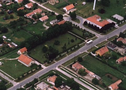
Aerialphotography of Mátyásdomb

External links


Wikimedia Foundation. 2010.

Игры ⚽ Нужна курсовая?

Look at other dictionaries:

  • Mátyásdomb — Administration …   Wikipédia en Français

  • Fejér — 47°10′0″N 18°35′0″E / 47.16667, 18.58333 …   Wikipédia en Français

  • Mačkovci — Mátyásdomb …   Wikipedia

  • Fejér County — Infobox Hungarian county name =Fejér region =Central Transdanubia seat = Székesfehérvár area = 4359 population = 426,541 density = 98 cities = 108: For the historical county see Fejér (former county). : For the mathematician of the same name see… …   Wikipedia

  • Dunaújváros — The bridge on the Danube …   Wikipedia

  • Mór — For other uses, see Mór (disambiguation). Mór Lamberg Castle, Mór …   Wikipedia

  • Martonvásár — Martonvásár, palace …   Wikipedia

  • Adony — See also: Adony (disambiguation) Adony Adony, church …   Wikipedia

  • Hungarian exonyms (Prekmurje, Slovenia) — The following is a list of Hungarian place names for towns and villages in the Prekmurje region of Slovenia. The hungarian administration in the 19th century few village name was change, mainly old hungarian names (Alsószlavecsa, Mladetincz,… …   Wikipedia

  • Puconci — Puconci …   Deutsch Wikipedia

Share the article and excerpts

Direct link
Do a right-click on the link above
and select “Copy Link”