Norton Bavant

Norton Bavant
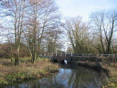
The River Wylye at Norton Bavant

Norton Bavant is a village and civil parish in Wiltshire, England.

Contents

Location

The village is 2 miles (3.2 km) southeast of the market town of Warminster, just off the A36 road to Salisbury, and at the edge of Salisbury Plain. To the north lies Scratchbury and Cotley Hills Site of Special Scientific Interest, and the iron age hillfort of Scratchbury Camp.

History

John Marius Wilson's Imperial Gazetteer of England and Wales (1870-1872) described Norton Bavant as follows:

NORTON-BAVANT, a village and a parish in Warminster district, Wilts. The village stands on the river Wiley, adjacent to the Salisbury and Westbury railway, 1¼ mile N W of Heytesbury r. station, and 2¾ S E by E of Warminster. The parish includes a detached portion, separated from the main body by Warminster parish. Post-town, Warminster. Acres, 2,165. Real property, £3,549. Pop., 261. Houses, 61. The property is divided among a few. Norton House is a chief residence. The living is a vicarage in the diocese of Salisbury. Value, £250. Patron, the Lord Chancellor. The church was recently rebuilt. There are a parochial school, and charities £4.[1]

Local government

Norton Bavant is considered to be too small to elect a parish council, and instead has a Parish Meeting, at which all electors for the parish are able to speak and vote. Local government services are provided by Wiltshire Council, which has its offices in Trowbridge. The village is represented in Parliament by the MP for Westbury, Andrew Murrison, in Wiltshire Council by Christopher Newbury.

Notable people

  • Sir John Jardine Paterson (1920–2000)[2]

See also

  • Fifield Bavant for etymology of Bavant. Village was owned by the Beaufaunt family, later usually spelt Bavant.[3]

References

  1. ^ Norton Bavant at visionofbritain.org.uk
  2. ^ 'Jardine Paterson, Sir John (Valentine)', in Who Was Who, online edition December 2007, accessed 5 January 2011
  3. ^ Ebbesbourne Wake through the Ages by Peter Meers

See also

External links

Coordinates: 51°11′N 2°08′W / 51.183°N 2.133°W / 51.183; -2.133


Wikimedia Foundation. 2010.

Игры ⚽ Поможем написать курсовую

Look at other dictionaries:

  • River Wylye — Geobox River name = River Wylye native name = other name = other name1 = image size = image caption = River Wylye at Norton Bavant country = England country1 = County = Wiltshire County1 = region = Wessex region1 = region2 = district = West… …   Wikipedia

  • Wiltshire Victoria County History — The Wiltshire Victoria County History is an encyclopaedic history of the county of Wiltshire in England. It forms part of the overall Victoria County History of England founded in 1899 in honour of Queen Victoria. With eighteen volumes published …   Wikipedia

  • GB-WIL — Wiltshire Geografie Status: Zeremonielle und Verwaltungsgrafschaft Region: South West England …   Deutsch Wikipedia

  • List of civil parishes in Wiltshire — This is a list of civil parishes in Wiltshire, England.Kennet*Aldbourne *All Cannings *Alton *Avebury *Baydon *Beechingstoke *Berwick Bassett *Bishops Cannings *Broad Hinton *Bromham *Burbage *Buttermere *Charlton *Cheverell Magna *Cheverell… …   Wikipedia

  • Mere, Wiltshire — Coordinates: 51°05′24″N 2°15′58″W / 51.090°N 2.266°W / 51.090; 2.266 …   Wikipedia

  • West Wiltshire — is a local government district in Wiltshire, England and was formed on 1 April, 1974, further to the Local Government Act 1972, as a merger of the former urban districts of Bradford on Avon, Melksham, Trowbridge, Warminster and Westbury, along… …   Wikipedia

  • Christopher Newbury — (born 10 November 1956, Trowbridge, England)[1] is an English politician, a member of the Congress of the Council of Europe since 1998 and an Independent member of Wiltshire Council since 2009.[1] Contents 1 Early life …   Wikipedia

  • Scratchbury and Cotley Hills SSSI — Scratchbury Cotley Hills SSSI (grid reference ST915437) is a 53.5 hectare biological Site of Special Scientific Interest at Norton Bavant in Wiltshire, notified in 1951. The Iron Age hillfort of Scratchbury Camp occupies the summit of the hill.… …   Wikipedia

  • Sutton Veny — is a small village situated in the Wylye valley, about 2 miles south east of the town of Warminster in Wiltshire, England. ( Sutton means south farmstead in relation to Norton Bavant one mile to the north. Veny is either a French family name or… …   Wikipedia

  • John Thurnam — (* 1810; † 1873) war ein britischer Antiquar. Er war Mitglied des Royal College of Surgeons und medical superintenden der grafschaftlichen Irrenanstalt in Devizes in Wiltshire. Er war Mitbegründer der Wiltshire Archaeological and Natural History… …   Deutsch Wikipedia

Share the article and excerpts

Direct link
Do a right-click on the link above
and select “Copy Link”