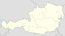
- Ottenthal
-
Coordinates: 48°46′0″N 16°35′0″E / 48.766667°N 16.583333°E
Ottenthal Country Austria State Lower Austria District Mistelbach Mayor Albert Graf Area 15.46 km2 (6 sq mi) Elevation 240 m (787 ft) Population 598 (1 January 2011)[1] - Density 39 /km² (100 /sq mi) Time zone CET/CEST (UTC+1/+2) Postal code 2163 Area code 02554 Ottenthal is a town in the district of Mistelbach in the Austrian state of Lower Austria.
References
Altlichtenwarth · Asparn an der Zaya · Bernhardsthal · Bockfließ · Drasenhofen · Falkenstein · Fallbach · Gaubitsch · Gaweinstal · Gnadendorf · Groß-Engersdorf · Großebersdorf · Großharras · Großkrut · Hausbrunn · Herrnbaumgarten · Hochleithen · Kreuttal · Kreuzstetten · Laa an der Thaya · Ladendorf · Mistelbach · Neudorf bei Staatz · Niederleis · Ottenthal · Pillichsdorf · Poysdorf · Rabensburg · Schrattenberg · Staatz · Stronsdorf · Ulrichskirchen-Schleinbach · Unterstinkenbrunn · Wildendürnbach · Wilfersdorf · Wolkersdorf im Weinviertel
Categories:- Cities and towns in Lower Austria
- Lower Austria geography stubs
Wikimedia Foundation. 2010.

