Knockvicar

Knockvicar

Infobox Irish Place
name = Knockvicar
gaeilge = Cnoc an Bhiocáire
crest

motto =
map

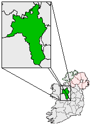
pin coords = left: 51px; top: 24px
north coord = 54 | west coord = 8.12 | irish grid = G870060
area = | elevation = 83 m
province = Connacht
county = County Roscommon
population = | town pop = | rural pop =
census yr =
web = |

Knockvicar ( _ga. Cnoc an Bhiocáire) is a village in County Roscommon, Ireland. It is located on the R285 regional road, between Boyle and Carrick-on-Shannon near Lough Key Forest Park in the north of the county.

It is where the actress Maureen O'Sullivan spent part of her youth.

Knockvicar lies on the Arigna Scenic Drive off the N4 road from Dublin to Sligo

At Knockvicar bridge Donal Cam O'Sullivan Bere, the Irish Chieftain, after his defeat in Cork in 1603 travelled through the village of Knockvicar where his people rested for the last time before reaching O'Rourke's castle at Leitrim village.

The Boyle River, which flows under Knockvicar bridge, connects with Lough Key via a weir and Claredon lock gates 300m upstream. People can park near the bridge and walk along the towpath.

ee also

External links

http://www.knockvicargardener.com/


Wikimedia Foundation. 2010.

Игры ⚽ Нужно сделать НИР?

Look at other dictionaries:

  • County Roscommon — Not to be confused with Roscommon County, Michigan, United States. County Roscommon Contae Ros Comáin …   Wikipedia

  • River Boyle — Infobox River river name = Boyle River An Bhúill caption = Boyle River at Knockvicar. origin = Lough Garra, County Mayo. mouth = Atlantic Ocean via the River ShannonThe Boyle River is a river in Ireland. It flows from Lough Garra on the… …   Wikipedia

  • Ноквикар — Деревня Ирландии Ноквикар англ. Knockvicar, ирл. Cnoc an Bhiocáire Страна …   Википедия

  • Provisional Irish Republican Army — (Óglaigh na hÉireann) Participant in the Troubles Masked Provisional IRA volunteers at a rally in August 1979 …   Wikipedia

  • Old Town, County Roscommon — Old Town an Seanbhaile   Town   …   Wikipedia

  • Regional road — Regional roads are also used in some parts of Ontario. See County Road for more information. A regional road ( ga. Bóthar Réigiúnach) in Ireland is a class of road not forming a major route (such as a national primary route or national secondary… …   Wikipedia

  • Tarmonbarry — Termonbarry Tearmann Bearaigh   Town   …   Wikipedia

  • Cloonfad — Cluain Fada   Town   …   Wikipedia

  • R285 road — The R285 road is a regional road in Ireland linking the N4 at a point east of Boyle, County Roscommon to the R280 at Mountallen. The road lies entirely within County Roscommon.En route it passes through Knockvicar and Keadue.The road is km to mi… …   Wikipedia

  • Cloonbonniffe — Cloonbonniffe, officially Cloonbonniff (Irish: Cluain Banbh),[1] is a small village and townland in County Roscommon, Ireland. The nearest town is Castlerea, about five miles east. Cloonbonniff is home to the O Connor Don National School and… …   Wikipedia

Share the article and excerpts

Direct link
Do a right-click on the link above
and select “Copy Link”