- Tafjordfjella
Geobox | Range
name = Tafjordfjella
native_name =
other_name =
other_name1 =
image_size =
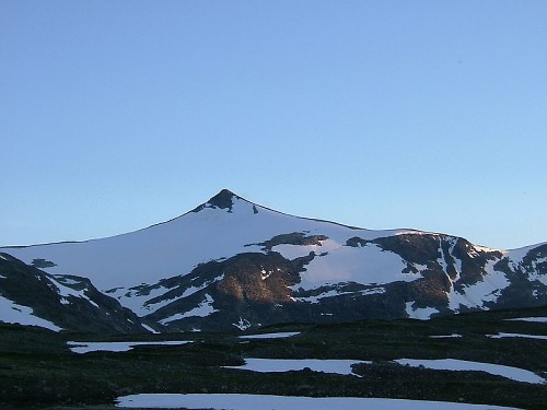
image_caption =Karitind 1,982 m
country =Norway
state =
region = Møre og Romsdal
region1 = Oppland
region_type = Counties
district =
district1 =
city =
city1 =
parent =
border =
border1 =
geology =
geology1 =
period =
period1 =
orogeny =
orogeny1 =
area =
length =
length_orientation =
width =
width_orientation =
highest =Puttegga
highest location =
highest_country =
highest_state =
highest_region =
highest_district =
highest_elevation = 1999
highest_lat_d =
highest_lat_m =
highest_lat_s =
highest_lat_NS =
highest_long_d =
highest_long_m =
highest_long_s =
highest_long_WE =
lowest =
lowest_location =
lowest_country =
lowest_state =
lowest_region =
lowest_district =
lowest_elevation =
lowest_lat_d =
lowest_lat_m =
lowest_lat_s =
lowest_lat_NS =
lowest_long_d =
lowest_long_m =
lowest_long_s =
lowest_long_WE =
woods =
free_name =
free_value =
map_size =
map_caption =
map_first =Tafjordfjella ("The Tafjord mountains") is a mountain range in
Møre og Romsdal andOppland ,Norway . The area takes its name from the village and fjordTafjord , the main entry point. The highest peaks arePuttegga at 1,999 m,Karitind at 1,982 m andTordsnose at 1,975 m.Lakes in the area include
Tordsvatnet , Veltdalsvatnet, Zakariasdammen andGrønvatnet .The
Norwegian Mountain Touring Association has the cabins Reindalsseter, Pyttbua, Veltdalshytta, Vakkerstøylen and Danskehytta. The western part of the area has since 1923 been extensively developed for hydro electric power production by the Tafjord Kraft company.
Wikimedia Foundation. 2010.