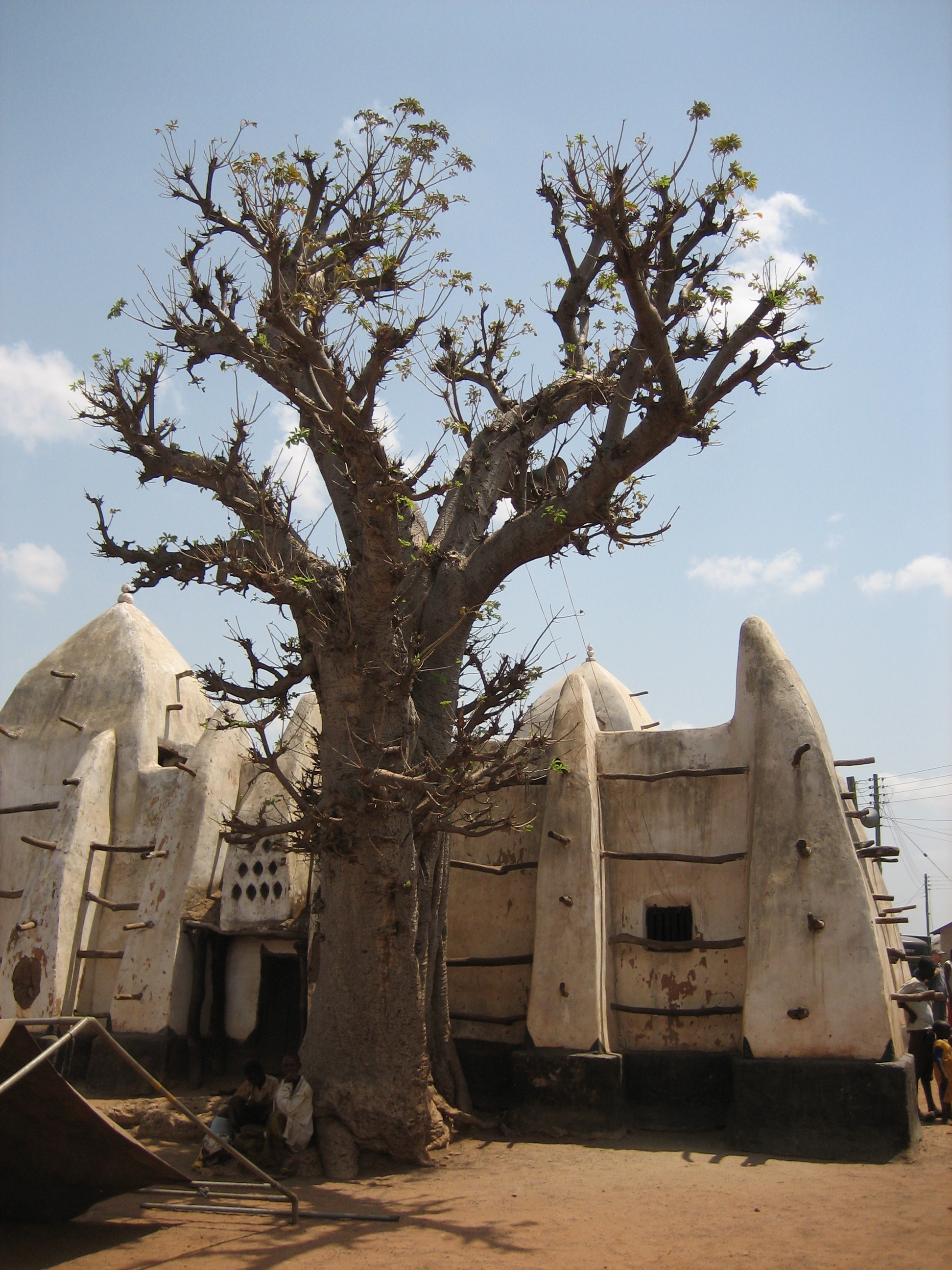
- Larabanga
Infobox Settlement
official_name = Larabanga
other_name =
native_name =
nickname =
settlement_type =
motto =
imagesize = 200px
image_caption =Larabanga Mosque
flag_size =
image_
seal_size =
image_shield =
shield_size =
image_blank_emblem =
blank_emblem_type =
blank_emblem_size =
mapsize =
map_caption =
mapsize1 =
map_caption1 =
image_dot_
dot_mapsize =
dot_map_caption =
dot_x = |dot_y =
pushpin_
pushpin_label_position =bottom
pushpin_map_caption =Location in Ghana
subdivision_type = Country
subdivision_name =
subdivision_type1 = Region
subdivision_name1 = Northern Region
subdivision_type2 = District
subdivision_name2 =
subdivision_type3 =
subdivision_name3 =
subdivision_type4 =
subdivision_name4 =
government_footnotes =
government_type =
leader_title =
leader_name =
leader_title1 =
leader_name1 =
leader_title2 =
leader_name2 =
leader_title3 =
leader_name3 =
leader_title4 =
leader_name4 =
established_title =
established_date =
established_title2 =
established_date2 =
established_title3 =
established_date3 =
area_magnitude =
unit_pref =Imperial
area_footnotes =
area_total_km2 =
area_land_km2 =
area_water_km2 =
area_total_sq_mi =
area_land_sq_mi =
area_water_sq_mi =
area_water_percent =
area_urban_km2 =
area_urban_sq_mi =
area_metro_km2 =
area_metro_sq_mi =
area_blank1_title =
area_blank1_km2 =
area_blank1_sq_mi =
population_as_of =2005
population_footnotes =
population_note =
population_total =
population_density_km2 =
population_density_sq_mi =
population_metro =
population_density_metro_km2 =
population_density_metro_sq_mi =
population_urban =
population_density_urban_km2 =
population_density_urban_sq_mi =
population_blank1_title =Ethnicities
population_blank1 =
population_blank2_title =Religions
population_blank2 =
population_density_blank1_km2 =
population_density_blank1_sq_mi =
timezone =
utc_offset =
timezone_DST =
utc_offset_DST =
latd=9|latm=13 |lats= |latNS=N
longd=1|longm=51|longs= |longEW=W
elevation_footnotes =
elevation_m =
elevation_ft =
postal_code_type =
postal_code =
area_code =
blank_name =
blank_info =
blank1_name =
blank1_info =
website =
footnotes =Larabanga is a town in north western
Ghana . It is known for its mud-built whitewashed Sahelianmosque , said to date from1421 , although this is mere estimate, it is older than the first white people in the country, but the exact date is unknown. It was at the height of thetrans-Saharan trade . It is reputed to be Ghana's oldestmosque and houses a copy of theQur'an almost as old. The foundations of the mosque are said to have been started by Allah, also the walls are also reputed to be partly Allah's work as every morning, the workers found the walls higher than they had built.The town is also known for its
Mystic Stone , for its patternedvernacular architecture and as the entrance to theMole National Park .External links
* [http://www.geocities.com/larabangaghana geocities.com: Larabanga website]
Wikimedia Foundation. 2010.

