- Hohenzell
Infobox Town AT
name=Hohenzell
name_local=
image_coa = Wappen_at_hohenzell.png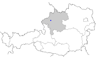
state = Oberösterreich
regbzk =
district =Ried im Innkreis
population =2002
population_as_of = 01.01.2001
population_ref =
pop_dens =
area = 23
elevation = 478
lat_deg=48
lat_min=11
lat_sec=39
lat_hem=N
lon_deg=13
lon_min=32
lon_sec=40
lon_hem=E
postal_code = A-4921
area_code =+43 7752
mayor = Johann Zweimüller (ÖVP)
website = [http://www.hohenzell.at www.hohenzell.at]Hohenzell is a municipality in
Upper Austria . It is situated in the district ofRied im Innkreis in theInnviertel and has 2,002 inhabitants. The responsible jurisdiction is "Ried im Innkreis".Geography
Hohenzell is situated 478 m above
sea level in theInnviertel . Its dimensions are 6.8 km from the North to the South and 5.7 km from the West to the East. The complete area accounts for 22.6 km². 10.2 % of the land is afforested, 80.1 % is used agriculturally. Parts of the municipality are "Aching", "Aschbrechting", "Breiningsham", "Breitsach", "Dürnberg", "Emprechting", "Engersdorf", "Ficht", "Gadering", "Gonetsreith", "Hilprechting", "Hohenzell", "Kager", "Langstadl", "Leisen", "Mauler", "Oberham", "Oberlemberg", "Obermauer", "Plöck", "Ponner", "Roith", "Wöging", "Wötzling", "Wanger", and "Willmerting".Coat of Arms
The official description of the coat of arms (translation): "From Red to Silver diagonally separated, with two heraldic roses in complementary colours; on the separating line a sword, which is silver at the top and black at the bottom." The municipal colours are green and white.
History
From the foundation of the
Bavaria ndukedom the city belonged to Bavaria until1780 . Together with the Innviertel (former known as "Innbaiern") it was ceded toAustria after theTreaty of Teschen . During theFrench Revolutionary Wars it became Bavarian again, then in1814 it became part of Upper Austria to whom it has belonged up to the present day. After theAnschluß to theGerman Reich on the 13th of March1938 the city was part of the "Gau Oberdonau". After1945 the restitution of Upper Austria took place.Politics
Since April
2005 Johann Zweimüller (ÖVP ) has been the mayor and Mag. Thomas Fischer (ÖVP) the vice mayor.Population Development
According to the
population census in1991 the municipality had 1,870 inhabitants, and 2,002 inhabitants in2001 .
Wikimedia Foundation. 2010.