- Ajlun
Infobox Settlement
official_name = Ajlun
other_name =
native_name = مدينة عجلون
nickname =
settlement_type =
motto =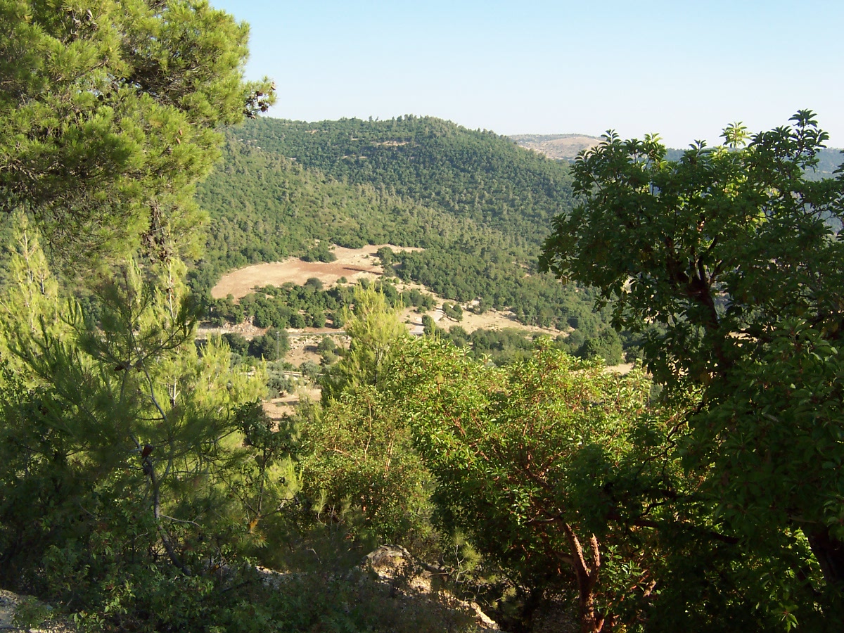
imagesize = 300px
image_caption =
flag_size =
image_
seal_size =
image_shield =
shield_size =
image_blank_emblem =
blank_emblem_type =
blank_emblem_size =
mapsize =
map_caption =
mapsize1 =
map_caption1 =
image_dot_
dot_mapsize =
dot_map_caption =
dot_x = |dot_y =
pushpin_
pushpin_label_position =bottom
pushpin_map_caption =Location in Jordan
subdivision_type = Country
subdivision_name =Jordan
subdivision_type1 = Province
subdivision_name1 =Ajlun Governorate
subdivision_type2 =
subdivision_name2 =
subdivision_type3 =
subdivision_name3 =
subdivision_type4 =
subdivision_name4 =
government_footnotes =
government_type =
leader_title =
leader_name =
leader_title1 =
leader_name1 =
leader_title2 =
leader_name2 =
leader_title3 =
leader_name3 =
leader_title4 =
leader_name4 =
established_title =
established_date =
established_title2 =
established_date2 =
established_title3 =
established_date3 =
area_magnitude =
unit_pref =Imperial
area_footnotes =
area_total_km2 =
area_land_km2 =
area_water_km2 =
area_total_sq_mi =
area_land_sq_mi =
area_water_sq_mi =
area_water_percent =
area_urban_km2 =
area_urban_sq_mi =
area_metro_km2 =
area_metro_sq_mi =
area_blank1_title =
area_blank1_km2 =
area_blank1_sq_mi =
population_as_of =2004
population_footnotes =
population_note =
population_total =
population_density_km2 =
population_density_sq_mi =
population_metro =
population_density_metro_km2 =
population_density_metro_sq_mi =
population_urban =
population_density_urban_km2 =
population_density_urban_sq_mi =
population_blank1_title =Ethnicities
population_blank1 =
population_blank2_title =Religions
population_blank2 =
population_density_blank1_km2 =
population_density_blank1_sq_mi =
timezone = GMT
utc_offset = +2
timezone_DST = +3
utc_offset_DST =
latd=32|latm=21|lats= |latNS=N
longd=35 |longm=44 |longs= |longEW=E
elevation_footnotes =
elevation_m = 1240
elevation_ft = 4068
postal_code_type =
postal_code =
area_code = +(962)2
blank_name =
blank_info =
blank1_name =
blank1_info =
website =
footnotes =Ajlun ( _ar. عجلون) is the capital town of the
Ajlun Governorate (although it is not the largest city in the governorate). A hilly town in the north ofJordan , located 76 kilometers (around 47 miles) north west ofAmman . It is noted for its impressive ruins the 12th century castle which known nowadays asAjlun Castle . Ajlun Governorate has a population of over 130 thousand widespread in twenty seven villages and towns and area about 420 km2. Population of Ajlun Governorate is mainly composed of the following tribes: Alqudah, Almomani, Freihat, Zoghoul and Rabadi. People of the area are very well-known for pursuing university degrees and higher education. The most notable towns and villages in Ajlun (other than Ajlun itself) are : Ain-Janna, Kufranji, Anjara, Sakhra and Ibbeen.Demographics
According to the Jordan national census of 2004, the population of the town of Ajlun was 7,289. Ajlun Governorate is about 119,000. Muslims make up the majority of Ajlun's population, there are Christian minority groups in the city as well. The governorate of Ajlun is highly agricultural, as the population distibution tells.
Point of Interest
The
Ajlun Castle , is located on the site of an old monastery. It was built byIzz al-Din Usama , a general ofSaladin army, in 1184. It permitted to control the road ofDamascus andEgypt . The fortress marks the limit which the Franks could never exceed in the east. TheMamelukes increased it then, adding its square tower in particular to it. It was taken by the Mongols into 1260 and partially destroyed.Climate and Topography
The Ajlun mountains are famous for their lush vegetation and thick green forests and a good place for hikes. Its highest mountain peaks reach around 1250 meters above
sea level . It's one of the countries most beautiful regions. It receives a number of snow storms per year with snow accumulations that reach up to a meter at times.Gallery
External links
* [http://www.jordan.jo/ Ajlun, Jordan Information Center Ar_icon]
* [http://www.visitjordan.com/visitjordan_cms/Default.aspx?tabid=169 Jordan Tourism Board]

Wikimedia Foundation. 2010.