- Adrar Province
Infobox Algerian Province
name1 = Adrar
name2 = أدرار
provincecode = 1
areacode = 49
capital = Adrar, Algeria
districts = 11
municipalities = 28
wali = Mr. Messaoud Djari
president = Mr. Menad Mehdi (FLN)
order = 1 E+10 m²
area1 = 439,700
area2 = 169,769
population = 402,197 [http://rgph2008.ons.dz/resultat/histo.htm Office National des Statistiques, Recensement General de la Population et de l’Habitat 2008] Preliminary results of the 2008 population census. Accessed on 2008-07-02. ]
popyear = 2008
density1 = 0,9
density2 = 2,4|:"For the region of Mauritania, see
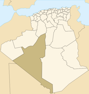
Adrar (region) ."Adrar ( _ar. ولاية أدرار ) is a province of southwesternAlgeria , named after its capital Adrar. It is the second-largest province, with an area of 427,368 km². It had 402,197 inhabitants at the 2008 population census.It is bordered to the north by the
Wilaya (province) ofBechar ,El Bayadh andGhardaïa ; to the west by the Wilaya ofTindouf ; to the east by the Wilaya ofTamanrasset ; to the south byMauritania andMali .Adrar is composed of three natural and cultural Regions:
Touat (Adrar,Zaouit Kounta ),Gourara (Aoulef ,Timimoune ), andTidikelt (Aoulef ) and 299 "ksour".Administrative divisions
It is made up of 11 districts and 28 municipalities. The districts are (in no particular order):
*Fenoughil
*Reggane
*Bordj Badji Mokhtar
*Aoulef
*Timimoune
*T'Sabit
*Aougrout
*Tinerkouk
*Charouine
*Adrar
*Zaouiat KountaThe municipalities are:
*Adrar
*Akabli
*Aougrout
*Aoulef
*Bordj Badji Mokhtar
*Bouda
*Charouine
*Deldoul
*Fenoughil
*In Zghmir
*Ksar Kaddour
*Metarfa
*Ouled Ahmed Timmi
*Ouled Aissa
*Ouled Said
*Reggane
*Sali
*Sebaa
*Talmin
*Tamantit
*Tamest
*Timekten
*Timiaouine
*Timimoun
*Tinerkouk
*Tit
*Tsabit
*Zaouiet Kounta References

Wikimedia Foundation. 2010.