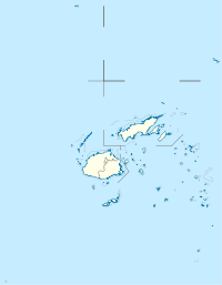
Mana Island, Fiji — Mana Island belongs to the Mamanuca Islands, Fiji. Mana Island Airport is located there. Coordinates: 17°41′S 177°06′E / 17.683°S 177.1°E … Wikipedia
Mana Island Resort (Mana Island) — Mana Island Resort country: Fiji, city: Mana Island (Mana Island) Mana Island Resort Location Mana Island is the largest gem in the cluster of jewels that nestle in the sunset of the Mamanuca Group of beckoning tropical islands. The resort is 32… … International hotels
Mana (New Zealand electorate) — Mana is a New Zealand Parliamentary electorate north of Wellington. It is currently held by Kris Faafoi MP. Contents 1 Population centres 2 History 3 Members of … Wikipedia
Mana Motuhake — Mana Māori Motuhake was a Māori political party in New Zealand. The name is difficult to translate accurately, but essentially refers to Māori self rule and self determination mana, in this context, can be understood as authority or power , while … Wikipedia
Mana Wahine Te Ira Tangata — was a small and short lived political party in New Zealand. It was established by Alamein Kopu, a member of the New Zealand Parliament who had left her original party (the Alliance). After a short time as an independent MP, Kopu established Mana… … Wikipedia
Mana Māori Movement — The Mana Māori Movement was a New Zealand political party. It advocated on behalf of the Māori people. It was founded by Eva Rickard, a prominent Māori activist. Rickard was originally a member of Mana Motuhake, another Māori party, but quit when … Wikipedia
Wellington International Airport — Wellington Airport redirects here. For other uses, see Wellington Airport (disambiguation). Wellington International Airport Aerial photo of Wellington International Airport (north to left) IATA: WLG – … Wikipedia
Mountain View Airport (Missouri) — Coordinates: 36°59′34″N 091°42′52″W / 36.99278°N 91.71444°W / 36.99278; 91.71444 … Wikipedia
Easter Island — For the album by Kris Kristofferson, see Easter Island (album). Rapa Nui redirects here. For other uses, see Rapa Nui (disambiguation). Coordinates: 27°7′S 109°22′W / … Wikipedia
No Commercial Airport at Whenuapai Airbase Party — No Commercial Airport at Whenuapai Airbase logo Toby Hutton 2010 The No Commercial Airport at Whenuapai Airbase Party was a local political pa … Wikipedia

