- Lesko County
Infobox Settlement
name = Lesko County
native_name = Powiat leski
settlement_type = County
total_type = Total
image_shield =

image_shield =
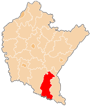
map_caption = Location within the voivodeship
subdivision_type = Country
subdivision_name = POL
subdivision_type1 = Voivodeship
subdivision_name1 = Subcarpathian
area_total_km2 = 834.86
population_total = 26613
population_as_of = 2006
population_density_km2 = auto
population_urban = 5864
population_blank1_title = Rural
population_blank1 = 20749
coor_type = Lesko
latd = 49
latm = 28
lats = 28
latNS = N
longd = 22
longm = 19
longs = 44
longEW = E
seat =Lesko
parts_type =Gmina s
parts = Total 5
p1 =Gmina Baligród
p2 =Gmina Cisna
p3 =Gmina Lesko
p4 =Gmina Olszanica
p5 =Gmina Solina
blank_name = Car plates
blank_info = RLS
website = http://www.powiat-leski.pl/ __NOTOC__Lesko County ( _pl. powiat leski) is a unit of territorial administration and local government (powiat ) inSubcarpathian Voivodeship , south-easternPoland , on the Slovak border. It was created in 2002 out of fivegmina s which previously made up the western part ofBieszczady County . Its administrative seat and only town isLesko , which lies convert|67|km|mi|0 south of the regional capitalRzeszów .The county covers an area of convert|834.86|km2|sqmi|1. As of 2006 its total population is 26,613, out of which the population of Lesko is 5,864 and the rural population is 20,749.
Neighbouring counties
Lesko County is bordered by
Sanok County to the west,Przemyśl County to the north andBieszczady County to the east. It also bordersSlovakia to the south.Administrative division
The county is subdivided into five
gmina s (one urban-rural and four rural). These are listed in the following table, in descending order of population.References
* [http://www.stat.gov.pl/gus/45_655_PLK_HTML.htm Polish official population figures 2006]
Rural landscape picture
Wikimedia Foundation. 2010.