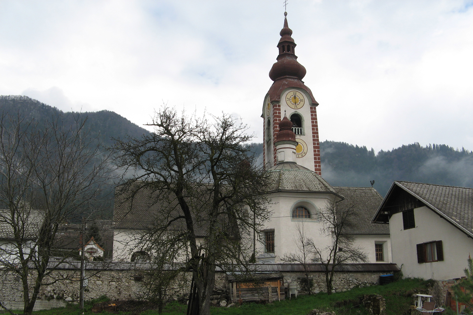
- Rodine
Infobox Settlement
official_name = Rodine
other_name =
native_name =
nickname =
settlement_type =
motto =
imagesize = 250px
image_caption =
flag_size =
image_
seal_size =
image_shield =
shield_size =
image_blank_emblem =
blank_emblem_type =
blank_emblem_size =
mapsize =
map_caption =
mapsize1 =
map_caption1 =
image_dot_
dot_mapsize =
dot_map_caption =
dot_x = |dot_y =
pushpin_
pushpin_label_position =bottom
pushpin_map_caption = Location in Slovenia
subdivision_type = Country
subdivision_name =
subdivision_type1 = Region
subdivision_name1 =Upper Carniola
subdivision_type2 = Municipality
subdivision_name2 =Žirovnica
subdivision_type3 =
subdivision_name3 =
subdivision_type4 =
subdivision_name4 =
leader_name =
leader_title1 =
leader_name1 =
leader_title2 =
leader_name2 =
leader_title3 =
leader_name3 =
leader_title4 =
leader_name4 =
established_title =
established_date =
established_title2 =
established_date2 =
established_title3 =
established_date3 =
area_magnitude =
area_footnotes =
area_total_km2 =
area_land_km2 =
area_water_km2 =
area_total_sq_mi =
area_land_sq_mi =
area_water_sq_mi =
area_water_percent =
area_urban_km2 =
area_urban_sq_mi =
area_metro_km2 =
area_metro_sq_mi =
area_blank1_title =
area_blank1_km2 =
area_blank1_sq_mi =
population_as_of =2002
population_footnotes =
population_note =
population_total =340
population_density_km2 =
population_density_sq_mi =
population_metro =
population_density_metro_km2 =
population_density_metro_sq_mi =
population_urban =
population_density_urban_km2 =
population_density_urban_sq_mi =
population_blank1_title =Ethnicities
population_blank1 =
population_blank2_title =Religions
population_blank2 =
population_density_blank1_km2 =
population_density_blank1_sq_mi =
timezone =
utc_offset =
timezone_DST =
utc_offset_DST =
latd= 46|latm= 23|lats=4 |latNS=N
longd=14|longm=10|longs=34 |longEW=E
elevation_footnotes =
elevation_m = 544
elevation_ft =
postal_code_type =
postal_code =
area_code =
blank_name =
blank_info =
blank1_name =
blank1_info =
website =
footnotes = [ [http://www.stat.si/eng/index.asp Statistical Office of the Republic of Slovenia] ]Rodine is one of ten villages in the
Žirovnica municipality in theUpper Carniola region ofSlovenia .There is evidence of Roman settlement in the area of Rodine with the remains of a Roman farm (
villa rustica ) inKljuči . This was partially excavated in1959 , and finds show that it was settled from the late1st century AD until the5th century . Remains of three buildings and a number of small objects were found during excavation. Some are now on display inJalen's house [ [http://www.gorenjski-muzej.videofon.si/ Gorenjski Muzej Kranj] ] .The village church is the Church of St Klemen. There is evidence that a religious building was built on the site in the second half og the 10th century. A later gothic structure burnt down and the
Baroque church seen today was built in1692 . There is a tomb under the church which allegedly contains the remains of St Klemen, a saint who was tortured and killed in theCrimea ,Ukraine , whose bones were found in Rodine. The church was renovated in1876 to repair extensive damage to the roof and spire [ [http://www.zirovnica.si/podrocje.aspx?id=250 Žirovnica Municipality site] ] . The Slovene writerJanez Jalen 's birth-house, now a small museum, is in Rodine as well.In recent years, the settlement has grown northwards, further up the hill side and westwards to reach right to the outskirts of
Smokuč . There are open fields and forests towards the east and south of the village.Notes
External links
* [http://www.geopedia.si/#L410_F10097967_T105_b4_x437242.40599999995_y137884.5_s15 Rodine at Geopedia]
* [http://www.zirovnica.eu/ Žirovnica Tourist Association site]
Wikimedia Foundation. 2010.

