- Poznań Voivodeship (1921-1939)
Infobox Former Subdivision
conventional_long_name = Poznań
native_name =
common_name = Poznań
subdivision = Voivodeship
nation= Poland
year_start = 1919
date_start = 1 August
year_end = 1939
date_end = 12 September
event_end = Annexed
event1 = Territorial changes
date_event1 = April 1, 1938
p1 = Province of Posen
flag_p1 = Flagge Preußen - Provinz Posen.svg
s1 = Reichsgau Wartheland
flag_s1 =
today =

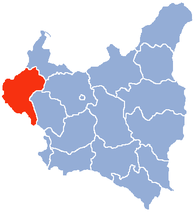
image_map_caption = Location of Poznań Voivodeship within Poland (1938 borders)
capital = Poznań
latd=52 |latm=24 |latNS=N |longd=16 |longm=55 |longEW=E
stat_area1= 26528
stat_year1 = 1921
stat_pop1 = 1967865
stat_year2 = 1931
stat_pop2 = 2339600
stat_area2= 26528
stat_year3 = 1938
stat_area3 = 28089
stat_year4 = 1939
stat_area4 = 27379
political_subdiv=
title_leader = Voivode
leader1 = Wojciech Trąmpczyński
year_leader1 = August - October 1919
leader2 = Cyryl Ratajski
year_leader2 = Sept 1939Poznań Voivodeship ( _pl. Województwo Poznańskie) was a unit of administrative division and local government in Poland in the years 1921-1939, created after World War I from the Prussian-German province of Poznań (
Province of Posen ). The borders were changed in 1939: the city of Bydgoszcz passed to thePomeranian Voivodeship , but some Eastern areas were included (see:Territorial changes of Polish Voivodeships on April 1, 1938 ).During World War II it was occupied byNazi Germany and annexed as "Reichsgau Wartheland " "(Reich province of the Land of the Warta river)."Area and counties
Between April 1, 1938 - September 1, 1939, the Voivodeship's area was 28 089 km², and its population - 2 339 600 (according to the
1931 Polish census ). It consisted of 29powiats (the highest number in Poland, however, most of them were very small, both in area and population), 100 towns (the highest number in Poland) and 237 villages. Railroad density was high, with 10.1 km. per 100 km² (total length of railroads within the Voivodeship's area was 2 684 km., the highest in the whole country). Forests covered 19.8% of the Voivodeship, which was lower than the national average (in 1937 the average was 22.2%).Poznańskie Voivodeship was one of the richest and best developed in interwar Poland. With numerous cities and well-developed rail, it also was a breadbasket of the country, its highly efficient agriculture was well-mechanized. The city of Poznań was a big industrial center, as well as a key railroad junction. Only 7.6% of population was illiterate, which was much lower than the national average of 23.1% (as of 1931). Poles made up the majority of the population (90.5%), with 7.4%
Germans and 1.9%Jews .This is the list of the Poznań Voivodeship counties as for August 31, 1939:
*
Chodzież county (area 893 km², pop. 44 500),
*Czarnków county (area 919 km², pop. 43 300),
* city ofGniezno county (area 18 km², pop. 30 700),
* Gniezno county (area 1 126 km², pop. 57 300),
*Gostyń county (area 701 km², pop. 55 900),
*Jarocin county (area 1 124 km², pop. 87 500),
*Kalisz county (area 1 478 km², pop. 196 700),
*Kępno county (area 1 179 km², pop. 86 900),
* Koło county (area 1 097 km², pop. 109 800),
*Konin county (area 2 152 km², pop. 168 000),
*Kościan county (area 1 057 km², pop. 78 900),
*Krotoszyn county (area 915 km², pop. 75 500),
*Leszno county (area 827 km², pop. 61 200),
*Międzychód county (area 755 km², pop. 31 000),
*Mogilno county (area 1 059 km², pop. 70 300),
*Nowy Tomyśl county (area 1 276 km², pop. 87 300),
*Oborniki county (area 966 km², pop. 50 400),
*Ostrów Wielkopolski county (area 1 194 km², pop. 104 100),
* city ofPoznań county (area 77 km², pop. 246 500),
*Poznań county (area 1 227 km², pop. 91 200),
*Rawicz county (area 523 km², pop. 49 900),
*Szamotuły county (area 1 076 km², pop. 67 700),
*Środa Wielkopolska county (area 800 km², pop. 49 900),
*Srem county (area 921 km², pop. 57 300),
*Turek county (area 1 591 km², pop. 130 500),
*Wągrowiec county (area 1 037 km², pop. 54 300),
*Wolsztyn county (area 754 km², pop. 47 900),
*Września county (area 608 km², pop. 43 700),
*Żnin county (area 739 km², pop. 41 500).Main cities
The biggest cities of the Voivodeship were (data according to the 1931 census):
* Poznań (pop. 246 500),
* Kalisz (pop. 68 300),
* Gniezno (pop. 30 700),
* Ostrów Wielkopolski (pop. 24 400),
* Leszno (pop. 19 400),
* Koło (pop. 13 800)
* Krotoszyn (pop. 13 000),
* Konin (pop. 10 300).Voivodes
*
Wojciech Trąmpczyński 1 August 1919 – 23 October 1919
*Witold Celichowski 1 August 1919 – 2 January 1923
*Adolf Bniński 10 January 1923 – 9 May 1928
*Piotr Dunin-Borkowski 9 May 1928 – 11 October 1929
*Roger Adam Raczyński 11 October 1929 – 31 July 1934
*Stanisław Kaucki 1 August 1934 – 15 January 1935 (acting)
*Artur Maruszewski 16 June 1935 – 23 June 1935
*Mikołaj Kwaśniewski 26 June 1935 – 13 September 1935
*Tadeusz Walicki 19 September 1935 – 29 October 1935 (acting)
*Artur Maruszewski 29 October 1935 – 19 May 1939
*Ludwik Bociański 19 May 1939 – 12 September 1939
*Cyryl Ratajski 4 September 1939 – 12 September 1939 (acting)ee also
*
Poland 's current Greater Poland and Kuyavian-Pomeranian VoivodeshipsReferences
* Maly rocznik statystyczny 1939, Nakladem Glownego Urzedu Statystycznego, Warszawa 1939 (Concise Statistical Year-Book of Poland, Warsaw 1939).
Wikimedia Foundation. 2010.