- Belitung
Infobox Islands
name = Belitung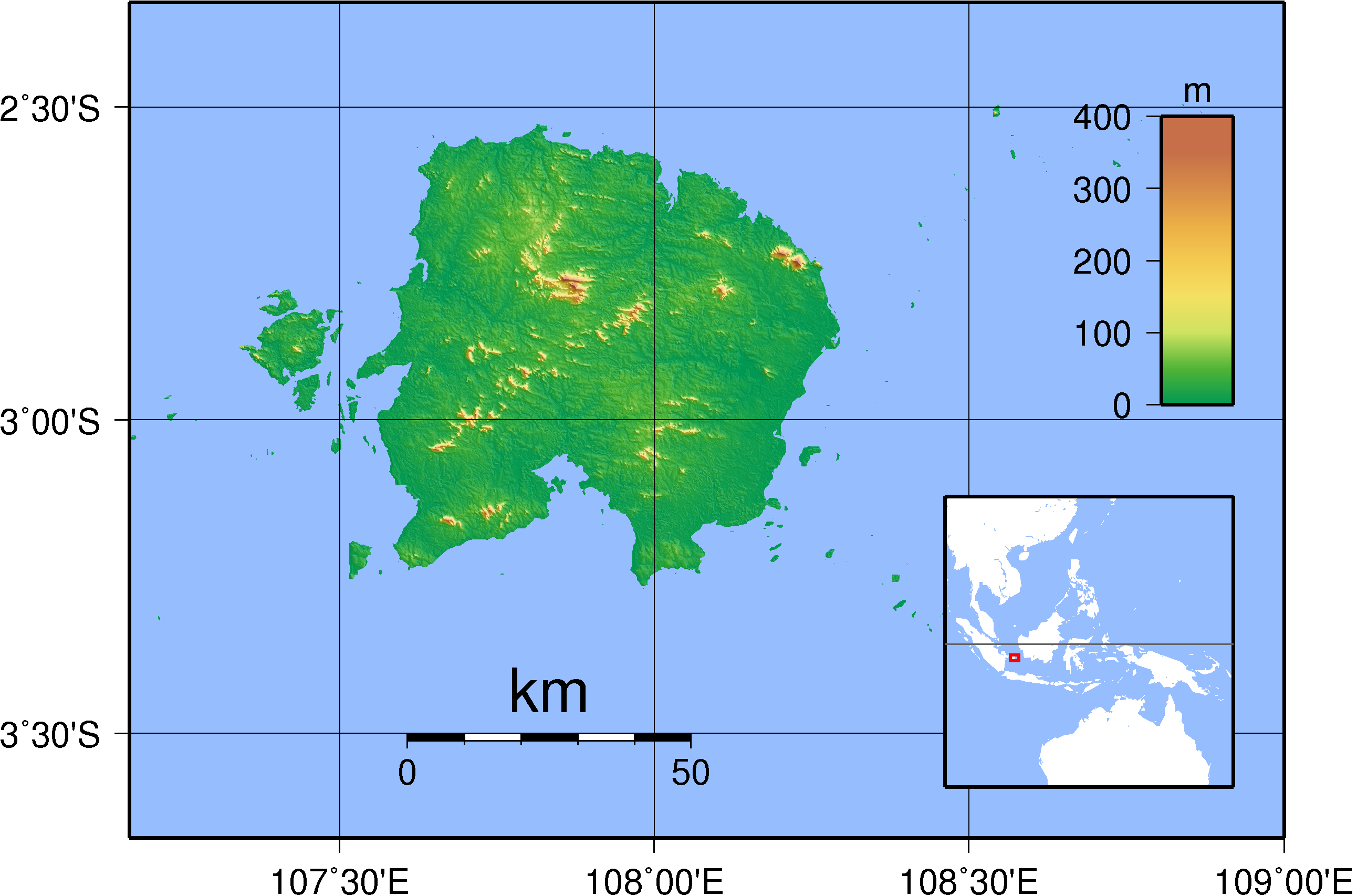
image caption = Topography of Belitung island
locator
native name =
native name link =
location =South East Asia
coordinates= coord|2|50|S|107|55|E|region:ID_type:isle
archipelago =
total islands =
major islands =
area =
highest mount =
elevation =
country = Indonesia
country admin divisions title =
country admin divisions =
country largest city =
country largest city population =
population =
population as of =
density =
ethnic groups =Belitung, formerly known as Billiton, is an island on the east coast of
Sumatra ,Indonesia in theJava Sea . The island is known for its pepper and for itstin . It was in the possession of the British from1812 until the British ceded control of the island to the Dutch in theAnglo-Dutch Treaty of 1824 . Its main town isTanjung Pandan .Geography
It is a small island, moderately rugged terrain with several hills. The highest one is Mount Tajam with the height of only less than m to ft|500. Being surrounded by straits, its sea is moderately calm and shallow. Belitung is popular with its granite boulder white stones beach in Tanjung Tinggi, Tanjung Kelayang, Tanjung Binga and Lengkuas island.
Demography
The population is centered in several small towns, populated by approximately 200,000 inhabitants.
Economy
Belitung is a producer of tin, clay and silica sands. It also a producer of fishery products, pepper, and palm oil. People work as farmers, fishermen and miners. The island is easily accessible with daily 50-minute flights from Jakarta. Australian mining company
BHP Billiton derives its name from this island.ee also
*
BHP Billiton
Wikimedia Foundation. 2010.