Paxton Water Tower and Pump House
- Paxton Water Tower and Pump House
Infobox_nrhp | name = Paxton Water Tower and Pump House
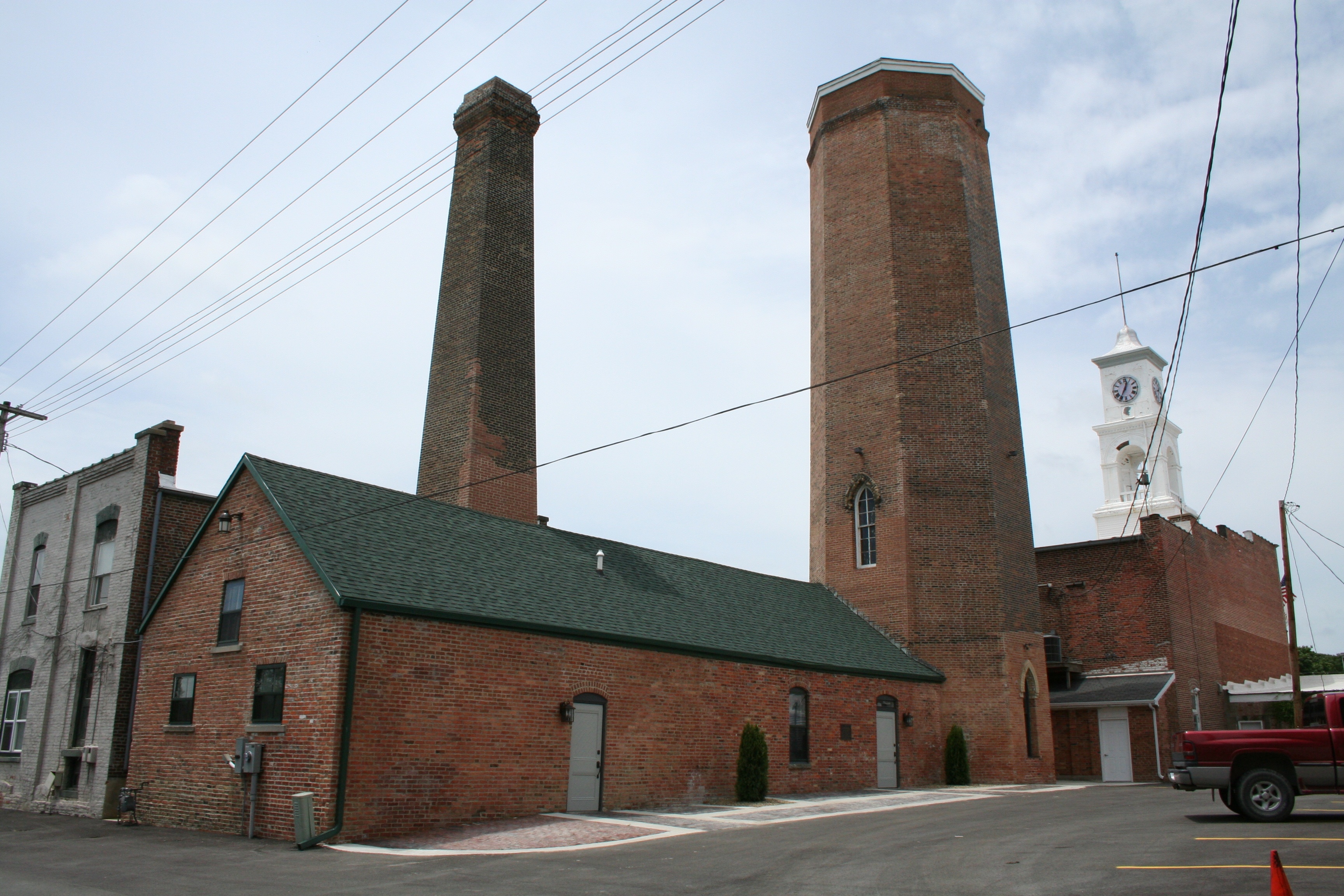
caption = Rear of the water tower and pump house
locator_x =
locator_y =
location = Paxton, Ford County, Illinois, USA
nearest_city =
lat_degrees = 40
lat_minutes = 27
lat_seconds = 31
lat_direction = N
long_degrees = 88
long_minutes = 5
long_seconds = 45
long_direction = W
built =
added = November 13, 1984 [ [http://www.nr.nps.gov/nrloc1.htm NRIS Database] , National Register of Historic Places, retrieved Jan. 2007.]
governing_body =
The Paxton Water Tower and Pump House, a Registered Historic Place, is located in the county seat of Ford County, Illinois, Paxton. The location has been listed on the National Register since November 1984. Three of Ford County's four Registered Historic Places can be found in Paxton, the other two being the Paxton Carnegie Public Library and the Paxton First Schoolhouse. The fourth site, found in Gibson City, Illinois, is the Alfred Phillips House.
Notes
Wikimedia Foundation.
2010.
Look at other dictionaries:
Paxton First Schoolhouse — Infobox nrhp | name = Paxton First Schoolhouse caption = locator x = locator y = location = Paxton, Ford County, Illinois, USA nearest city = lat degrees = 40 lat minutes = 27 lat seconds = 31 lat direction = N long degrees = 88 long minutes = 5… … Wikipedia
Alfred Phillips House — Infobox nrhp | name = Alfred Phillips House caption = locator x = locator y = location = Gibson City, Ford County, Illinois, USA nearest city = lat degrees = 40 lat minutes = 27 lat seconds = 56 lat direction = N long degrees = 88 long minutes… … Wikipedia
National Register of Historic Places listings in Illinois — Map of all coordinates from Google Map of all coordinates from Bing … Wikipedia
Chatsworth House — across the River Derwent, with the Hunting Tower visible above Chatsworth House is a stately home in North Derbyshire, England, 3.5 miles (5.6 km) northeast of Bakewell and 9 miles (14 km) west of Chesterfield (GB Grid SK260700). It is… … Wikipedia
List of historic buildings and architects of the United Kingdom — The Historic buildings of the United Kingdom date from the stone age to the twenty first century AD, and tell the story of the architecture of the United Kingdom.See also: List of British architects Pre Historic buildings structures Roman… … Wikipedia
building construction — Techniques and industry involved in the assembly and erection of structures. Early humans built primarily for shelter, using simple methods. Building materials came from the land, and fabrication was dictated by the limits of the materials and… … Universalium
Civil parishes in Cambridgeshire — A map of Cambridgeshire, showing the Districts, clockwise from the top left: Peterborough; Fenland; East Cambridgeshire; South Cambridgeshire; Cambridge; and Huntingdonshire. A civil parish is a subnational entity, forming the low … Wikipedia
Steam engine — A steam engine is a heat engine that performs mechanical work using steam as its working fluid. [ [http://www.britannica.com/EBchecked/topic/564472/steam engine steam engine Britannica Online Encyclopedia ] ] Steam engines have a long history,… … Wikipedia
Buxton — Infobox UK place official name= Buxton country= England region= East Midlands population= 25,000 os grid reference= SK059735 latitude= 53.259 longitude= 1.911 map type= Derbyshire post town= BUXTON postcode area= SK postcode district= SK17 dial… … Wikipedia
List of songs about London — This is a list of songs about London. Instrumental pieces are tagged with an uppercase [I] , or a lowercase [i] for quasi instrumental including non lyrics voice samples.Included are::* Songs titled after London, or a location or feature of the… … Wikipedia