- Injibara
Infobox Settlement
official_name = PAGENAME
native_name =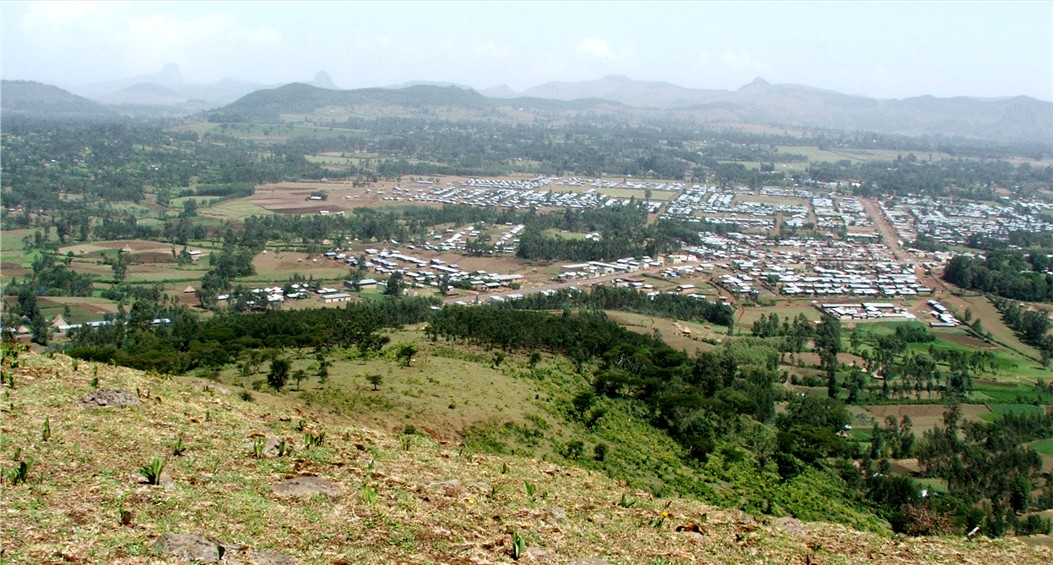
imagesize = 340px
image_caption =
image_
map_caption =
pushpin_
pushpin_label_position =bottom
pushpin_mapsize = 300
pushpin_map_caption =Location in Ethiopia
subdivision_type = Country
subdivision_type1 = Region
subdivision_name =Ethiopia
subdivision_name1 =Amhara Region
subdivision_type2 = Zone
subdivision_name2 =Agew Awi Zone
established_title =
established_date =
government_type =
leader_title =
leader_name =
area_magnitude =
area_total_sq_mi =
area_total_km2 =
area_land_sq_mi =
area_land_km2 =
area_urban_sq_mi =
area_urban_km2 =
area_metro_km2 =
area_metro_sq_mi =
population_as_of= 2005
population_footnotes =
population_total = 1364 (est)
population_urban =
population_metro =
population_density_sq_mi =
population_density_km2 =
timezone = EAT
utc_offset = +3
timezone_DST =
utc_offset_DST =
latd=10|latm=57|lats=|latNS=N
longd=36|longm=56|longs=|longEW=E
elevation_footnotes=
elevation_m = 2560
elevation_ft =
postal_code_type =
postal_code =
area_code =
website =
footnotes =Injibara (እንጅባራ) is a town in
Ethiopia . It is the administrative center of theAgew Awi Zone in theAmhara Region . Injibara is located at coord|10|57|N|36|56|E, at an elevation of 2560 meters above sea level, inBanja Woreda .Injibara is situated in a predominantly mountainous location. Entering the town by the
Bahir Dar road, it is impossible not to notice the great Mount Zerehi to the right, one of many massive stone monoliths found in the area. Another geographical feature of the area is the Zengena crater lake just south of the town. The hills and valleys receive high amounts of rain, especially in the rainy season. This high rainfall permits farmers to grow multiple crops a year. With this rainy weather comes hail, however, which is a major problem for the local farmers.Based on figures from the Central Statistical Agency in 2006, the old town Injibara has an estimated total population of 1364, of whom 649 were males and 715 were females. [ [http://www.csa.gov.et/text_files/national%20statistics%202006/Population.pdf CSA 2006 National Statistics] , Table B.4] . The figures for modern Injibara (Kosober) are 2,317 (male), 2,532 (female) and 4,849 (total).
History
Injibara was the scene of (in the words of Sven Rubenson) "one of the most bloody battles" of Emperor Tewodros' reign. In
1863 , he marched againstTedla Gwalu , who had revolted against him in Gojjam, defeated him, but Tedla Gwalu escaped to continue his revolt against Emperor Tewodros. [Ref Ethiopia|Rubenson-1966|pages= p. 80]Modern Injibara was constructed since 1991 at a place called
Kosober by locals, at the junction of Highway 3 fromAddis Ababa toBahir Dar and the road leading west towardsChagni and intoMetekel Zone . The older town of Injibara is situated approximately 5 km north of Modern Injibara at coord|10|59|N|36|55|E, at a 2660 meter elevation.Notes

Wikimedia Foundation. 2010.