- Wewak
Infobox PNG Place
type = city
name = Wewak
othername =
province = esp
llg = Wewak Urban, Wewak Rural, Wewak Island
lang = English,Tok Pisin ,Kairiru ,Boikin
langarea =Kairiru
dot_x = 42
dot_y = 36

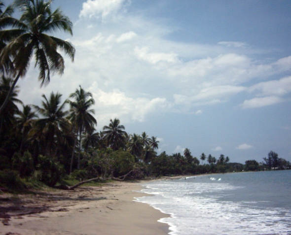
caption = One of Wewak's beaches
pop = 25,143
popdate = 2002
poprank = 6th
est = 1919
postcode =
elevation = 5
coor = coord|3|33|S|143|38|E|region:PG_type:city|display=inline,title
maxtemp = 30.8
mintemp = 24.2
rainfall =
dist1 = 260
location1 =Wuvulu Island Wewak is the capital of the
East Sepik province ofPapua New Guinea . It is located on the northern coast of the island ofNew Guinea . It is the largest town betweenMadang andJayapura .Between 1943 and 1945, during
World War II , Wewak was the site of the largest Japanese airbase in mainland New Guinea. The base was subjected to repeated bombing by Australian and U.S. planes, most notably in one massive attack onAugust 17 ,1943 . Directly to the west of the town centre is a peninsula known asCape Wom , which was the site of the surrender of Japanese forces in New Guinea, and now houses a small memorial.The old centre of the town is situated on a small peninsula, with the rest of the urban area occupying a narrow band of flat land between the ocean and the coastal range of mountains that emerges a short distance inland.
To the east of the town center is a small peninsula on which is located Boram Hospital, and
Wewak International Airport , which is also known as Boram.Wewak is linked by road to three villages on the
Sepik River :Angoram ,Timbunke , andPagui , though the roads are not always in good condition, and there are regular reports of criminal hold-ups of road traffic. In addition, a coastal highway extends to the west, linking Wewak with the coastal towns ofAitape andVanimo , which is the capital ofSandaun province.
Wikimedia Foundation. 2010.
