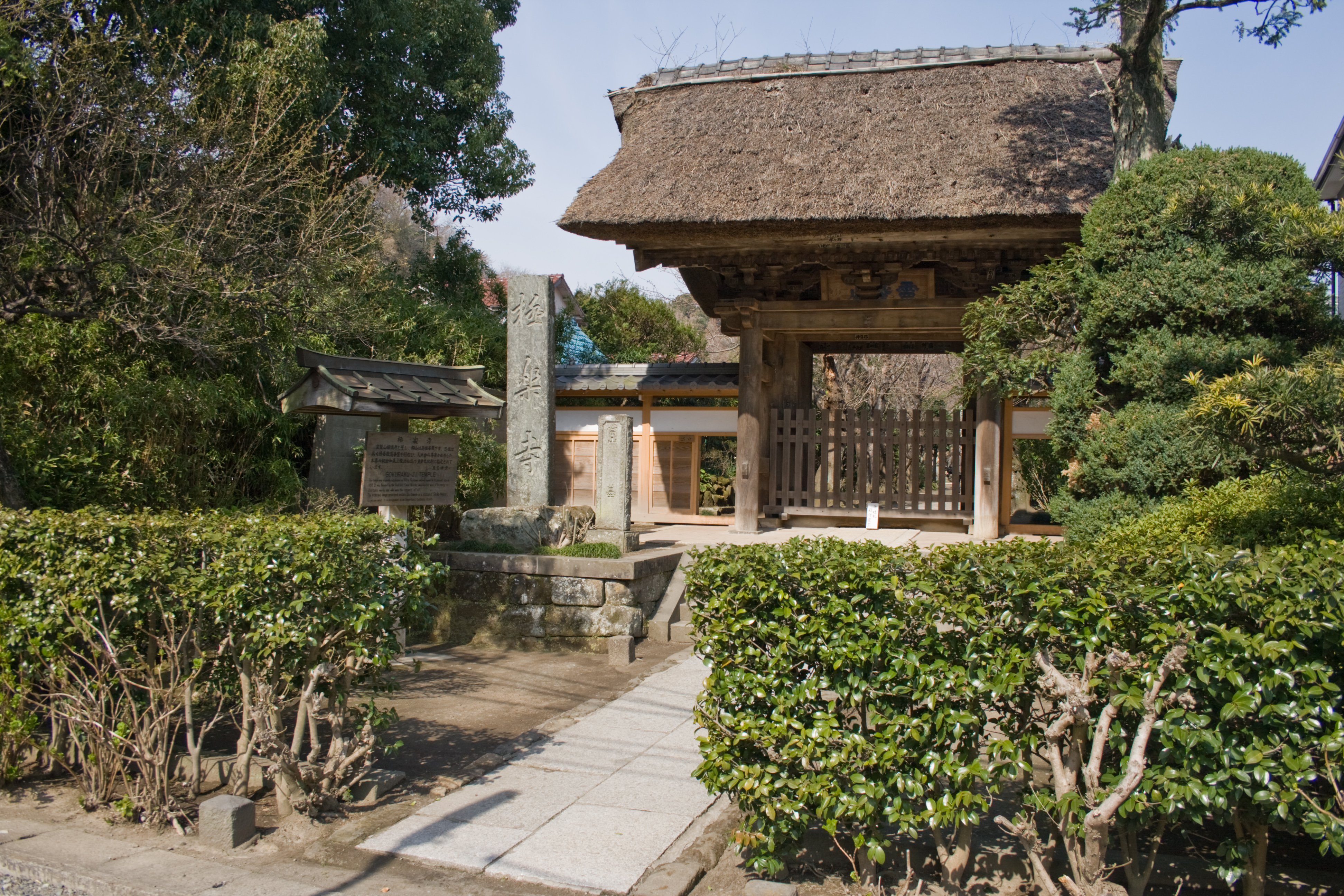
Gokuraku-ji (Kamakura) — 35° 18′ 37″ N 139° 31′ 42″ E / 35.310278, 139.528472 … Wikipédia en Français
Gokuraku-ji — Cette page d’homonymie répertorie les différents sujets et articles partageant un même nom. Gokuraku ji ou Gokurakuji (en japonais: 極楽寺) peut faire référence à : Patronymes la famille Gokurakuji, une famille de samourais. Temples Plusieurs… … Wikipédia en Français
Kamakura's Seven Entrances — The city of Kamakura, Kanagawa in Japan, is closed off on three sides by very steep hills and on the fourth by the sea: before the construction of several modern tunnels and roads, the so called nihongo|Seven Entrances|, or nihongo|Seven… … Wikipedia
Kamakura's proposed World Heritage sites — The city of Kamakura, Kanagawa has proposed some of its historic sites for inclusion in Unesco s World Heritage Sites list. The sites on the list are: * The nihongo|Asaina Pass|朝夷奈切通 One of Kamakura s Seven Entrances * The nihongo|Daibutsu… … Wikipedia
Kamakura — Pour le jeu de société Kamakura, voir Kamakura (jeu). Kamakura shi (鎌倉市) Vue sur le mont Fuji, avec Kamakura et la plage de Shichirigahama au premier plan … Wikipédia en Français
Kamakura, Kanagawa — Infobox City Japan Name= Kamakura JapaneseName= 鎌倉市 Map Region= Kantō Prefecture= Kanagawa District= Area km2= 39.60 PopDate= January 2008 Population= 173,588 Density km2= 4380 Coords= LatitudeDegrees= 35 LatitudeMinutes= 19 LatitudeSeconds=… … Wikipedia
Siege of Kamakura (1333) — Infobox Military Conflict conflict=Siege of Kamakura partof=the Genkō War caption=Statue of Nitta Yoshisada in front of Keiō Line Bubaigawara Station. date=May 18, 1333 place=Kamakura, Sagami Province casus= territory= result=Nitta victory; city… … Wikipedia
Jōmyō-ji (Kamakura) — Haupthalle des Jōmyō ji Garten im Jōmyō … Deutsch Wikipedia
Gokurakuji — (Jp: 極楽寺) can refer to a number of things: *The Gokurakuji family of samurai *A number of Buddhist temples in Japan: **Gokuraku ji (Kamakura) founded in Kamakura in 1259 by the Jōdō shū sect **Gokuraku ji (Hachiōji) in Hachiōji, Tokyo Prefecture… … Wikipedia
Liste de temples bouddhistes — Cette liste est incomplète ou mal ordonnée. Votre aide est la bienvenue ! Temples et monastères bouddhistes dans le monde. Sommaire 1 Allemagne 2 Argentine … Wikipédia en Français