- Talgar
Infobox City
official_name = Talgar
native_name = Талғар
motto =
image_
pushpin_
pushpin_label_position =bottom
pushpin_mapsize = 280
pushpin_map_caption =Location in Kazakhstan
map_caption = Location inKazakhstan
subdivision_type = Country
subdivision_type1 = Province
subdivision_type2 =subdivision_name = flag|Kazakhstan
subdivision_name1 =Almaty Province
subdivision_name2 = [Talgarskiy Rayon]
established_title = First settled
established_date = IX
established_title2 = Founded
established_date2 =1858
established_title3 = Incorporated (city )
established_date3 =1959
government_type =
leader_title = Akim (mayor )
leader_name =T.A. Umraliev
area_magnitude =
area_total_sq_mi =
area_total_km2 = 18.8
area_land_sq_mi =
area_land_km2 =
area_water_sq_mi =
area_water_km2 =
area_urban_sq_mi =
area_urban_km2 =
area_metro_km2 =
area_metro_sq_mi =
population_as_of=1999
population_footnotes =
population_total = 41,800
population_urban =
population_metro =
population_density_sq_mi =
population_density_km2 =
timezone =UTC
utc_offset = +6
timezone_DST =
utc_offset_DST =
latd=43|latm=18|lats=|latNS=N
longd=77|longm=14|longs=|longEW=E
elevation_footnotes=
elevation_m = 1000 - 1500
elevation_ft =
postal_code_type =Postal code
postal_code = 041601-041605 (town)
area_code = +7 72774 [ [http://www.almaly.almaty.kz/page.php?page_id=93&lang=2&news_id=483 CODE OF ACCESS] ]
website = http://www.almaty-reg.kz
footnotes =Talgar ( _kz. Талғар IPA|/tɑlˈɣɑr/ ; _ru. Талгар) is a town in
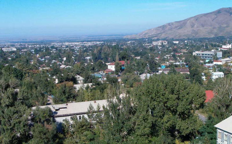
Almaty Province , southeasternKazakhstan . It is the administrative center ofTalgar District . The town is located betweenAlmaty andEsik , 25 km from Almaty.Name
There are several possible explanations for the town's name. The most obvious is that Talgar originates from a later modified name of an ancient settlement of Talkhir, situated in the Talgar suburbs.
History
Middle Ages
The first records of Talgar settlement were made by a
Persian geographer in an ancient geographical treatiseKhudud al-alem ("Borders of The World") in 982. The settlement bore a name Talkhiz and was situated in the mountains ofSemirechye at the borders ofTurkic tribesKarluk andChigiley . The geographer described inhabitants of Talkhiz as "brave, martial, and valiant people". Scientists analyzed the name of the settlement and concluded it to have been distorted by a copyist, so that originally it sounded as “Talkhir”. However, Talkhir (Talgar) is a well-known name in modernKazakhstan . A town neighboring toAlmaty , its river and the highest peak ofZailiisky Alatau also bear this name. It became obvious that the ancient settlement had been situated somewhere close by. Thus, archeological excavations in the southeastern suburbs of modern Talgar revealed the mysterious settlement.Thanks to the work of archeologists I.I. Kopylov, A.Kh. Morgulin, K.M. Baipakov, and T.V. Savelyeva the scenario of the development of Talgar settlement was reconstructed.
In the 9th century a fortification belonging to the head of a
Turkic tribe was founded on the place of Talgar settlement. The locality was chosen because it was on theSilk Road and situated at the foothills ofZailiisky Alatau , incorporating rich land sources and summer pastures there.With time Talgar settlement became popular with merchants and craftspeople. First they served the owner of the settlement and his court, but later they started producing goods for nomads and surrounding settlements. Such
city development was common inCentral Asia at that time.By the beginning of the
10th century Talgar had become a city. It was a time of political and economic change in Kazakhstan history, since the country got controlled by the feudalKarakhanid dynasty . The territory of Kazakhstan was conditionally divided into several appanges governed by Karakhanid deputies. Talgar developed rapidly in this period and, like other cities of thIli river valley it became the capital of an economically and geographically important territory.19th and 20th centuries
After a
Cossack fortification,Vernoye , was established in February 1854 in nearby Almaty, the local government decided to further fortify the eastern border with theRussian Empire . Threestanitsa s were founded close to Vernoye: Sofiiskaya (Talgar), Nadezhdinskaya (Issyk ), and Lyubavinskaya (Kaskelen ). According to a legend the stanitsas were named after the three daughters of a local governor.First information concerning the founding of Sofiiskaya stanitsa was registered in February-March 1858 when
Khorunzhy Zherebyatyev and 24 Siberiankazak families built several houses on the right bank of the Talgar river. “38090dessiatina s of land for tillage and buildings and 2636 dessiatinas of neudobitsa (inarable land)” were apportioned for settlement of the stanitsa.Stanitsa Sofiiskaya was renamed for Murayevo village in 1918 and for stanitsa Talgar in 1919. On 22nd of December, 1959 Talgar received town status. The town was a center of the
Iliisky District until 1969, and became a center ofTalgar District in May, 1969.Geography
Topography
Talgar is located at the southern boader of
Almaty Province . Talgar's official geographic coordinates are coord|43|18|0|N|77|14|0|E|. The town sits at the foot ofZailiisky Alatau which is a mountain range ofTian Shan and a part of theHimalayan orogenic belt . The town stretches along the river for approximately 6 km from the highest point inMeliorator microdistrict to the lowest point inKen Dala .Talgar has a total area of 18.8 square km (7.3 mi²). The grade of the town's built-up areas is consistent with the natural uneveness of its overall natural geography. The average land elevation is 1250 m above
sea level . The lowest points are in the northern part of the town at 1000 m, while the highest points at 1500 m are located in the town's south side.Geographic Location (8-way)
Centre = Talgar
North =Novoalekseyevka
East =Esik
South =Zailiisky Alatau
West =Almaty Talgar Mountains
Talgar mountains is an informal name for a north-western part of Zailiisky Alatau adjacent to the town. The Talgar mountains are a popular tourist destination famous for its mountaineering routes, camping and recreational facilities.
Almaty Reserve andIle-Alatau State National park are partially situated in the mountains.The Talgar mountains are peculiar of vertical zonality, that specified a wide variety of landscapes. The high-mountainous nival glacial band occupies altitudes of 3000 m and more above sea level and is characterized by sharp tops and steep stony declines. It is the place of formation of glaciers whose tongues are penetrating into spur valleys of the head rivers. The basic type of vegetation is alpine meadows, rich in
edelweiss es, alpine poppies, daisies and original high-mountainous sedge bogs.Pik Talgar is the highest peak of Talgar mountains andZailiisky Alatau as well. Its highest point reaches 4,979 metres above the sea level. The peak is located about 10 km far from the center of Talgar.The sub-alpine chord (2400-3000 m) of Talgar mountains is characterized by dominance high-grass meadows and steppe with the bushes of junipers on southern stony slopes. The erosive relief of middle part of the mountains occupies absolute altitudes in a range of 1700 up to 3000 m. The gorges and narrow valleys with the depth up to 700 m. with steep slopes are most typical here. The relief of the given chord is notable for intensive by slope processes: talus, downfalls and stonefalls. Bush-meadow-coniferous forest chord has a composite vegetative overlying strata. Northern slopes are occupied by endemic fur-trees of Schrenk, while southern by bushes of dogrose. Also there are aspen forests, and sometimes birch woods. Bushes and small-leaved wood band (1400-1600 m) is located in a submontane part. It was affected by antropogenic factor, which has changed a tentative vegetative overlying strata. The groves of Siverse apple-tree and wild apricot are remained. On southern slopes rosaries are widely spread.
In general the territory is the young mountain land. Thus, Talgar mountains are notable for catastrophic cyclic natural processes such as earthquakes, mudflows, and snow avalanches.
Climate
The town lies within the hot summer continental climate zone (Koppen Dsa), and experiences four distinct seasons with hot, dry summers and mild winters. Average annual temperature is 7.7-8.7°C. In July, typically the warmest month, high temperatures average 22.4 °C and low temperatures 19.3 °C. In January, typically the coldest month, high temperatures average -3.7 °C with low temperatures averaging −7.4 °C. First autumn frosts take place in the middle of October, last spring frosts in the end of April.
Talgar’s yearly precipitation averages 463-779 mm. Spring is typically the rainiest season, with short-lived rainfall and thunderstorms more common than prolonged rainy periods. Winter precipitation tends to be more snow than rain. [cite web|url=http://www.camp.kg/rus/old/report/kz/m8_reprezentativ25.htm |title=CAMP Горные травы]
References
External links
*http://www.e-talgar.com/
*http://www.talgar.kz/
*http://www.talgar.narod.ru/
*http://www.almaty-reg.kz/almaty/region/talgar.phtml

Wikimedia Foundation. 2010.