- Ngaere
-
Ngaere 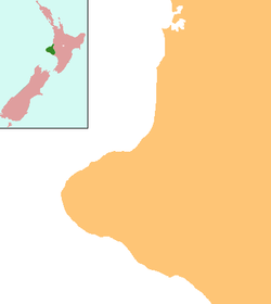
 Ngaere
Coordinates: 39°23′25″S 174°17′58″E / 39.39028°S 174.29944°E Country New Zealand Region Taranaki District Stratford District Ngaere is a village situated on State Highway 3, 4 kilometres south of Stratford, New Zealand.[1][2] The name Ngaere literally means "swamp" in English, and before settlement, the area was covered by a vast and ancient wetland.
For a time the name was spelt "Ngaire", but it was changed to its Maori spelling in 1909.
Contents
Attractions
"Ngaere Gardens", which once hosted a menagerie of exotic animals, was a popular picnic spot for early 20th century families. Several attempts at resurrecting the gardens have been to no avail. The gardens have now been cleared, and all that remains now is the large lake, and a number of mature exotic trees.
Another "famous in NZ" landmark is the Ngaere Dairy Factory, founded in 1914. It had its own brand of cheese called "Triumph". Since its closure in the mid 1970s, the factory has been put to many uses - a clothing factory, indoor cricket arena, rave dance hall, and currently a saw mill.
Ngaere formerly had a service station, which closed in the 1990s. The building has been put to a variety of uses, including as a boutique brewery, and a health shop. It is currently a motorcycle repair shop. "Fred's Place" is well known for its antiques.
Local Legends
Maori legend says that the Ngaere swamp was formed when Mt. Taranaki stopped and wept on its journey to its current resting place. Most of the swamp was drained in the early 20th century for dairy farming.
Name
People who have been named Ngaere have had the name spelled Ngaire or Nyree. There are other variations, but the Maori spelling is "Ngaere."
Education
Ngaere School is a coeducational full primary (years 1-8) school with a decile rating of 8 and a roll of 138.[3] The school was founded in 1882.[4]
Notes
- ^ Peter Dowling (editor) (2004). Reed New Zealand Atlas. Reed Books. map 34. ISBN 0-7900-0952-8
- ^ Roger Smith, GeographX (2005). The Geographic Atlas of New Zealand. Robbie Burton. map 85. ISBN 1-877333-20-4
- ^ Te Kete Ipurangi - Ngaere School. Ministry of Education. http://www.tki.org.nz/e/schools/display_school_info.php?school_id=2205
- ^ "Ngaere School and Districts 125th Jubilee" (– Scholar search). Education Gazette New Zealand 85 (16). 18 September 2006. http://www.edgazette.govt.nz/notices.php/notices.php?action=view&id=604142[dead link]
External links
Further reading
General historical works
-
- Carncross, Claude (1957). Ngaere School, 1882-1957: souvenir booklet: a history of the school and district. Ngaere, [N.Z.] ; Eltham, [N.Z.]: 75th Jubilee Committee ; Eltham Argus
- Robinson, Alison (1982). The Ngaere story. Ngaere, [N.Z.] ; New Plymouth, [N.Z.]: Ngaere Centennial Committee ; Taranaki Newspapers
- Robinson, Alison (1992). Finnerty Road School and the Lowgarth district. Lowgarth, [N.Z.]: Finnerty Road School 75th Jubilee Committee
Business history
-
- The records of the New Plymouth Sash and Door Factory and Timber Company (which had a sawmill in Ngaere) can be found at "Puke Ariki". http://www.pukeariki.com/en/resources/collections.htm.. A summary of this holding may be seen at "New Plymouth Sash and Door Factory and Timber Company (C148)". http://www.nram.org.nz/record.php?id=7234&parent=searchresults&match=Phrase&format=Long&sort=title&words=Eltham. Retrieved 2008-01-10.
-
- Slightly related to the above (in that it involves a sawmill) are the dissenting letters from residents of Cheal and Windsor Roads to the a train operated by Inglewood businessman Henry Brown and the local Ngaire Sawmills. The letters date from 1897. See "Stratford County Council (ARC2003-853)". http://vernon.npdc.govt.nz/collection/results.do?view=detail&db=object&id=37014. Retrieved 2008-02-07.[dead link]
-
- Ngaire (Ngaere) Co-operative Dairy Factory Co., Ltd. (1953). Triumph, Ngaire (Ngaere) Co-operative Dairy Factory Co., Ltd., 1893-1953, cheese. Eltham, [N.Z.]: Eltham Argus
-
- Architectural drawings for a curing room and accommodation house for the above company are housed within "Puke Ariki". http://www.pukeariki.com/en/resources/collections.htm. in New Plymouth. They date from 1929. See "Ngaire Co-operative Dairy Company Limited (ARC2003-1031)". http://vernon.npdc.govt.nz/collection/results.do?view=detail&db=object&id=36311. Retrieved 2008-02-07.[dead link]
People
-
- Some of the papers of Alistair and Mary Dickson are held within "Puke Ariki". http://www.pukeariki.com/en/resources/collections.htm. in New Plymouth. The Dicksons farmed in the Ngaere district in the 1920s and 1930s. See "Dickson, Alistair and Mary (ARC2002-216)". http://vernon.npdc.govt.nz/collection/results.do?view=detail&db=object&id=35274. Retrieved 2008-02-07.[dead link]
-
- Betteridge, Cyril (1999). From bondage to liberty: a collection of stories, gathered and bound into a single volume, which portray the heroism of the Pioneers in relation to the Johnson and Betteridge clans. New Plymouth, [N.Z.]: Cyril Betteridge
-
- The oral historian Alison Robinson interviewed Bruce and Jenny Clarke in 1992. They talk about their farm, Jenny's experience as a teacher (at Finnerty Road School), and the district in general. The interview is held within "Puke Ariki". http://www.pukeariki.com/en/resources/collections.htm. in New Plymouth. See "(ARC2002-390)". http://vernon.npdc.govt.nz/collection/results.do?view=detail&db=object&id=35396. Retrieved 2008-02-07.[dead link]
-
- The oral historian Alison Robinson interviewed Alf Willan in 1992. He talks about the district, Lowgarth, and the Lowgarth dairy co-operative (which later merged with the Ngaere Co-operative Dairy Company) The interview is held within "Puke Ariki". http://www.pukeariki.com/en/resources/collections.htm. in New Plymouth. See "Willan, Alf. S. (ARC2002-377)". http://vernon.npdc.govt.nz/collection/results.do?view=detail&db=object&id=35383. Retrieved 2008-02-07.[dead link]
-
- A typed manuscript by local farmer Henry Arthur Wood (1873-1956) chronicled his life draining and farming swampy land in the Ngaere district. This document is held within "Puke Ariki". http://www.pukeariki.com/en/resources/collections.htm. in New Plymouth. See "Wood, Henry Arthur (ARC2002-412)". http://vernon.npdc.govt.nz/collection/results.do?view=detail&db=object&id=35411. Retrieved 2008-02-07.[dead link]
Schools
-
- Carncross, Claude (1957). Ngaere School, 1882-1957: souvenir booklet: a history of the school and district. Ngaere, [N.Z.] ; Eltham, [N.Z.]: 75th Jubilee Committee ; Eltham Argus
- Robinson, Alison (1992). Finnerty Road School and the Lowgarth district. Lowgarth, [N.Z.]: Finnerty Road School 75th Jubilee Committee
-
- The oral historian Alison Robinson interviewed Jenny Clarke in 1992. Jenny talks about her experience as a teacher (at Finnerty Road School). The interview is held within "Puke Ariki". http://www.pukeariki.com/en/resources/collections.htm. in New Plymouth. See "(ARC2002-390)". http://vernon.npdc.govt.nz/collection/results.do?view=detail&db=object&id=35396. Retrieved 2008-02-07.[dead link]
Categories:- Stratford District
- Populated places in New Zealand

Wikimedia Foundation. 2010.