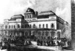
- Manor Way railway station
-
Manor Way Location Place South Beckton/Cyprus History Opened by Eastern Counties Railway Key dates Opened 1880
Closed 1940Replaced by Gallions Reach Manor Way railway station was a railway station located on the East Ham Manor Way, south of Beckton in east London, on the Eastern Counties and Thames Junction Railway (EC&TJR). It opened in November 1880, between Central and Gallions stations, on the Gallions branch of the line.
Manor Way was sparingly used by passenger services, which ceased in 1940 after wartime bombing, and the goods line closed with the closure of the Royal Docks. With the redevelopment of the Docklands region in the 1980s and 1990s, the line was replaced in 1994 by the Docklands Light Railway extension to Beckton. No trace of the station remains today (the University of East London's Cyprus campus lies on the site), although Gallions Reach DLR station is located 200 yards north-east of the site.
Eastern Counties and Thames Junction Railway Stations Beckton · Canning Town · Central · Connaught Road · Custom House · Gallions · Manor Way · North Woolwich · Silvertown · Stratford Low Level · Stratford Market · Tidal Basin
Relationships Absorbed by the Great Eastern Railway in 1862 ► Coordinates: 51°30′24″N 0°04′11″E / 51.50663°N 0.06981°E
References
Categories:- Railway stations opened in 1880
- Railway stations closed in 1940
- Disused railway stations in Newham
- Eastern Counties and Thames Junction Railway
- London railway station stubs
Wikimedia Foundation. 2010.

