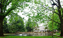
- Charbonneau, Oregon
-
Charbonneau Neighborhood Commercial district in CharbonneauCountry United States State Oregon Region Clackamas County City Wilsonville Coordinates 45°17′14″N 122°45′29″W / 45.28722°N 122.75806°W Timezone Pacific Postal code 97070 Elevation 141 feet (43 m)[1] Charbonneau (also known as the Charbonneau District) is a private planned community within the city limits of Wilsonville in Clackamas County, Oregon, United States. It was named for Jean Baptiste Charbonneau, the son of Sacagawea.[2]
Charbonneau began in 1972 as a nine-hole golf course and 228 town homes; it now has a population of about 3,500 living in 1,158 multi-family units and 510 houses with an integrated 27-hole golf course.[3] There is also a small commercial district with about 10 shops including a grocery store and restaurant.[4] As one of the oldest communities of its type in Oregon, its construction helped lead to the adoption of land use planning and the urban growth boundary to attempt to prevent urban sprawl.[4] While technically within the limits of the city of Wilsonville, the Charbonneau District holds an identity separate from that of the rest of the city.
Charbonneau is located on the eastern bank[5] of the Willamette River just north of the Aurora State Airport in Aurora. Travel from the main city is via Interstate 5 over the Boone Bridge, effectively leaving the city to reenter it from the south.
Socially, Charbonneau is even further separated from Wilsonville. The district has its own town center around the golf course club house and publishes a monthly newspaper that covers current events within its borders. Also, Charbonneau's 200 schoolchildren do not attend the West Linn-Wilsonville School District; instead, they attend the Canby High School in the Canby School District.[4] In many ways, residents of Charbonneau relate more closely to the city of Canby perhaps due, in part, to the school zoning.[citation needed]
References
- ^ "Charbonneau". Geographic Names Information System, U.S. Geological Survey. 1999-09-14. http://geonames.usgs.gov/pls/gnispublic/f?p=gnispq:3:::NO::P3_FID:1851671. Retrieved 2009-11-14.
- ^ McArthur, Lewis A.; Lewis L. McArthur (2003) [1928]. Oregon Geographic Names (Seventh Edition ed.). Portland, Oregon: Oregon Historical Society Press. p. 190. ISBN 0-87595-277-1.
- ^ "History of the Charbonneau Country Club". Charbonneau Country Club homeowners association. May 6, 2005. Archived from the original on 2007-01-26. http://web.archive.org/web/20070126174635/http://www.charbonneaucountryclub.com/id5.html. Retrieved 2006-12-14.
- ^ a b c Tims, Dana (April 19, 2001). "Southwest Zoner: Charbonneau, setting the tone". The Oregonian: p. 1.
- ^ The Willamette River runs directly eastward between Wilsonville and Charbonneau: Charbonneau is directly south of Wilsonville, so the "eastern bank" is on the southern side.
External links
Categories:- Planned communities in the United States
- Wilsonville, Oregon
Wikimedia Foundation. 2010.


