- Leitzaran
Infobox River
river_name = Leitzaran
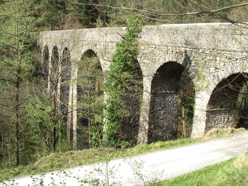
caption =Aqueduct over river Leitzaran in Ameraun
origin = Leitza
mouth = River Oria
basin_countries = Spain
length = 42 km
elevation = ~600 m
mouth_elevation = 92 m
discharge = 2.88 m³/s
watershed = 124.02 km²The Leitzaran (IPA: [lei'tsaɾan] , or Leizaran in Spanish) is a river and a valley in the Basque Country. It flows into the river Oria from its right.
Its source is in the
Leitza municipalty inNavarre , and is 42 km long. It enters intoGuipuscoa in a place called Urto. It takes water from the municipalties ofAreso ,Berastegi ,Elduain ,Villabona ,Urnieta andAndoain and has an area of 124.02 km², of which 69.72 km² belongs to Guipuscoa.The
Gipuzkoa n part of its basin is known as "Valle de Leizaran" (Leitzaran Valley), and it mostly shapes up in the "Macizo de Cinco Villas", formed by materials formed in thePaleozoic (concretely in theCarboniferous ), mostly slate and sandstone, fold during theHercynian orogeny . The Leitzaran is very crooked and shows several meanders.The gipuscoan Leitzaran limits in the east with river
Urumea ’s valley, divided by theAdarra -Mandoegi mountain chain. Altzadi in this chain treads into the valley and separates de gipuscoan and the navarre Leitzaran. The divisive line in the west starts in Arizmendi and joins Uzturre-Ipuliño chain later, in Belabieta. This mountains separate the valley from Zelai and Elduain, as well as the small valleys in the area of Amasa-Villabona.The shorelines of the Leitzaran and the ones of its affluents Ubaran (Ubane) and Malo have been declared Protected
Biotope on the 29th of September, 1995. They have a total area of 0.74 km².Despite of its apparent dehumanised appearance, men’s trace is strong. There are plenty of prehistoric monuments (especially in its borders) and grazing has been long-practised (as shown by the "seles" presence), but the most significant one is the usefulness given to the river by theblast furnaces . Mineral was from the valley itself, but there was some imported from Somorrostro.The river’s waters have moved flour watermills and small hidroelectric power stations as well, some of them still functioning.In order to carry the mineral from the Bizkotx mines a railway from the mines (located near the place known as Plazaola) to Andoain. Afterwards, its two ends were lengthen to
Pamplona and toLasarte , place where it joined up the Ferrocarriles Vascongados (Basque Railways), where it could provide service toDonostia . This railway (Pamplona - San Sebastián or PSS) was popularly called "Tren del Plazaola" (Plazaola’s Train in Spanish) and "Tren-txiki" (Little Train in Basque).Nowadays, a big part of the railway’s course is being recovered for leisure, the Vía Verde del Plazaola (Plazaola’s Green Way).
Wikimedia Foundation. 2010.