- Colyell, Louisiana
-
Colyell Unincorporated community Country United States State Louisiana Parish Livingston Elevation 26 ft (7.9 m) Coordinates 30°23′26″N 90°46′12″W / 30.39056°N 90.77°W Timezone CST (UTC-6) - summer (DST) CDT (UTC-5) Area code 225 
 Location of Colyell in Louisiana
 Location of Louisiana in the United States
Colyell is an unincorporated community in Livingston Parish, Louisiana, United States. It was named for Francisco Collel, who was the commandant of Galveztown in 1779.[citation needed]
Currently, the only school located in the Colyell area is Frost School, grades Pre-K through 8. [1]
Colyell supports a community ballpark, located on Perrilloux Rd. Colyell also has a volunteer fire department, known as Livingston Parish Fire Protection District 7. [2]
All residents use Livingston, LA 70754 Livingston, Louisiana as their home mailing address.[citation needed] The area code for Colyell is 225, and the telephone prefix is 698, the same as French Settlement, LA French Settlement, Louisiana[citation needed]
References
- ^ Frost School at www.ourfrostschool.com
- ^ Livingston Parish Fire Protection District 7 at www.lted.com/lpfd7
Municipalities and communities of Livingston Parish, Louisiana City 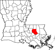
Towns Villages Unincorporated
communitiesCoordinates: 30°23′26″N 90°46′12″W / 30.39056°N 90.77°W
Categories:- Populated places in Livingston Parish, Louisiana
- Unincorporated communities in Louisiana
- Baton Rouge metropolitan area
- Louisiana geography stubs


Wikimedia Foundation. 2010.