- Velipojë / Velipoja
Infobox Settlement
official_name = Velipojë
native_name =
other_name = Velipoja
settlement_type = Town
motto =
imagesize = 258px
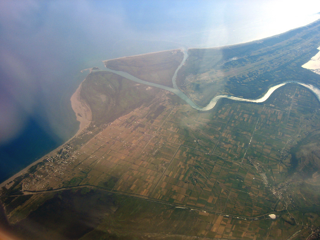
image_caption = The Buna estuary with Velipojë to the left
image_
seal_size =
image_shield =
city_logo =
citylogo_size =
mapsize =
map_caption =
mapsize1 =
map_caption1 =
image_dot_
dot_mapsize =
dot_map_caption =
dot_x = |dot_y =
pushpin_
pushpin_label_position =
pushpin_map_caption =
pushpin_mapsize =
subdivision_type = Country
subdivision_name =Albania
subdivision_type1 = County
subdivision_name1 =Shkodër County
subdivision_type2 = District
subdivision_name2 =Shkodër District
subdivision_type3 =
subdivision_name3 =
subdivision_type4 =
subdivision_name4 =
government_footnotes =
government_type =
leader_title = Mayor
leader_name = Nikollë Zef Marku [ [http://www.cec.org.al/2004/zgjedhvendorefiles/2007/Rezultatet/rezultate%20perfundimtare/kryetar.pdf Municipal elections of 2007] sq icon] (DP)
leader_title1 =
leader_name1 =
leader_title2 =
leader_name2 =
leader_title3 =
leader_name3 =
leader_title4 =
leader_name4 =
established_title =
established_date =
established_title2 =
established_date2 =
established_title3 =
established_date3 =
area_magnitude =
unit_pref =
area_footnotes =
area_total_km2 =
area_land_km2 =
area_water_km2 =
area_total_sq_mi =
area_land_sq_mi =
area_water_sq_mi =
area_water_percent =
area_urban_km2 =
area_urban_sq_mi =
area_metro_km2 =
area_metro_sq_mi =
population_as_of =
population_footnotes =
nickname =
population_total = 8,026
population_density_km2 =
population_density_sq_mi =
population_metro =
population_density_metro_km2 =
population_density_metro_sq_mi =
population_urban =
population_density_urban_km2 =
population_density_urban_sq_mi =
population_blank1_title =
population_blank1 =
population_density_blank1_km2 =
population_density_blank1_sq_mi =
timezone = Central European Time
utc_offset = +1
timezone_DST = CEST
utc_offset_DST = +2
latd=41 |latm=51 |lats=53.13|latNS=N
longd=19 |longm=25|longs=48.08|longEW=E
elevation_footnotes =
elevation_m = 0
elevation_ft =
postal_code_type = Postal code
postal_code = 4020
area_code = (+355) 022
blank_name =Car Plates
blank_info =SH
blank1_name =
blank1_info =
website = http://www.shkodra.gov.al
footnotes =Velipojë, also called Velipoja, is an
Albania n town inShkodër District . The population is approximately 8026.Geography and economy
Velipoja is situated on the estuary of the River Buna (the only navigable river of Albania), where it flows into the
Adriatic Sea near the border withMontenegro . The "Commune" (i.e. the administrative unit) of Velipoja has a population of around 10,000, spread over several small settlements, the largest of which is the town of Velipoja itself.Its economy is based on agriculture (
arable land and livestock,sheep andcattle ), some fishing, and chiefly tourism. The scenery is largely unspoilt: a mixture of sea-coast, river estuary, heathland, thick pine woods, farmland, and high mountains. It has been remarked by visitors that the heathland to the north of Velipoja is very reminiscent of Scottish scenery. A nature reserve lies within the commune. The area is a prime site forbirdwatching , game shooting and fishing. A long, sandy beach is a popular attraction in summer.In recent years, several projects have been instituted with the aim of conserving the environment (including the marine life of the Buna) and the encouragement of ecological tourism. There have also been recent efforts to develop
fish farm ing. The area has many small hotels and guest houses. There is a market, where local farmers sell their produce. In the commune, there is a church-sponsored kindergarten, several primary schools, two secondary schools, and one gymnasium. There is also a small theatre and a thriving local football team,KS Ada Velipojë and ground.History and traditions
Historically not a wealthy area, and like the rest of the country subject to much emigration, Velipoja has recently begun to expand as a tourist resort, favoured especially by the inhabitants of
Shkodër , the chief city of northern Albania, which lies about 30 km distant inland.The ancient
Albanian language has been preserved despite encroachments from its neighbours. There are many traditions that are proudly maintained: there is a national costume that may be compared with the Scottish Highland costume: men wear a pleated whitekilt ; there is even a local version of the bagpipes (called gajde). And traditionally, the inhabitants of northern Albania belonged to different clans similar to theScottish clan system.References
Wikimedia Foundation. 2010.

