- Söderåsen
Infobox_protected_area | name = Söderåsen National Park
iucn_category = II
caption =
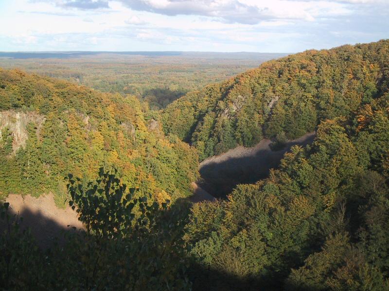
View from Kopparhatten
locator_x =
locator_y =
location = Scania,Sweden
nearest_city =
lat_degrees =
lat_minutes =
lat_seconds =
lat_direction =
long_degrees =
long_minutes =
long_seconds =
long_direction =
area = 16 km²
established =2001
visitation_num =
visitation_year =
governing_body = Swedish National Environmental Protection AgencySöderåsen is a ridge (more precisely, a horst) in the province of Scania in southern
Sweden . The highest point is 212 meters. It is intersected by several fissure valleys.The Söderåsen National Park is a designated area of about 16 km², established in 2001 and situated in the municipalities of Klippan and
Svalöv . This part of the hill has a particularly dramatic landscape, with up to 90 meters deep ravines. From the highest point, Kopparhatten, there is a stunning view. The park consists of broadleaf forest, mostlybeech . Because of the rugged landscape, many characteristics of primeval forest have been preserved, such as an abundance of dead trees. This makes the insect life rich, with many rarebeetle s. The flora is also extremely rich, with species such asholewort ,enchanter's nightshade and great meadow-rue.External links
* [http://www.naturvardsverket.se/en/In-English/Menu/Enjoying-nature/National-parks-and-other-places-worth-visiting/National-Parks-in-Sweden/Soderasen-National-Park/ Söderåsen National Park] from the
Swedish Environmental Protection Agency
Wikimedia Foundation. 2010.