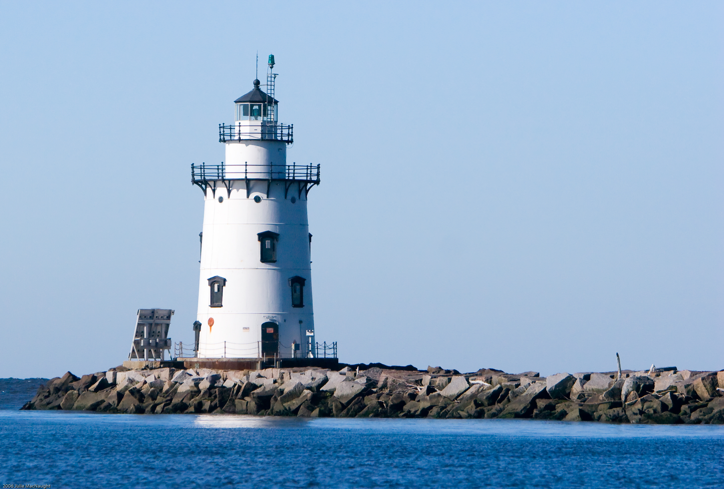
- Saybrook Breakwater Light
Infobox Lighthouse
caption =
location = Old Saybrook,Connecticut
coordinates = coord|41.2632|N|72.34276|W
yearbuilt = 1886
yearlit = 1886
automated = 1959
yeardeactivated =
foundation =Cast Iron andConcrete Caisson
construction =Cast Iron withBrick lining
shape = Conical
height = 48 ft
currentlens = 300 MM
lens = Fifth orderFresnel lens
range =
characteristic = green flash every 6 sSaybrook Breakwater Lighthouse is a
lighthouse inConnecticut ,United States , at Fenwick Point on theConnecticut River near Old Saybrook,Connecticut . It is featuredAssociated Press news article, titled "Old Saybrook lighthouse for sale for $1" in "The Advocate" ofStamford, Connecticut ,August 7 ,2007 , page A4] on the state's "Save the Sound" license plates."That outer lighthouse is the symbol of Old Saybrook," town First Selectman Michael Pace said in 2007, when the town was making plans to buy the lighthouse from the federal government.
The lighthouse is also known simply as "Breakwater Light" or "Outer Light". It is one of two built off Lynde Point in the nineteenth century. The other lighthouse, known as
Lynde Point Light or more commonly as "Inner Light", is 75 years older than this lighthouse. The two lighthouses mark the harbor channel at the mouth of the Connecticut River.History
The lighthouse has been in service since 1886.
In 2007, the federal government announced it would sell the lighthouse as part of the National Historic Lighthouse Preservation Program, which was created to transfer responsibility for maintenance of lighthouses to municipal governments or private entities. The Old Saybrook town government expressed an entrance in the lighthouse, which is not expected to be transferred from the federal government until sometime in 2008 or 2009. The National Park Service will screen potential owners. The Coast Guard would continue to maintain the light while the new owners maintain the historic structure. The Coast Guard also owns the land on which the lighthouse sits, and transferring the land is not part of the preservation program.
Notes
Wikimedia Foundation. 2010.