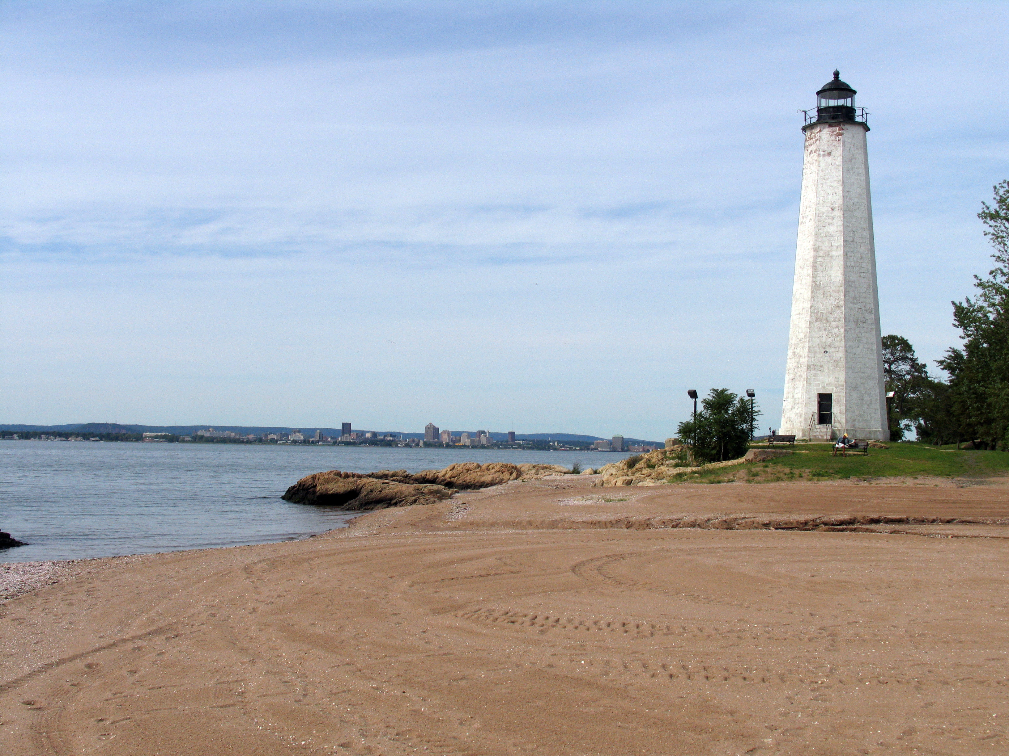
Five Mile Point

Five Mile Point

Infobox Lighthouse


caption =
location = Long Island Sound, Connecticut
coordinates = coord|41.2483|N|72.9039|W|region:US_type:landmark
yearbuilt =1805
yearlit = 1845 (current tower)
automated =
yeardeactivated = 1877
foundation = Brownstone
construction = Brownstone
shape = Octagonal
height = convert|65|ft|m|0|abbr=on
currentlens = Fourth order Fresnel lens
lens = 12 Lamps, 21 inch reflectors, 1845
range = convert|10|nmi|km|-1
characteristic =

Five Mile Point Light, also known as New Haven Harbor Lighthouse, is a lighthouse in New Haven, Connecticut, United States, on the harbor entrance to Long Island Sound, five miles (8 km) from Downtown New Haven. It is located in Lighthouse Point Park.

History

The original lighthouse, built in 1805, was a 30 foot octagonal wooden tower. Mariners complained that the light was not bright enough nor tall enough, so in 1847, a new convert|65|ft|m|0|sing=on tower with 12 Lamps with 21 inch reflectors, was built. The lamp system was upgraded to a fourth-order Fresnel lens in 1855. The lighthouse was extinguished in 1877 when the offshore Southwest Ledge Light replaced it for navigation.

The tower was renovated in 1986.

External links

* [http://lighthouse.cc/newhaven/ Five Mile Point Lighthouse]
* [http://www.cityofnewhaven.com/parks/parksinformation/lighthousepoint.asp Lighthouse Point Park]


Wikimedia Foundation. 2010.

Игры ⚽ Нужна курсовая?

Look at other dictionaries:

  • Five Mile Point — Coordonnées …   Wikipédia en Français

  • Five Mile Point Speedway — Motorsport venue Name = Five Mile Point Speedway | Nicknames = The Home Speedway of the Southern Tier Location = Kirkwood, New York Events = Race of Champions Dirt Modified Series, STAR Modified Series, IMCA Modified Series, Keystone Legends, BRC …   Wikipedia

  • Nine Mile Point Nuclear Generating Station — Nine Mile Point Nuclear Generating Station …   Wikipedia

  • Forty Mile Point Light — Infobox Lighthouse caption = Forty Mile Point Light location = Presque Isle County, Michigan coordinates = coord|45|29|12|N|83|54|48|W yearlit = 1897 automated = 1969 yeardeactivated = foundation = Limestone construction = Brick shape = Square… …   Wikipedia

  • Mile Road System (Detroit) — The Mile Road System in southeast Michigan was established as a way to delineate east west roads through the Detroit area and the surrounding rural rim.HistoryThe Mile Road System, and its most famous road, 8 Mile Road, came about largely as a… …   Wikipedia

  • Mile high club — The Mile high club redirects here. For the song by Bow Wow Wow, see The Last of the Mohicans (Bow Wow Wow EP). A plane lavatory The Mile High Club (or MHC) is a slang term applied collectively to individuals who have sex while on board an… …   Wikipedia

  • Point Reyes Station, California — Point Reyes Station   census designated place   State Route 1 runs through Point Reyes Station …   Wikipedia

  • Point Judith Pond — is a shallow, four mile (6 km) long salt body of water lying behind the barrier beaches and sand dunes that form Point Judith Harbor, which lies immediately west of Point Judith in Narragansett, Rhode Island at the southwestern tip of… …   Wikipedia

  • Mile Mrkšić — in courtroom in Hague in May 2009 Born 20 July 1947 …   Wikipedia

  • Avery Point Light — Le phare d Avery Point Light en 2000, avant sa rénovation Position …   Wikipédia en Français

Share the article and excerpts

Direct link
Do a right-click on the link above
and select “Copy Link”