- Kluczbork County
Infobox Settlement
name = Kluczbork County
native_name = Powiat kluczborski
settlement_type =
image_shield = POL powiat kluczborski COA.svg
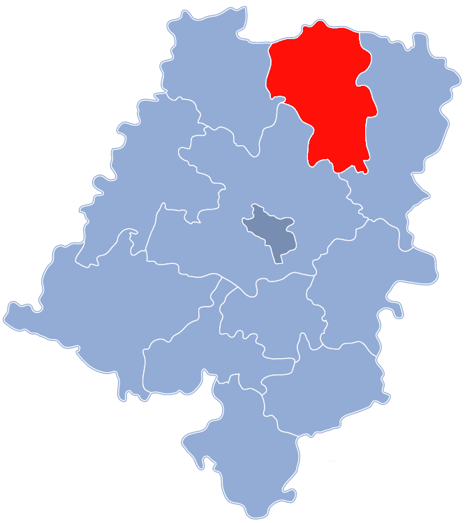
map_caption = Location within the voivodeship
subdivision_type = Country
subdivision_name = POL
subdivision_type1 = Voivodeship
subdivision_name1 = Opole
area_total_km2 = 851.59
population_total = 70082
population_as_of = 2006
population_density_km2 = auto
population_urban = 35726
population_blank1_title = Rural
population_blank1 = 34356
coor_type = Kluczbork
latd = 50
latm = 59
lats =
latNS = N
longd = 18
longm = 13
longs =
longEW = E
seat =Kluczbork
parts_type =Gmina s
parts = Total 4
p1 =Gmina Byczyna
p2 =Gmina Kluczbork
p3 =Gmina Lasowice Wielkie
p4 =Gmina Wołczyn
blank_name = Car plates
blank_info = OKL
website = http://www.powiatkluczborski.pl __NOTOC__Kluczbork County ( _pl. powiat kluczborski) is aunit ofterritorial administration andlocal government (powiat ) inOpole Voivodeship , south-westernPoland . It was created onJanuary 1 ,1999 as a result of the Local Government Reorganization Act of 1998. Its administrative seat and largest town isKluczbork , which lies convert|41|km|mi|0 north-east of the regional capitalOpole . The county also contains the towns ofWołczyn , lying convert|12|km|mi|0|abbr=on west of Kluczbork, andByczyna , convert|15|km|mi|0|abbr=on north of Kluczbork.The county covers an area of convert|851.59|km2|sqmi|1. As of 2006 its total population is 70,082, out of which the population of Kluczbork is 25,910, that of Wołczyn is 6,139, that of Byczyna is 3,677, and the rural population is 34,356.
Neighbouring counties
Kluczbork County is bordered by
Kępno County andWieruszów County to the north,Olesno County to the south-east,Opole County to the south, andNamysłów County to the west.Administrative division
The county is subdivided into four
gmina s (three urban-rural and one rural). These are listed in the following table, in descending order of population.References
* [http://www.stat.gov.pl/gus/45_655_PLK_HTML.htm Polish official population figures 2006]

Wikimedia Foundation. 2010.