- Santa Isabel, Puerto Rico
Infobox Settlement
settlement_type =
subdivision_type = Country
subdivision_name =United States subdivision_type1 = Territory
subdivision_name1 =Puerto Rico
subdivision_type2 =
subdivision_name2 =timezone=AST
utc_offset=-4
timezone_DST=
utc_offset_DST=
unit_pref=Imperial
map_caption =Location of PAGENAME within Puerto Rico.
latNS=N
longEW=W| official_name = Santa Isabel, Puerto Rico | nickname = Tierra de Campeones", "La Ciudad de los Potros
image_
| population_blank1 = Santaisabelinos|population_blank1_title=Gentilic| | population_blank1 = Santaisabelinos|population_blank1_title=Gentilic|
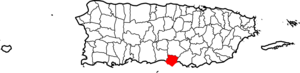
| map_caption = Location within the island ofPuerto Rico
established_date = October 5, 1842|established_title=Founded| |leader_title=Mayor
leader_name = Enrique 'Quique' Questell Alvarado
political party = Partido Nuevo Progresista
leader_party = PNP
leader_title1=Senatorial dist.
leader_name1= 6 - Guayama
leader_title2=Representative dist.
leader_name2 = 30 | area_magnitude = | area_total_km2 =
area_land_km2 = | area_water_km2 = | population_as_of = 2000 | population_note =
population_total = | population_density_km2 = | latd= |latm= |lats=
longd=|longm= |longs=
latitude =
longitude =
website =
footnotes = Anthem – "En un pedazo del sur estás presente" |Santa Isabel (IPA2|ˈsantaˈisaˌβel) is a
municipality ofPuerto Rico located in the southern coast, south of Coamo; east of Juana Díaz; and west of Salinas. Santa Isabel is spread over 7 wards and Santa Isabel Pueblo (the downtown area and the administrative center of the city).Santa Isabel is known as "La Ciudad de los Potros" ("The City of the Colts").
History
Santa Isabel was founded on October 5, 1842 by Antonio Vélez.
Flag
The flag is divided horizontally in three stripes of same the width: white the superior one, yellow the central one and red the inferior one, may be ornamented with sugar cane stems or without them.
Coat of Arms
The crowned I stands for Queen Elisabeth of Hungary (Isabel in Spanish). The shells are a symbol for St. James the patron saint of the town, as well as for the many shells found near the town.
Demographics
Barrios (Districts/Wards) [http://welcome.topuertorico.org/maps/santaisabel.pdf]
*Boca Velázquez
*Descalabrado
*Felicia Uno
*Felicia Dos
*Uceras
*Canta Sapo
*Jauca I
*Jauca II
*Playa
*Santa Isabel Pueblo
*Ollas
*Paso Seco
*PeñuelasGeo/Topography
*Aguirre State Forest
*Rivers; Cayures, Coamo, Descalabrado and JueyesEconomic
Agriculture
The surrounding areas produces fruits and vegetables.
Industrial
clothing, electrical and electronic machinery, metal products and nutritional products.
Tourism
Landmarks and places of interest
*Aguirre Forest
*El Malecón (boardwalk)
*Indian Museum
*Jauca Beach
*Hacienda Alomar RuinsFestivals and events
*Mango Festival - May
*Crab Carnival - June
*Patron Celebrations - July
*Cemí Carnival - October
*Turkey Festival - NovemberNotable "Santaisabelinos"
*Carmelo Colon Rivera
*César Miranda Rodríguez
*Benito Santiago - Baseball player; won unanimously the 1986 the National League's Rookie of the Year Award (San Diego Padres).
*Elvira Colón
*Carlos Muñoz
*Melwin Cedeño - actor, comedian, merengue musician, and singer.
*Carlitos Colón - professional wrestler known as "El Acróbata de Puerto Rico".
*Mario Ortiz - accomplished trumpet player, arranger and band leader of the 60's.
*Elvis Torres Serrant - Musical Director Limite 21 - released their first album in 1990 breaking new grounds in the genre of merengue.References
External links
* [http://www.ngw.nl/int/car/pr/images/santaisa.jpgCrest of the City] Map and Directory of Santa Isabel, PR [http://www.direccionespr.com/Town1.aspx?tnid=tL27hrbpXk0omnofjNjruQ=&rid=PIXVxsWnnhDaY= Courtesy of: http://www.mapanddirectory.com]
Wikimedia Foundation. 2010.