- Rurrenabaque
Infobox Settlement
official_name = PAGENAME
other_name =
native_name =
nickname =
settlement_type = Town and municipality
motto =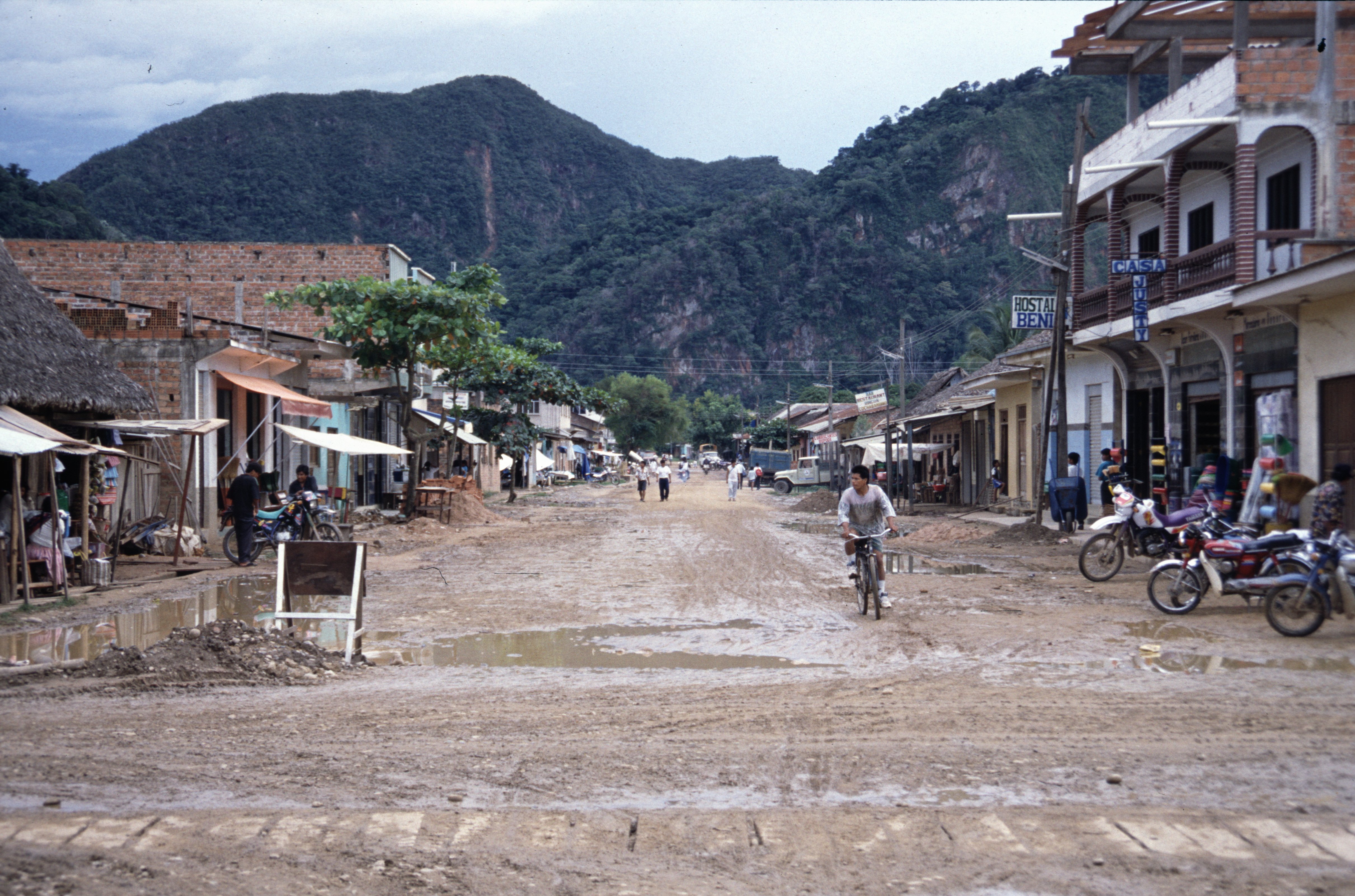
imagesize =
image_caption =
flag_size =
image_
seal_size =
image_shield =
shield_size =
image_blank_emblem =
blank_emblem_type =
blank_emblem_size =
mapsize =
map_caption =
mapsize1 =
map_caption1 =
image_dot_
dot_mapsize =
dot_map_caption =
dot_x = |dot_y =
pushpin_
pushpin_label_position =bottom
pushpin_map_caption =Location of PAGENAME town in Bolivia
subdivision_type = Country
subdivision_name =
subdivision_type1 = Department
subdivision_name1 =
subdivision_type2 = Province
subdivision_name2 =José Ballivián Province
subdivision_type3 =
subdivision_name3 =
subdivision_type4 =
subdivision_name4 =
government_footnotes =
government_type =
leader_title =
leader_name =
leader_title1 =
leader_name1 =
leader_title2 =
leader_name2 =
leader_title3 =
leader_name3 =
leader_title4 =
leader_name4 =
established_title =
established_date =
established_title2 =
established_date2 =
established_title3 =
established_date3 =
area_magnitude =
unit_pref =Imperial
area_footnotes =
area_total_km2 =
area_land_km2 =
area_water_km2 =
area_total_sq_mi =
area_land_sq_mi =
area_water_sq_mi =
area_water_percent =
area_urban_km2 =
area_urban_sq_mi =
area_metro_km2 =
area_metro_sq_mi =
area_blank1_title =
area_blank1_km2 =
area_blank1_sq_mi =
population_as_of =2001
population_footnotes =
population_note =
population_total =14,000
population_density_km2 =
population_density_sq_mi =
population_metro = 8,000
population_density_metro_km2 =
population_density_metro_sq_mi =
population_urban =
population_density_urban_km2 =
population_density_urban_sq_mi =
population_blank1_title =Ethnicities
population_blank1 =
population_blank2_title =Religions
population_blank2 =
population_density_blank1_km2 =
population_density_blank1_sq_mi =
timezone =
utc_offset =
timezone_DST =
utc_offset_DST =
latd=14 |latm=26 |lats=32 |latNS=S
longd=67 |longm=31 |longs=42 |longEW=W
elevation_footnotes =
elevation_m =
elevation_ft =
postal_code_type =
postal_code =
area_code =
blank_name =
blank_info =
blank1_name =
blank1_info =
website =
footnotes =Rurrenabaque is a smaller
town and municipality in the North ofBolivia , on theBeni River .It has in recent years become popular with international tourism as it is an easy gateway for visits toMadidi National Park (within the Bolivianrainforest ), as well as the surroundingpampas .Locals commonly refer to the town by its shortened nickname, "Rurre".Rurrenabaque is in the
José Ballivián Province of theBeni Department , Bolivia.
The Rurrenabaque municipio (Cuarta sección de José Ballivián) has 14,000 inhabitants out of which 8,000 live in Rurrenabaque itself. (Censo 2001, according to [http://www.ine.gov.bo Instituto Nacional de Estadística de Bolivia] ).Rurrenabaque is on the east bank of the Beni River. It is expected that a bridge will be built over the river to connect with the town San Buenaventura on the west bank. The coming bridge is a part of a road project that is expected to be carried out in the years from 2008. It will considerably broaden the economic relationship between the two towns, which has been traditionally stunted by limited and expensive transport by boat. Since the river simultaneously widens and shallows at the San Buenaventura section, the top current becomes much stronger than on many sections of the river. Most boats and motors capable of crossing the stretch of river represent an investment beyond the means of most individual Bolivian families, but a bridge will allow San Buenaventura to enjoy the same accessibility as that enjoyed between Rurrenabaque and the neighboring town of Reyes.
Transportation
Rurrenabaque is reached by bus, 410 km from La Paz (18 hours), or by airplane (1 hour).
Two airlines have flights to Rurrenabaque:Amaszonas and TAM - Transporte Aéreo Militar.
The bus from La Paz pass throughCoroico , 70 km from La Paz.On a part of the road from La Paz to Coroico a new highway has been opened at the end of 2006, and the old 'death road' is now only for bikers. This 'death road' is also called theYungas Road .The airfield in Rurrenabaque has a grass runway, giving some problems in wet weather; it may turn into mud that the planes can't land on. The runway will be paved, the work is going on, but it isn't expected to be finished in 2007. Also, low clouds can prevent planes from landing, and the nearby mountains don’t make things better.
The airlines could instead use the airport in the nearby town Reyes (32 kilometres and one hour by bus at north east), but they seldom do so. There are no mountains near Reyes, and the airport often has better weather and not so low clouds. (Reyes (Los Santos Reyes) is the capital of theJosé Ballivián Province in theBeni Department ).Tourism
Rurrenabaque is a starting point for
ecotourism , and someeco-lodge s are found in the area. The oldest and best known - though rather pricey - isChalalan Ecolodge in Chalalán on theTuichi River . Another is theSan Miguel del Bala Eco-Lodge on the banks of the Beni River, reached by boat 40 minutes up stream from Rurrenabaque.Events, festivities: The 2nd of February: Fiesta de Rurre - Anniversary of Rurrenabaque - The day of La Virgen de Candelaria.

Wikimedia Foundation. 2010.