- Džbánov (Ústí nad Orlicí District)
Infobox Settlement
official_name = Džbánov
other_name = Džbánov u Vysokého Mýta
native_name =
nickname =
settlement_type = Village
motto =
imagesize =
image_caption =
flag_size =
image_
seal_size =
image_shield =
shield_size =
image_blank_emblem =
blank_emblem_type =
blank_emblem_size =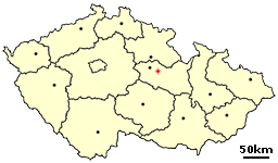
mapsize =
map_caption = Location of Džbánov in the Czech Republic
mapsize1 =
map_caption1 =
image_dot_
dot_mapsize =
dot_map_caption =
dot_x = |dot_y =
pushpin_
pushpin_label_position =
pushpin_map_caption =
pushpin_mapsize =
subdivision_type = Country
subdivision_name =Czech Republic
subdivision_type1 = Region
subdivision_name1 =Pardubice Region
subdivision_type2 = District
subdivision_name2 = Ústí nad Orlicí
subdivision_type3 = Microregion
subdivision_name3 = Vysokomýtsko
subdivision_type4 =
subdivision_name4 =
government_footnotes = [ [http://www.pardubickykraj.cz/city.asp?thema=2674&category=&item=25404 Information about Džbánov] , website of [http://www.pardubickykraj.cz Pardubice Region] , 7th August 2007 (Czech)]
government_type =
leader_title = Mayor
leader_name = Jindřich Svatoš
leader_title1 =
leader_name1 =
leader_title2 =
leader_name2 =
leader_title3 =
leader_name3 =
leader_title4 =
leader_name4 =
established_title = Čban
established_date =
established_title2 = Čbánov
established_date2 =
established_title3 =
established_date3 =
area_magnitude =
unit_pref =
area_footnotes =
area_total_km2 = 6.59
area_land_km2 =
area_water_km2 =
area_total_sq_mi =
area_land_sq_mi =
area_water_sq_mi =
area_water_percent =
area_urban_km2 =
area_urban_sq_mi =
area_metro_km2 =
area_metro_sq_mi =
area_blank1_title =
area_blank1_km2 =
area_blank1_sq_mi =
population_as_of =
population_footnotes =
population_note =
population_total = 311
population_density_km2 =
population_density_sq_mi =
population_metro =
population_density_metro_km2 =
population_density_metro_sq_mi =
population_urban =
population_density_urban_km2 =
population_density_urban_sq_mi =
population_blank1_title =
population_blank1 =
population_density_blank1_km2 =
population_density_blank1_sq_mi =
timezone = CET
utc_offset = +1
timezone_DST = CEST
utc_offset_DST = +2
latd=49 |latm=54 |lats=56 |latNS=N
longd=16 |longm=09 |longs= 51 |longEW=E
elevation_footnotes =
elevation_m = 294
elevation_ft =
postal_code_type = postal code
postal_code = 566 01
area_code =
blank_name =
blank_info =
blank1_name =
blank1_info =
website = [http://www.dzbanov.cz www.dzbanov.cz]
footnotes =Džbánov is a small village in the
Pardubice Region in the northeast ofBohemia ,Czech Republic . It lies near the southern border ofÚstí nad Orlicí District , close toSvitavy District , situated around 3 km to the southeast ofVysoké Mýto . The village is also called Džbánov u Vysokého Mýta (Džbánov by Vysoké Mýto).The population of the village is about 310 inhabitants.
History
The village was founded at the end of 13th century. In the 14th century
Zbraslav monastery owned the village. AfterHussite wars the village property was splitted to become a property of several placeholders (emperor , the town ofVysoké Mýto ,nobility , etc.) [ [http://www.dzbanov.cz/index_soubory/page0001.htm General information about Džbánov] , website of the village of [http://www.dzbanov.cz Džbánov] , 7th August 2007 (Czech)] . The town of Vysoké Mýto owned the whole village between the end of 16th century to1850 . Then the village became autonomous.Name
The name of the village probably originates in personal name Čban. One of the first reeves or inhabitants was called that. Later the village was called Čbánov and then Džbánov.
References
External links
* [http://portal.gov.cz/wps/portal/_s.155/696?kam=obec&kod=580210 Short official information about the village] (Czech)
* [http://www.dzbanov.cz Village website] (Czech)
Wikimedia Foundation. 2010.