- Puno
Infobox City
official_name = Puno
other_name =
native_name =
nickname = "Capital folklorica del Peru y Sud America"
(folkloric capital of Peru and South America)
motto =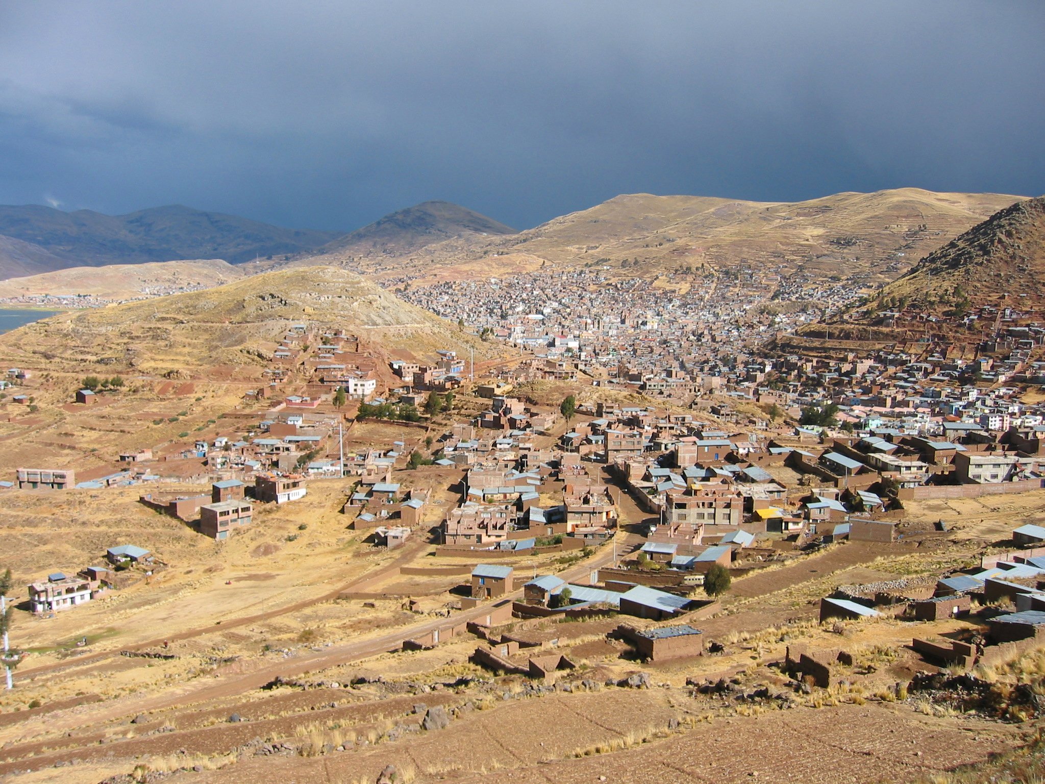
imagesize = 220px
image_caption = Puno under afternoon storm clouds.
flag_size =
image_
seal_size = 100px
image_shield =
shield_size =
image_blank_emblem =
blank_emblem_size =
mapsize = 250px
map_caption = Location inPeru
pushpin_
pushpin_label_position =
subdivision_type = Country
subdivision_name =Peru
subdivision_type1 = Region
subdivision_name1 =Puno Region
subdivision_type2 = Province
subdivision_name2 =Puno Province
subdivision_type3 =
subdivision_name3 =
subdivision_type4 =
subdivision_name4 =
government_type =
leader_title =
leader_name =
leader_title1 = Mayor
leader_name1 = Luis Butron Castillo
leader_title2 =
leader_name2 =
leader_title3 =
leader_name3 =
leader_title4 =
leader_name4 =
established_title =
established_date =
established_title2 =
established_date2 =
established_title3 =
established_date3 =
area_magnitude =
unit_pref =
area_footnotes =
area_total_km2 =
area_land_km2 =
area_water_km2 =
area_total_sq_mi =
area_land_sq_mi =
area_water_sq_mi =
area_water_percent =
area_urban_km2 =
area_urban_sq_mi =
area_metro_km2 =
area_metro_sq_mi =
population_as_of =
population_footnotes =
population_note =
settlement_type =
population_total = 100 168
population_density_km2 =
population_density_sq_mi =
population_metro =
population_density_metro_km2 =
population_density_metro_sq_mi =
population_urban =
population_density_urban_km2 =
population_density_urban_mi2 =
timezone =UTC-5
utc_offset =
timezone_DST =
utc_offset_DST =
latd=15 |latm=50 |lats=36|latNS=S
longd=70 |longm=01 |longs=25 |longEW=W
elevation_footnotes =
elevation_m = 3860
elevation_ft = 12421
postal_code_type =
postal_code =
area_code =
website =
footnotes =Puno is a city in southeastern
Peru , located on the shore ofLake Titicaca , the world's highest navigable lake, at 3,860 m (12,421 ft) above sea level. It is also the capital and largest city of thePuno Region and thePuno Province . The city was established in 1668 by viceroyPedro Antonio Fernández de Castro as capital of the province of Paucarcolla with the name San Juan Bautista de Puno. The name was later changed to San Carlos de Puno, in honor of kingCharles II of Spain . The city boasts several churches dating back from the colonial period, they were built to service the Spanish population and evangelize the natives.Overview
Today, Puno is an important agricultural and livestock region; particularly of
South America ncamelid s (llama s andalpaca s) which graze on its immenseplateau s andplain s. Many homes in Puno, much like surrounding cities, are half-finished. This is done so that the inhabitants do not have to pay taxes. Much of the city economy relies on the black market, fueled by cheap goods smuggled in fromBolivia . Puno has been designated to become aSpecial Economic Zone or "Zona Económica" by Peru's president, Alan Garcia. Puno is served by theInca Manco Capac International Airport in nearbyJuliaca .Puno's geography and layout is unique, it is practically squeezed into a the available land between the shores of Lake Titicaca and the small mountains surroudning the city. There is less than 2 miles distance of flat land between the shores and the foothills, which has caused the growing city to continue to expand upwards onto the hillsides, sprawling along every available, or nearly habitable plot of land on which a dwelling can possibly be built. As a result the town's less developed and poorest areas, which are high on the hillsides, often have very steep street, which are generally not paved and cannot be accessed by automobile.
Puno is known as the "Capital folklórica del Perú" (folkloric capital of Peru) due to its wealth of artistic and cultural expressions, particularly dance. They are most notable during the celebrations of the Feast of the "Virgen de la Candelaria" and the Regional Competition of Autochthonous Dances. Puno's access to
Lake Titicaca is surrounded by 41floating islands . To this day, theUros people maintain and live on these man-made islands, depending on the lake for their survival and are a large tourist destination.Puno is the first major hub in the constant migration of indigenous peoples of the Andes to the larger cities of Peru. It is the largest city in the Southern Altiplano and is the recipient of new residents from surrounding smaller agricultural communities of poorer classe of people seeking better opportunties for education and employment. As such, Puno is serviced by several small Institutes of Technology, Education and other technical or junior college type of facilities. Additionally it is home to what is commonly referred to as the la "UNA" or the Universidad Nacional del Altiplano, which was founded in 1856.
External links
* [http://www.travelpuno.com/en/ Travel Guide Puno]
* [http://www.travelpuno.com/index.php?id=Virgen-Candelaria-2008 Movies & Pics, Festivity Virgin Of The Candelaria 2008]
*References
* [http://www.fallingrain.com/world/PE/21/Puno.html FallingRain Map - elevation = 3808m]

Wikimedia Foundation. 2010.