- Eder
Geobox River
name = Eder
map_size =
map_caption =
other_name =
other_name1 =
country = Germany
country1 =
region = North Rhine-Westphalia
region1 = Hesse
region2 =
region3 =
region4 =
region5 =
region5 =
region6 =
city =Frankenberg
city1 =Fritzlar
city2 =Edermünde
city3 =
city4 =
length = 177
length_imperial =
watershed = 3362
watershed_imperial =
discharge_location =
discharge_average =
discharge_average_imperial =
discharge_max_month =
discharge_max =
discharge_max_imperial =
discharge_min_month =
discharge_min =
discharge_min_imperial =
discharge1_location =
discharge1_average =
discharge1_average_imperial =
discharge2_location =
discharge2_average =
discharge2_average_imperial =
discharge3_location =
discharge3_average =
discharge3_average_imperial =
discharge4_location =
discharge4_average =
discharge4_average_imperial =source_name =
source_location = Am Ederkopf
source_region = Sauerland
source_country =
source_country1 =
source_elevation = 648
source_elevation_imperial = 620
source_lat_d =
source_lat_m =
source_lat_s =
source_lat_NS =
source_long_d =
source_long_m =
source_long_s =
source_long_EW =
mouth_name =Fulda
mouth_location =Edermünde Grifte
mouth_country =
mouth_region =
mouth_country1 =
mouth_elevation = 143
mouth_elevation_imperial =
mouth_lat_d =
mouth_lat_m =
mouth_lat_s =
mouth_lat_NS =
mouth_long_d =
mouth_long_m =
mouth_long_s =
mouth_long_EW =
tributary_left =
tributary_left1 =
tributary_right =
tributary_right1 =

image_size = 320
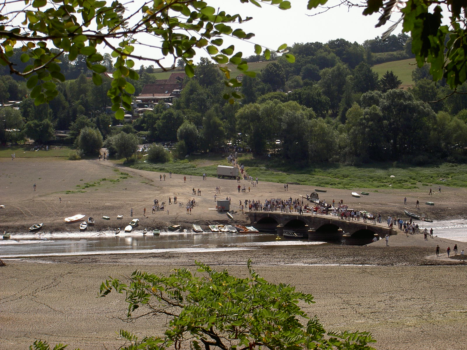
image_caption = The Eder in the dry lake "Edersee" in 2003The Eder is a 177 km longriver inGermany , left tributary of theFulda River . It was first mentioned by the Roman historianTacitus as the "Adrana" in the territory of theChatti .The river rises from the "Ederkopf" mountain in western
North Rhine-Westphalia near the springs of theLahn andSieg rivers. Unlike the Lahn and Sieg, that are both tributaries of theRhine , the Eder flows east and north and into the river Fulda atEdermünde , south ofKassel . AtHannoversch Münden , the Fulda joins with theWerra to form theWeser river which flows into theNorth Sea north of Bremen. Towns along the course of the Eder include Battenberg, Frankenberg,Waldeck andFritzlar .A rock-and-concrete dam (47 m high, 400 m long) completed in 1914 near the small town of Waldeck created the large
Edersee reservoir, which is 27 km long and has a holding caopacity of 200 million m³ of water. It is used to generate hydro-electricity and to regulate water levels for shipping on the Weser river.The dam was destroyed by British
Avro Lancaster bombers of the RAF's 617 Squadron on17 May 1943 (Operation Chastise ). The bombers were equipped with specialBarnes Wallis bouncing bombs. On the same night, the nearbyMöhne Reservoir dam was also attacked, causing enormous destruction and loss of life downstream (the great majority of drowning victims were UkrainianPOW s in a labor camp just below the dam). The story of the raid was made into a film called " The Dam Busters".The dam was rebuilt the same year, and the lake today is a major summertime recreation facility, particularly popular with Dutch campers.
Wikimedia Foundation. 2010.
