- Old Sartell Bridge
-
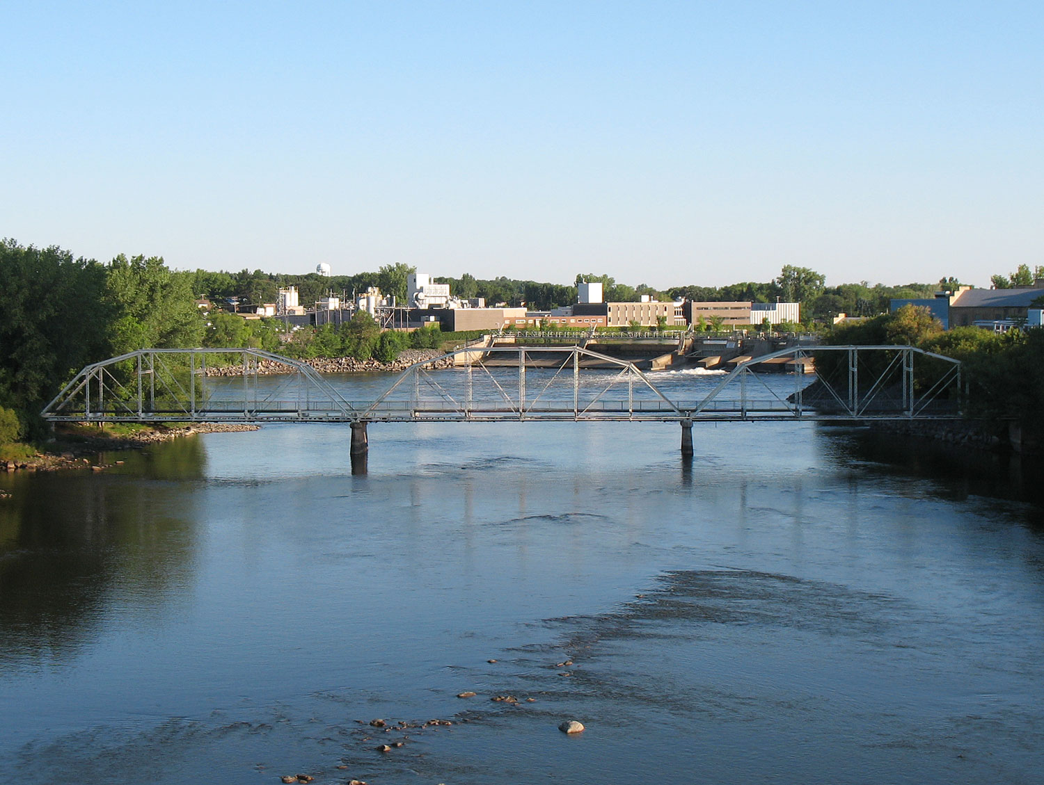
Old Sartell Bridge 
The Old Sartell Bridge as viewed from the Sartell Bridge to the south.Carries Only utility lines Crosses Mississippi River Locale Sartell, Minnesota Maintained by City of Sartell Design 3 span Truss bridge Total length 587 feet Width 28 feet Longest span 135 feet Clearance below 18 feet Opened 1914 Closed 1984 Coordinates 45°37′05″N 94°12′11″W / 45.61806°N 94.20306°W The Old Sartell Bridge is a bridge that spans the Mississippi River in the city of Sartell in the U.S. state of Minnesota. Though still standing, it is closed to traffic and was replaced by the Sartell Bridge constructed about 850 feet downstream. The bridge is around 1000 feet downstream of the Sartell Dam. The bridge was built during a six-month period in 1914, but over the years the bridge became congested and less able to carry heavy traffic. As early as 1957, heavy trucks were found to be too much for the span. When the new bridge was built in 1984, the old bridge was used as a pedestrian footbridge, but it was impractical for this use since there is a factory at the east end. The bridge now carries only utility lines.
The Old Sartell Bridge is a three span pin connected camelback through truss. The camelback design is a specific type of Parker truss, where the polygonal top chord is composed of exactly five sections. Each span of the Old Sartell Bridge is composed of six panels. The bridge is supported by concrete piers and abutments.
See also
References
- Historic Bridges of Michigan and Elsewhere - Provides identification information used to identify the Old Sartell Bridge.
- Costello, Mary Charlotte (2002). Climbing the Mississippi River Bridge by Bridge, Volume Two: Minnesota. Cambridge, MN: Adventure Publications. ISBN 0-9644518-2-4.
Bridges of the Mississippi River Upstream
125th Street BridgeOld Sartell Bridge Downstream
Sartell BridgeCategories:- Sartell, Minnesota
- Bridges in Minnesota
- Bridges over the Mississippi River
- Bridges completed in 1914
- Former road bridges in the United States
- Road bridges in Minnesota
- Pedestrian bridges in Minnesota
- Buildings and structures in Benton County, Minnesota
- Buildings and structures in Stearns County, Minnesota
- Transportation in Benton County, Minnesota
- Transportation in Stearns County, Minnesota
- United States bridge (structure) stubs
- Minnesota building and structure stubs
Wikimedia Foundation. 2010.