- Smolenice
Geobox | settlement
name = Smolenice
native_name =
other_name =
category = Village
etymology =
official_name =
motto =
nickname =
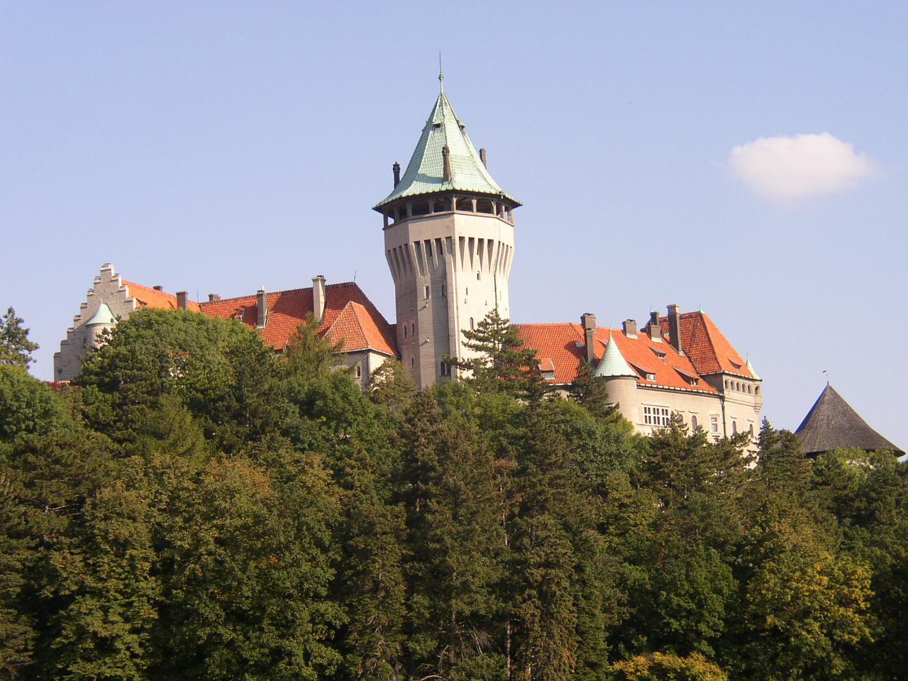
image_caption = Smolenice Castle
symbol =
country = Slovakia
country_
state =
region = Trnava
district = Trnava
municipality =
part =
river =
location =
elevation = 242
lat_d = 48
lat_m = 30
lat_s = 00
lat_NS = N
long_d = 17
long_m = 26
long_s = 00
long_EW = E
coordinates_type = region:SK_type:city
highest =
highest_lat_d =
highest_long_d =
lowest =
lowest_lat_d =
lowest_long_d =
area = 28.967
area_round = 3
population = 3264
population_date = 2005
population_density = auto
established =1256
established_type = First mentioned
date =
mayor =
timezone =
timezone_DST =
postal_code = 919 04
area_code = 421-33
code = TT
code_type = Car plate
free =

map_background = Slovakia - background map.png
map_locator = Slovakia
website = [http://www.smolenice.com/ www.smolenice.com]
commons = Smolenice
footnotes = Source: [http://www.statistics.sk/mosmis/eng/run.html Mestská a obecná štatistika SR ] ]Smolenice (German "Smolenitz", Hungarian "Szomolány") is a
village andmunicipality ofTrnava District in theTrnava Region ofSlovakia , on the foothills of theLittle Carpathians . It is 60 km northeast ofBratislava and 25 km northwest ofTrnava . The village is made of two parts, Smolenice and "Smolenická Nová Ves" (formerly "Neštich")History
Although the site was inhabited since
Paleolithic , but more archaeological discoveries are fromNeolith . The most significant period was a transition from Bronze to the Iron Ages, when the Celts around the 6th century BC had oppidum above the village. On the same place was a settlement from theGreat Moravia period. The village was first mentioned in 1256 under name "villa Solmus", though the settlement started to grow in the late Middle Ages. In the 14th century, the gothicSmolenice Castle was built above the village, as a part of chain of the castle protecting passes in theLittle Carpathians . The castle with the village was royal at first, but it kept changing its hands for several centuries, until thePálffys took it in the 18th century, when the castle was in decay. During theNapoleonic Wars , it burned down, and only outer fortifications remained. In the 19th century, new wood processing works sprung up near the village, which were replaced in 1968 with the chemical works "Chemolak". In the 20th century, reconstruction of the Smolenice castle ruins began, and was reconstructed as a château. Reconstruction finished after theSecond World War .ights
* The
Smolenice Castle , now reconstructed as a château.
* Ruins of Celtic oppidum on theMorpín hill.
* TheDriny limestone cave, the only public accessible cave in western Slovakia.
* Little Carpathians with many castle ruins, with the protectedHlboče valley, and the highest point of the Little Carpathians,Záruby (768 m)
* Grave of Štefan BaničPeople
*
Štefan Banič , born 1870 in Neštich, inventor of the militaryparachute .References
External links
* [http://www.smolenice.com Municipal website] sk icon


Wikimedia Foundation. 2010.