- Palaiseau
French commune
nomcommune=Palaiseau
caption=Town hall
map_size=270px
adjustable_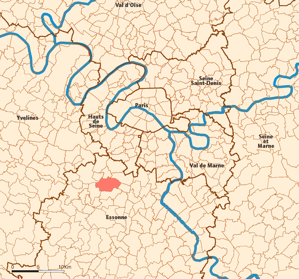
mapcaption=Location (in red) within Paris inner and outer suburbs
lat_long=coord|48|43|09|N|2|15|02|E|region:FR-J_type:city(30156)
région=Île-de-France
département=Essonne ("sous-préfecture ")
arrondissement= Palaiseau
canton=Palaiseau (chief town)
intercomm=CA du Plateau de Saclay
insee=91477
cp=91120
maire=François Lamy
mandat=2008-2014
alt mini=47 m
alt maxi=159 m
km²= 11.51
sans=
31,000
28,965
date-sans=Jan. 1, 2005 estimate)
(March 8, 1999 census
dens=2,693
date-dens=2005|Palaiseau is a commune in the southern suburbs of
Paris ,France . It is located unit length|km|16.9|1 from the center of Paris. Palaiseau is a "sous-préfecture " of theEssonne "département", being the seat of theArrondissement of Palaiseau .Colleges and universities
ParisTech has a strong presence in Palaiseau, with two member institutes: theÉcole Polytechnique , a very prestigious engineering school, and an annex ofÉcole nationale supérieure de Techniques Avancées , which are now located in Palaiseau, on the Plateau de Saclay.Demographics
At the 1999
census , the population was formatnum:28965. The estimate for 2005 was formatnum:30600.Inhabitants of Palaiseau are known as "Palaisiens".
Transport
Palaiseau is served by 3 stations on Paris RER line B: Palaiseau, Palaiseau – Villebon and Lozère (this last station is the closest to the famous "
École Polytechnique "). Please note that the station Massy-Palaiseau (RER B and RER C) is actually a station in the town of Massy.ee also
*
Communes of the Essonne department References
* [http://www.ume.asso.fr Mayors of Essonne Association] fr icon
* [http://www.insee.fr/en/home/home_page.asp INSEE] en icon
* [http://www.ign.fr/rubrique.asp?rbr_id=1&lng_id=EN IGN] en iconExternal links
* [http://www.ville-palaiseau.fr Official website] fr icon
* [http://www.culture.gouv.fr/public/mistral/merimee_fr?ACTION=CHERCHER&FIELD_98=INSEE&VALUE_98=91477 Mérimée database - Cultural heritage] fr icon
* [http://www.iaurif.org/en/gis/fichescom/mos99/ficmos/mos91477.html Land use (IAURIF)] en icon
Wikimedia Foundation. 2010.