- Gołdap
Infobox Settlement
name = Gołdap
imagesize = 250px
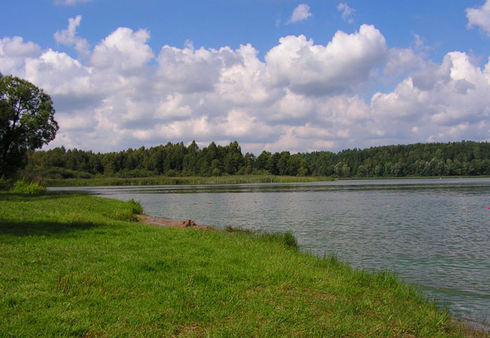
image_caption = Gołdap Lake
image_shield = POL Gołdap COA.svg
pushpin_
pushpin_label_position = bottom
subdivision_type = Country
subdivision_name = POL
subdivision_type1 = Voivodeship
subdivision_name1 = Warmian-Masurian
subdivision_type2 = County
subdivision_name2 =Gołdap County
subdivision_type3 =Gmina
subdivision_name3 =Gmina Gołdap
leader_title = Mayor
leader_name = Marek Aleksander Miros
established_title3 = Town rights
established_date3 = 1570
area_total_km2 = 17.2
population_as_of = 2007
population_total = 15600
population_density_km2 = auto
timezone = CET
utc_offset = +1
timezone_DST = CEST
utc_offset_DST = +2
latd = 54 | latm = 18 | lats = 58 | latNS = N | longd = 22 | longm = 18 | longs = 34 | longEW = E
postal_code_type = Postal code
postal_code = 19-500
area_code = +48 87
blank_name = Car plates
blank_info = NGO
website = http://www.goldap.pl/ Gołdap [IPA-pl|'|g|o|U|d|a|p] (Audio-de|Goldap|Goldap.ogg; _lt. Geldapė) is atown and the seat ofGołdap County in theWarmian-Masurian Voivodeship inPoland . It is located on theGołdapa River, between theWzgórza Szeskie ("Seesker Höhen") hills and thePuszcza Romincka forest. It has a population of 13,703 (as of 2004). Itscoat of arms depicts theHouse of Hohenzollern and Brandenburg.History
Masurians began to settle the region in the 16th century while it was part of theDuchy of Prussia . Systematic settlement began in 1565, while the town was officially founded by Caspar von Nostitz onMay 15 1570 . Located at a profitable location on the crossing of several trade routes near the Prussian border with Lithuania, Goldap grew rapidly. It became a part of theKingdom of Prussia in 1701 and theGerman Empire in 1871.From 1709-11 eastern Prussia suffered from a plague. The deceased were replaced by
Germans from Brandenburg, Pomerania, Magdeburg, Halberstadt, the Palatinate, and Nassau, as did Swiss andLithuanians . In 1732 Protestants expelled from Salzburg also resettled the area.Goldap was at the south of the partially Lithuanian-speaking part of
East Prussia , an ethnographic region known asLithuania Minor . In thelate Middle Ages the town had a majority ofLietuvininks (ethnic Lithuanians) and a minority of Germans and Masurians. This situation lasted until early the 19th century. BothGermanisation and the movement of Germans into Lithuania Minor was intense, and Goldap started to Germanise quite rapidly by the early 19th century. By the early 20th century less than 5% of people of Goldap were Lietuvininks; by that time only northern Lithuania Minor had territories with majorities or significant minorities of Lietuvininks.In the 18th and 19th centuries Goldap was a notable centre of commerce and production of various goods for the local market, as well as an important centre of grain production. In 1818 it became a seat of
Landkreis Goldap . In 1879 the town was linked to a railway.During
World War I Goldap was a scene of fierce fighting on the Eastern Front, which passed through the town twice. As a result, it was almost completely destroyed. The town was rebuilt, and soon after the war ended it reached a similar number of inhabitants it had had before.During
World War II Goldap was planned by the German staff as one of the strongholds guarding the rest of East Prussia from theRed Army on the Eastern Front. As a result of heavy fighting for the city and the regions directly east of it, in August and September 1944, 90% of the town was yet again destroyed. According to German war-time reports, about 50 civilians were murdered (somerape d) by the Red Army on its initial entry into Goldap in October 1944. It was the first town of the German Reich to fall. However, in November 1944 theWehrmacht reconquered Goldap and would be able to keep it until the end of December of the same year. In January, the German positions in far-eastern East Prussia broke down completely.After the war, the town -- together with the southern two-thirds of East Prussia -- was placed under Polish administration according to the 1945
Potsdam Conference . The remaining German-speaking populace, including Masurians, who had not evacuated were subsequently expelled westward. They were replaced byPoles who had been expelled fromPolish areas annexed by the Soviet Union . The town, renamed from the German "Goldap" to the Polish "Gołdap", was rebuilt and retained its status as a seat of apowiat .Today the town of Gołdap remains an important centre of local trade and commerce. There are several small food production facilities (milk plant, industrial
slaughterhouse , mill) located there, as well as a paper mill and a small tourist equipment works. In addition, it is one of the centres of tourism, with many skiing, swimming, sailing and leisure centres located both in the town and around it.Twin towns
Ano Syros ,Giv'at Shmuel ,Gusev ,Stade ,Šakiai External links
* [http://www.goldap.pl/ Municipal webpage] pl icon
* [http://www.ostpreussen.net/index.php?seite_id=12&kreis=03&stadt=01 Geschichte der Stadt Goldap] de iconee also
*
Evacuation of East Prussia
*Nemmersdorf

Wikimedia Foundation. 2010.