- Momarka
-
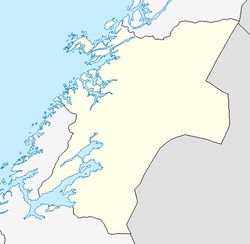
Momarka — Village — Location in Nord-Trøndelag Coordinates: 63°43′39″N 11°17′02″E / 63.7275°N 11.28389°ECoordinates: 63°43′39″N 11°17′02″E / 63.7275°N 11.28389°E Country Norway Region Trøndelag County Nord-Trøndelag District Innherred Municipality Levanger Elevation[1] 56 m (184 ft) Time zone CET (UTC+01:00) – Summer (DST) CEST (UTC+02:00) Post Code 7600 Levanger Momarka is a village in the municipality of Levanger in Nord-Trøndelag county, Norway. It is located just south of the town of Levanger, along the Nordlandsbanen railway line and the European route E6. Since 2002, Momarka has been considered a part of the Levanger urban area.[2][3]
References
- ^ "Momarka" (in Norwegian). yr.no. http://www.yr.no/place/Norway/Nord-Tr%C3%B8ndelag/Levanger/Momarka/. Retrieved 2011-05-27.
- ^ Statistics Norway (1 January 2002). Omitted settlements. http://www.ssb.no/english/subjects/02/01/10/beftett_en/arkiv/tab-2002-09-03-06-en.html.
- ^ Store norske leksikon. "Momarka" (in Norwegian). http://www.snl.no/Momarka. Retrieved 2011-05-27.
Categories:- Villages in Nord-Trøndelag
- Levanger
- Nord-Trøndelag geography stubs
Wikimedia Foundation. 2010.

