- Ponciau
Ponciau is a
village within the community ofRhosllannerchrugog in the county borough of Wrexham,Wales .Ponciau is located close to the villages of Legacy,Pentre Bychan and Johnstown and is overlooked byRuabon Mountain.History
The Welsh word 'ponc' means "bank" or "hillock" and the village takes its name from the large number of
spoil tips which formerly covered the area. This was corrupted into theanglicised name 'Ponkey' which is no longer used, except occasionally by locals.The
village of Ponciau grew up around opencast mining and houses were built, with little regard for planning, to house the workers. At Brynydd, close to the "Royal Oak" public house, was the former site of typical very basic, one room, terraced, workers' houses.Tin baths were kept to the rear of the houses for bathing.Iron was also worked, with large furnaces in use at Furnace Bank.
Ponciau and Rhosllannerchrugog previously had over 150 public houses, although the majority of them have closed. The "Colliers Arms", "Horse & Jockey" and "Royal Oak" (Built in 1853 by John and Mary Boyer) still remain. There is a Chip Shop ("The Trawler Fish Bar" on North Road), a small
Post Office , a school ("Ysgol y Ponciau" on School Lane). One of the main streets in Ponciau is Chapel Street which once contained a large number ofnonconformist chapels, reflecting the importance of religion in the village in former times. Several chapels, such as "Bethel" Calvinistic Methodist Chapel still exist, but like the public houses, the majority have now closed.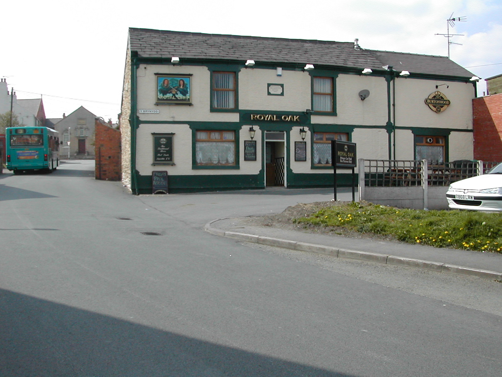
Royal_Oak_Public_House,_Fennant_RoadImage:TrawlerFishBarPonciau.jpg|Trawler_Fish_Bar,_North_RoadImage:BankStreetPonciau.jpg|Bank_StreetImage:BethelChapelPonciau.jpg|Bethel_Chapel,_Johnson_StreetMany of the old buildings in the village are made from distinctive red bricks, from the [http://www.rhwydwaitharchifaucymru.info/cgi-bin/anw/fulldesc_nofr?inst_id=29&coll_id=2537&expand= Ruabon Brick and Terracotta Company] .
The junction where Fennant Road meets the Ruabon Road marks the end of Pentre Bychan, the beginning of Johnstown and the lower boundary line of Ponciau village. Fennant Road is one of the main roads to Ponciau, and leads to a farm originally known as Fynnant.
Offa's Dyke runs across Fennant Road closely to a line of electricpylons which lead off around Johnstown. A footpath also follows Offa's Dyke in the direction of Pentre Bychan towards the Crematorium and Dovecote. The higher boundary of the village is at the top of Bank Street. The Coach & Horses and Grango school on High Street are in Rhosllannerchrugog not Ponciau. The turning after Fennant Road off the Ruabon Road is Aberderfyn Road. The line of this road marks the lower left corner of Ponciau, leading up towards Clarke Street, Baptist Street and Pearson Street.Ponciau ward has one of the largest populations ( [http://www.wrexham.gov.uk/english/planning_portal/statistics/wardpopulation.htm 4,486] ) of Wrexham County Borough. The ward is described as 'The Ponciau North, Ponciau South and Rhos wards of the Community of Rhosllannerchrugog and the Aberoer and Pentrebychan wards of the Community of Esclusham' in the OPSI document [http://www.opsi.gov.uk/si/si1998/19983142.htm|Statutory Instrument 1998 No. 3142] . 29% of households do not own a car. A section of the ward boundary follows the path of the
River Clywedog .Most map sites such as [http://www.multimap.com Multimap] do not show the village of Ponciau, however they do generally show Rhosllannerchrugog.
The Ponciau Banks
In the latter part of the 19th century and the early 20th century, the area was used by the local miners who sank pits to extract coal. This 'coal getting' was done extensively during the miners' strike in 1921. These pits were later capped by the
National Coal Board to leave 16 acres of land being sold in 1932 for the sum of £500 to be re-developed as a park. Much of the landscaping of the park to the form that can be seen today was organised by the Miner's Institute Committee, the first sod being cut in June 1932 and the work being carried out by 50 local volunteers along with International Students. HRH Edward,Prince of Wales paid a visit to the [http://www.ingenious.org.uk/See/Societyandwars/Socialandeconomiclife/?target=SeeLarge&ObjectID={CA84DD88-6F9C-5341-F270-6B4D48E2A522}&viewby=images| Ponciau Banks in May 1934] to view the progress. In 1935 the laying of the football pitch was completed and the local team, "Rhos Aelwyd", have used this pitch for a number of years.The Second World War temporarily halted the reclamation works but in 1950 the works re-commenced.
The park has been the site of many
village events and includes theGorsedd stone circle from the 1961 National Eisteddfod which took place in Rhosllannerchrugog.The Ponciau Banks park, is due to be developed extensively by Wrexham County Borough Council using
National Lottery funding. The development will see a User Centre and recreational & sports facilities includingtennis ,bowls ,skateboarding , aBMX cycle track and a Children's Play Area. [http://www.wrexham.gov.uk/english/env_services/community_services/parks_pitches/ponciau_park.htm Ponciau Park]Transport
In 1861 the
Great Western Railway constructed an industrial branch line from Gardden Lodge Junction, north of Ruabon, to thefurnaces at Ponciau and Aberderfyn, which was later extended to Legacy. By 1901 this branch had been connected to the newly extended branch line fromPontcysyllte viaAcrefair , Plasbennion,Wynn Hall and Rhosllannerchrugog to Legacy. The "Ponkey Branch", as it was then known, had a short lived passenger service between 1905 and 1915 with halts at Fennant Road, Aberderfyn and Ponkey Crossing. Since the closure of passenger services on this lines the village has relied on road transport.Language
37% of the population of Ponciau speak Welsh (2001 Census)
Bibliography
* Dennis W Gilpin, "Rhosllannerchrugog, Johnstown, Ponciau, Pen-y-cae, a collection of pictures - Volume I" (1991)
* Dennis W Gilpin, "Rhosllannerchrugog, Johnstown, Ponciau, Pen-y-cae, a collection of pictures - Volume II" (1992)External links
* [http://www.wrexham.gov.uk/english/council/wardmap.htm Wrexham County Borough Ward Map]
* [http://www.geograph.org.uk/search.php?i=3538632 www.geograph.co.uk : photos of Ponciau and surrounding area]
Wikimedia Foundation. 2010.