- Hellouw
Dutch town locator maps
mun_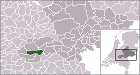
town_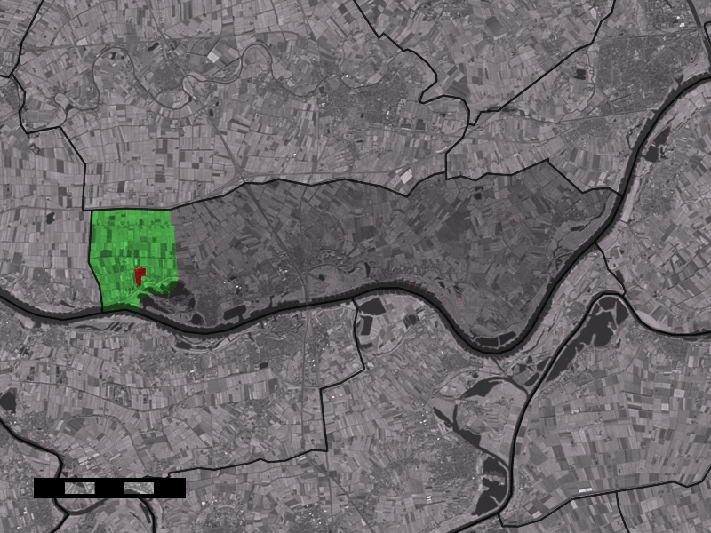
caption = The town centre (red) and the statistical district (light green) of Hellouw in the municipality of Neerijnen.Hellouw (coord|51|50|N|5|11|E|type:city(482)) is a town in the Dutch province of
Gelderland . It is a part of the municipality ofNeerijnen , and lies about 14 km east ofGorinchem .In 2001, the town of Hellouw had 482 inhabitants. The built-up area of the town was 0.14 km², and contained 183 residences.Statistics Netherlands (CBS), [http://www.cbs.nl/nl-NL/menu/themas/milieu-natuur-ruimte/ruimte/publicaties/cartografie-geografie/geografische-data/2001-bevolkingskernen-in-nederland.htm "Bevolkingskernen in Nederland 2001"] . (Statistics are for the continuous built-up area).] The statistical area "Hellouw", which also can include the peripheral parts of the village, as well as the surrounding countryside, has a population of around 910.Statistics Netherlands (CBS), [http://statline.cbs.nl/ "Statline: Kerncijfers wijken en buurten 2003-2005"] . As of
January 1 ,2005 .]References
Wikimedia Foundation. 2010.