- Spijk (Lingewaal)
Dutch town locator maps
mun_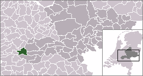
town_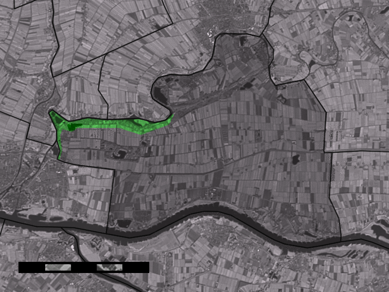
caption = The village centre (dark green) and the statistical district (light green) of Spijk in the municipality of Lingewaal.Spijk (coord|51|51|N|5|1|E|type:city(413)) is a village in the Dutch province of
Gelderland . It is a part of the municipality ofLingewaal , and lies about 3 km northeast ofGorinchem .In 2001, the village of Spijk had 413 inhabitants. The built-up area of the village was 0.093 km², and contained 158 residences.Statistics Netherlands (CBS), [http://www.cbs.nl/nl-NL/menu/themas/milieu-natuur-ruimte/ruimte/publicaties/cartografie-geografie/geografische-data/2001-bevolkingskernen-in-nederland.htm "Bevolkingskernen in Nederland 2001"] . (Statistics are for the continuous built-up area).] The statistical area "Spijk", which also can include the peripheral parts of the village, as well as the surrounding countryside, has a population of around 980.Statistics Netherlands (CBS), [http://statline.cbs.nl/ "Statline: Kerncijfers wijken en buurten 2003-2005"] . As of
January 1 ,2005 .]Spijk was a separate municipality between 1817 and 1855, when it became part of
Heukelum . At that time, Spijk was still part of the province ofSouth Holland . [Ad van der Meer and Onno Boonstra, "Repertorium van Nederlandse gemeenten", KNAW, 2006. [http://www.knaw.nl/cfdata/publicaties/detail.cfm?boeken__ordernr=20061061] ]References
Wikimedia Foundation. 2010.