- Artibonite Department
:"Artibonite redirects here. For a river in Haiti, see
Artibonite River ."Geobox Region
name = Artibonite Department
native_name =
other_name =
other_name1 =
category =

image_size =
image_caption = Valley in the Artibonite
flag_size =
symbol =
symbol_size =
country = Haiti
state =
region =
district =
capital =Gonaïves
capital_type = Capital
capital_lat_d =
capital_lat_m =
capital_lat_s =
capital_lat_NS =
capital_long_d =
capital_long_m =
capital_long_s =
capital_long_E =
capital_elevation =
city_type =
city =
part_type =
part_count =
part =
part1 =
area = 4984
highest =
highest location =
highest_lat_d =
highest_lat_m =
highest_lat_s =
highest_lat_NS =
highest_long_d =
highest_long_m =
highest_long_s =
highest_long_EW =
highest_elevation =
lowest =
lowest_location =
lowest_lat_d =
lowest_lat_m =
lowest_lat_s =
lowest_lat_NS =
lowest_long_d =
lowest_long_m =
lowest_long_s =
lowest_long_EW =
lowest_elevation =
population_as_of = 2002
population = 1,168,800
population_density =
established_type =
established =
leader =
timezone =
utc_offset =
timezone_DST =
utc_offset_DST =
code_type =
code =
code1_type =
code1 =
free_type =
free =
free1_type =
free1 =
map_size = 230
map_caption =
map_locator =
map_locator_x =
map_locator_y =
map_first = 1
website =
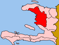
footnotes =Artibonite ( _ht. Latibonit) is one of the ten departments (French: "
département s") ofHaiti . With an area of 4,984 km² it is Haiti's largest department. Artibonite has a population of 1,168,800 (2002). The region is the country's main rice-growing area. The main cities areGonaïves (the capital) andSaint-Marc . An insurgency tried unsuccessfully to declare Artibonite's independence in February2004 .The department has been in a state of an economic decrease since the insurgencies and coups have reduced the nation's stability. Since the election of President
René Garcia Préval , the production of rice and other crops has been on an increase.Deschapelles , in the Artibonite valley, is the location of theHospital Albert Schweitzer Haiti Arrondissements & Communes
*Dessalines Arrondissement
**Desdunes
**Dessalines
**Grande Saline
**Petite Rivière de l'Artibonite *
Gonaïves Arrondissement
**Ennery
**Estère
**Gonaïves *
Gros Morne Arrondissement
**Anse Rouge
**Gros-Morne
**Terre-Neuve*
Marmelade Arrondissement
**Marmelade
**Saint Michel de l'Attalaye *
Saint-Marc Arrondissement
**La Chapelle
**Saint-Marc
**Verettes
Wikimedia Foundation. 2010.