- Barstow-Daggett Airport
Infobox Airport
name = Barstow-Daggett Airport
nativename =
nativename-a =
nativename-r =
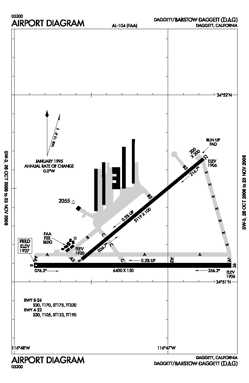
image-width =
caption =
IATA = DAG
ICAO = KDAG
FAA = DAG
type = Public
owner =
operator = County of San Bernardino
city-served =Daggett, California
location =
elevation-f = 1,927
elevation-m = 587
coordinates = coord|34|51|13|N|116|47|12|W|type:airport_region:US
website = [http://www.co.san-bernardino.ca.us/airports/#BARSTOW-DAGGETT_AIRPORT www.co.san-bernardino.ca.us]
r1-number = 8/26
r1-length-f = 6,400
r1-length-m = 1,951
r1-surface =Asphalt
r2-number = 4/22
r2-length-f = 5,119
r2-length-m = 1,560
r2-surface = Asphalt
stat-year =
stat1-header =
stat1-data =
footnotes =Barstow-Daggett Airport Airport codes|DAG|KDAG|DAG is a public
airport located near the city of Barstow and the town of Daggett in San Bernardino County,California , USA. Built in 1933, it is the oldest of the six airports operated by San Bernardino County.Facilities
Barstow-Daggett Airport covers convert|1087|acre|ha|0|lk=on and has two
runway s:
* Runway 4/22: 5,119 x 100 ft. (1,560 x 30 m), Surface:Asphalt
* Runway 8/26: 6,400 x 150 ft. (1,951 x 46 m), Surface: AsphaltHistory
During
World War II the airfield was used by theUnited States Army Air Force Fourth Air Force .ee also
*
California World War II Army Airfields References
* [http://www.co.san-bernardino.ca.us/airports/#BARSTOW-DAGGETT_AIRPORT San Bernardino County Department of Airports: Barstow-Daggett Airport]
*FAA-airport|ID=DAG|use=PU|own=PU|site=01479.*AExternal links
* http://stratocat.com.ar/bases/17e.htm Historical record of balloons launched from the airport in the early 90's
*FAA-diagram|00104
Wikimedia Foundation. 2010.