Dlouhoňovice

Dlouhoňovice
Dlouhoňovice
Village
Country Czech Republic
Region Pardubice
District Ústí nad Orlicí
Commune Dlouhoňovice
Population 766 (2006-07-03)
Density 766 / km2 (1,984 / sq mi)
Timezone CET (UTC+1)
 - summer (DST) CEST (UTC+2)
Postal code 564 01
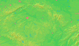
Location in the Czech Republic
Wikimedia Commons: Dlouhoňovice
Website: [1]

Dlouhoňovice is village in the Pardubice Region of the Czech Republic. It has slightly less than 800 inhabitants. Name of the village is derived from its founders Dlúhoň family line. The village is situated to the south from Žamberk. File:Dln.jpg

External links

Coordinates: 50°04′20″N 16°26′38″E / 50.07222°N 16.44389°E / 50.07222; 16.44389


Wikimedia Foundation. 2010.

Игры ⚽ Нужна курсовая?

Look at other dictionaries:

  • Dlouhoňovice — Héraldique …   Wikipédia en Français

  • Hejnice u Žamberka — Hejnice …   Deutsch Wikipedia

  • Helvíkovice — Helvíkovice …   Deutsch Wikipedia

  • District d'Ústí nad Orlicí — District de Ústí nad Orlicí Okres Ústí nad Orlicí (cs) Administration …   Wikipédia en Français

  • Česká Třebová — Coordinates: 49°54′6″N 16°26′52″E / 49.90167°N 16.44778°E / 49.90167; 16.44778 …   Wikipedia

  • Ústí nad Orlicí District — Okres Ústí nad Orlicí   District   Ústí nad Orlicí town …   Wikipedia

  • Choceň — For the village in Poland, see Choceń. Coordinates: 49°59′59″N 16°13′2″E / 49.99972°N 16.21722°E / 49.99972; 16.21722 …   Wikipedia

  • Červená Voda — For the village in Slovakia, see Červená Voda, Sabinov. Location of Červená Voda in the Czech Republic Červená Voda is a village in the Pardubice Region of the Czech Republic. It has cca 3,200 inhabitants. Several smaller villages are… …   Wikipedia

  • Nové Hrady (Ústí nad Orlicí District) — Location of Nové Hrady in the Czech Republic Nové Hrady (German: Neuschloss) is a small village in Ústí nad Orlicí District (until January 1, 2007 in the Chrudim District) of the Pardubice Region of the Czech Republic. It has around 290… …   Wikipedia

  • Dolní Čermná — Coordinates: 49°58′45″N 16°34′0″E / 49.97917°N 16.566667°E / 49.97917; 16.566667 …   Wikipedia

Share the article and excerpts

Direct link
Do a right-click on the link above
and select “Copy Link”